Fairmount, Maryland

Last updated
Fairmount, Maryland
CDP
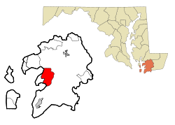
Somerset County Maryland Incorporated and Unincorporated areas Fairmount Highlighted.svg
Coordinates: 38°5′40″N75°47′25″W / 38.09444°N 75.79028°W / 38.09444; -75.79028
CountryFlag of the United States.svg United States
State Flag of Maryland.svg  Maryland
County Flag of Somerset County, Maryland.svg Somerset
Area
[1]
  Total17.11 sq mi (44.33 km2)
  Land12.26 sq mi (31.75 km2)
  Water4.86 sq mi (12.58 km2)
Elevation
3 ft (1 m)
Population
 (2020)
  Total408
  Density33.28/sq mi (12.85/km2)
Time zone UTC−5 (Eastern (EST))
  Summer (DST) UTC−4 (EDT)
ZIP code
21867
Area code(s) 410, 443, and 667
FIPS code 24-27375
GNIS feature ID0590184

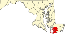
Fairmount is a census-designated place (CDP) in Somerset County, Maryland, United States. The population was 537 at the 2000 census. It is included in the Salisbury, Maryland-Delaware Metropolitan Statistical Area.

Contents

Geography

Fairmount is located at 38°5′40″N75°47′25″W / 38.09444°N 75.79028°W / 38.09444; -75.79028 (38.094554, 75.790342). [2]

According to the United States Census Bureau, the CDP has a total area of 17.2 square miles (45 km2), of which 12.6 square miles (33 km2) is land and 4.5 square miles (12 km2) (26.34%) is water.

Demographics

Historical population
CensusPop.Note
2020 408
U.S. Decennial Census [3]

As of the census [4] of 2000, there were 537 people, 206 households, and 140 families residing in the CDP. The population density was 42.5 inhabitants per square mile (16.4/km2). There were 275 housing units at an average density of 21.7 per square mile (8.4/km2). The racial makeup of the CDP was 65.36% White, 32.22% African American, 0.19% Native American, 0.56% Asian, 1.12% from other races, and 0.56% from two or more races. Hispanic or Latino of any race were 1.12% of the population.

There were 206 households, out of which 27.7% had children under the age of 18 living with them, 51.5% were married couples living together, 9.7% had a female householder with no husband present, and 32.0% were non-families. 27.7% of all households were made up of individuals, and 15.0% had someone living alone who was 65 years of age or older. The average household size was 2.61 and the average family size was 3.13.

In the CDP, the population was spread out, with 27.4% under the age of 18, 5.4% from 18 to 24, 26.4% from 25 to 44, 24.6% from 45 to 64, and 16.2% who were 65 years of age or older. The median age was 38 years. For every 100 females, there were 91.8 males. For every 100 females age 18 and over, there were 97.0 males.

The median income for a household in the CDP was $24,185, and the median income for a family was $38,542. Males had a median income of $26,146 versus $21,786 for females. The per capita income for the CDP was $18,494. About 20.8% of families and 22.5% of the population were below the poverty line, including 33.0% of those under age 18 and 23.6% of those age 65 or over.

Transportation

Fairmount is located on Maryland Route 361: Fairmount Road. The state designation for the road ends in the CDP, near Fairmount Volunteer Fire Department. The road leads back to Maryland Route 413 in Westover.

Shore Transit once provided access to the CDP from a transfer point in Westover, but service ended in the early 2000s.

Related Research Articles

<span class="mw-page-title-main">Hillsmere Shores, Maryland</span> Former census-designated place in Maryland, United States

Hillsmere Shores was a census-designated place (CDP) in Anne Arundel County, Maryland, United States. It is a suburb of Annapolis. The population was 2,977 at the 2000 census. It was included in the Annapolis Neck CDP at the 2010 census. Built in phases, beginning in 1960, the community has been home to The Key School, a non-sectarian private school, since the 1960s.

<span class="mw-page-title-main">Mayo, Maryland</span> Census-designated place in Maryland, United States

Mayo is a census-designated place (CDP) in Anne Arundel County, Maryland, United States. The population was 8,298 at the 2010 census. The Mayo CDP of 2010 includes all of the area that used to be counted as the Selby-on-the-Bay CDP. The beach in Mayo used to be a popular weekend resort.

<span class="mw-page-title-main">Dunkirk, Maryland</span> Census-designated place in Maryland, United States

Dunkirk is a census-designated place (CDP) in Calvert County, Maryland, United States. The population was 2,521 at the 2010 census.

<span class="mw-page-title-main">Fairland, Maryland</span> Census-designated place in Maryland, United States

Fairland is a census-designated place and an unincorporated area in Montgomery County, Maryland, United States. It had a population of 25,396 per the 2020 census.

<span class="mw-page-title-main">Fairmount Heights, Maryland</span> Historic district in Maryland, United States

Fairmount Heights is a town in Prince George's County, Maryland, United States. Per the 2020 census, the population was 1,528. The town was formally incorporated in 1935, making the town the second oldest African-American-majority municipality in Prince George's County. The town is composed of six subdivisions: Fairmount Heights (1900), Waterford (1907), Mount Weissner (1909), North Fairmount Heights (1910), West Fairmount Heights (1911) and Sylvan Vista (1923).

<span class="mw-page-title-main">Chance, Maryland</span> CDP in Maryland, United States

Chance is a census-designated place (CDP) in Somerset County, Maryland, United States. The population was 377 at the 2000 census. It is included in the Salisbury, Maryland-Delaware Metropolitan Statistical Area.

<span class="mw-page-title-main">Dames Quarter, Maryland</span> CDP in Maryland, United States

Dames Quarter is a census-designated place (CDP) in Somerset County, Maryland, United States. The population was 188 at the 2000 census. It is included in the Salisbury, Maryland-Delaware Metropolitan Statistical Area.

<span class="mw-page-title-main">Eden, Maryland</span> CDP in Maryland, United States

Eden is a census-designated place (CDP) in Somerset County, Maryland, United States. The Eden zip code (21822) also includes parts of Wicomico and Worcester counties. The population was 793 at the 2000 census. It is included in the Salisbury, Maryland-Delaware Metropolitan Statistical Area.

<span class="mw-page-title-main">Frenchtown-Rumbly, Maryland</span> CDP in Maryland, United States

Frenchtown-Rumbly is a census-designated place in Somerset County, Maryland, United States. The population was 96 at the 2000 census. It is included in the Salisbury, Maryland-Delaware Metropolitan Statistical Area.

<span class="mw-page-title-main">Mount Vernon, Maryland</span> CDP in Maryland, United States

Mount Vernon is a census-designated place (CDP) in Somerset County, Maryland, United States. The population was 761 at the 2000 census. It is included in the Salisbury, Maryland-Delaware Metropolitan Statistical Area.

<span class="mw-page-title-main">West Pocomoke, Maryland</span> CDP in Maryland, United States

West Pocomoke is a census-designated place (CDP) in Somerset County, Maryland, United States. The population was 498 at the 2000 census. It is included in the Salisbury, Maryland-Delaware Metropolitan Statistical Area.

<span class="mw-page-title-main">Cordova, Maryland</span> Village in Maryland, United States

Cordova is a village in Talbot County, Maryland, United States. The population was 592 at the 2000 census.

<span class="mw-page-title-main">Chewsville, Maryland</span> CDP in Maryland, United States

Chewsville is a census-designated place (CDP) in Washington County, Maryland, United States. The population was 293 at the 2000 census.

<span class="mw-page-title-main">Wilson-Conococheague, Maryland</span> CDP in Maryland, United States

Wilson-Conococheague is a census-designated place (CDP) in Washington County, Maryland, United States. The population was 2,262 at the 2020 census.

<span class="mw-page-title-main">Girdletree, Maryland</span> CDP in Maryland, United States

Girdletree is a census-designated place in Worcester County, Maryland, United States. The population was 149 at the 2010 census. It is part of the Salisbury, Maryland-Delaware Metropolitan Statistical Area.

<span class="mw-page-title-main">Newark, Maryland</span> CDP in Maryland, United States

Newark is a census-designated place (CDP) in Worcester County, Maryland, United States. The population was 339 at the 2000 census. It is part of the Salisbury, Maryland-Delaware Metropolitan Statistical Area.

<span class="mw-page-title-main">West Ocean City, Maryland</span> CDP in Maryland, United States

West Ocean City is a census-designated place (CDP) in Worcester County, Maryland, United States. The population was 4,375 at the 2010 census. It is part of the Salisbury, Maryland-Delaware Metropolitan Statistical Area.

<span class="mw-page-title-main">Whaleyville, Maryland</span> CDP in Maryland, United States

Whaleyville is a census-designated place in Worcester County, Maryland, United States. The population was 149 at the 2010 census. It is part of the Salisbury, Maryland-Delaware Metropolitan Statistical Area.

<span class="mw-page-title-main">Fairmount, New York</span> Census-designated place in New York, United States

Fairmount is a hamlet in Onondaga County, New York, United States. Fairmount is a western suburb of Syracuse, located in the far southeastern corner of the town of Camillus. Its zip code is 13219 (Syracuse). It is located within the West Genesee Central School District. The population was 10,224 at the 2010 census.

Fairmount is a census-designated place (CDP) in Hamilton County, Tennessee, United States. The population was 2,193 at the 2020 census, down from 2,825 at the 2010 census. It is part of the Chattanooga, TN–GA Metropolitan Statistical Area.

References

  1. "2020 U.S. Gazetteer Files". United States Census Bureau. Retrieved April 26, 2022.
  2. "US Gazetteer files: 2010, 2000, and 1990". United States Census Bureau. 2011-02-12. Retrieved 2011-04-23.
  3. "Census of Population and Housing". Census.gov. Retrieved June 4, 2016.
  4. "U.S. Census website". United States Census Bureau . Retrieved 2008-01-31.