Westover, Maryland | |
|---|---|
 Westover | |
| Coordinates: 38°07′26″N75°42′23″W / 38.12389°N 75.70639°W | |
| Country | |
| State | |
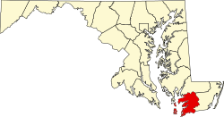
| County | |
| Elevation | 4 m (13 ft) |
| Time zone | UTC-5 (Eastern (EST)) |
| • Summer (DST) | UTC-4 (EDT) |
| ZIP codes | 21871, 21890 |
| Area codes | 410, 443, and 667 |
| GNIS feature ID | 588163 [1] |
Westover is an unincorporated community in Somerset County, Maryland, United States. [2] It is located on Maryland Route 413 near its terminus at U.S. Route 13. Owing to its central location in Somerset County, Westover is home to many important services and businesses.
Contents
- About
- Schools
- Public Schools
- Private Schools
- Other
- Transportation
- Main roads
- Public transportation
- References
Westover has a post office with the zip code of 21871, located at 8930 Crisfield Hwy. Its area code is 410.