
Maryland Route 45 is a state highway in the U.S. state of Maryland. Known for most of its length as York Road, the state highway runs 30.06 miles (48.38 km) from U.S. Route 1 /US 40 Truck in Baltimore north to the Pennsylvania state line in Maryland Line, where the highway continues as State Route 3001. MD 45 is the primary highway between Downtown Baltimore and Towson, the county seat of Baltimore County. North of Interstate 695 (I-695), the state highway parallels I-83 and serves the suburban communities of Lutherville, Timonium, Cockeysville, and Hunt Valley. MD 45 also connects the northern Baltimore County communities of Hereford and Parkton. The state highway is maintained by the Maryland State Highway Administration in Baltimore County and by the Baltimore City Department of Transportation in the city, where the highway also follows Greenmount Avenue.

Maryland Route 648 is a collection of state highways in the U.S. state of Maryland. These nine highways are current or former sections of the Baltimore–Annapolis Boulevard between Annapolis and Baltimore via Glen Burnie. There are five signed mainline segments of MD 648 through Arnold, Severna Park, Pasadena, Glen Burnie, Ferndale, and Pumphrey in northern Anne Arundel County; Baltimore Highlands in southern Baltimore County; and the independent city of Baltimore. MD 648 mainly serves local traffic along its meandering route, with long-distance traffic intended to use the parallel and straighter MD 2 south of Glen Burnie and freeway-grade Interstate 97 (I-97), I-695, and MD 295 between Glen Burnie and Baltimore.
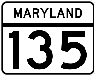
Maryland Route 135 is a state highway in the U.S. state of Maryland. Known for most of its length as Maryland Highway, the state highway runs 29.00 miles (46.67 km) from U.S. Route 219 in Oakland in Garrett County east to US 220 in McCoole in Allegany County. MD 135 is the main link between the towns of Oakland, Mountain Lake Park, Loch Lynn Heights, and Deer Park on the Appalachian Plateau and the communities of Bloomington, Luke, Westernport, and McCoole in the upper valley of the North Branch Potomac River. These groups of towns are separated by Backbone Mountain.

Maryland Route 108 is a state highway in the U.S. state of Maryland. The highway runs 34.23 miles (55.09 km) from MD 27 in Damascus east to MD 175 in Columbia. MD 108 is an S-shaped highway that winds through northern Montgomery County and central Howard County. The highway connects the Montgomery County communities of Laytonsville, Olney, Sandy Spring, and Ashton with the Howard County villages of Highland and Clarksville. MD 108 serves as the northern edge of Columbia and connects several of the planned community's suburban villages.

Maryland Route 23 is a state highway in the U.S. state of Maryland. The state highway runs 20.58 miles (33.12 km) from U.S. Route 1 in Hickory north and west to the Pennsylvania state line near Norrisville, where the highway continues as Pennsylvania Route 24. MD 23 is an L-shaped highway in northwestern Harford County that consists of two major sections. Between US 1 and MD 165 in Jarrettsville, MD 23 is marked east–west along a two-lane road with partial control of access named East–West Highway. From MD 165 to the state line, the state highway is marked north–south along Norrisville Road, a rural two-lane highway that passes through the villages of Madonna and Shawsville. The two sections of MD 23 are connected by a short concurrency with MD 165.

Maryland Route 980 is a designation used for a collection of five service roads in the U.S. state of Maryland along MD 4, four in Bristol and Waysons Corner in southern Anne Arundel County and one near Upper Marlboro in southern Prince George's County. MD 980 was assigned to the service roads constructed during the expansion of MD 4 to a four-lane divided highway in the early to mid-1960s.
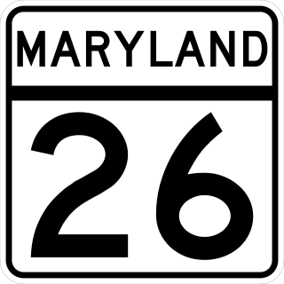
Maryland Route 26 is a state highway in the U.S. state of Maryland. Known for most of its length as Liberty Road, the state highway runs 44.10 miles (70.97 km) from U.S. Route 15 in Frederick east to MD 140 in Baltimore. MD 26 connects Frederick and Baltimore with the highway's namesake of Libertytown in eastern Frederick County, the suburban area of Eldersburg in southern Carroll County, and the western Baltimore County suburbs of Randallstown, Milford Mill, and Lochearn. The highway also serves as a major thoroughfare in the western part of Baltimore, where the street is named Liberty Heights Avenue. MD 26 is maintained by the Maryland State Highway Administration outside of Baltimore and by the Baltimore City Department of Transportation within the city.

Maryland Route 180 is a state highway in the U.S. state of Maryland. Known for most of its length as Jefferson Pike, the state highway runs 14.95 miles (24.06 km) from U.S. Route 340 in Knoxville east to Ballenger Creek Pike and Interstate 70 (I-70) in Frederick. MD 180 is the old alignment of US 340 through Knoxville, Petersville, and Jefferson in the Middletown Valley of western Frederick County. The state highway was originally constructed in the early 1910s and designated US 340 in 1927. MD 180 was assigned to the highway bypassed by the US 340 freeway between Sandy Hook in far southern Washington County and Jefferson in the mid-1960s. The state highway was extended east to Frederick and south along Ballenger Creek Pike after the US 340 freeway was completed in the late 1960s. MD 180 was rolled back to Frederick and removed from Washington County in 1989.
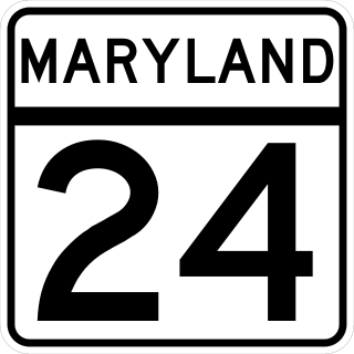
Maryland Route 24 (MD 24) is a state highway in the U.S. state of Maryland. The state highway runs 25.17 miles (40.51 km) from an entrance to Aberdeen Proving Ground in Edgewood north to the Pennsylvania state line near Fawn Grove, Pennsylvania, where the road becomes State Route 2055 (SR 2055). MD 24 is the main north–south highway of Harford County. The southern half of the state highway connects U.S. Route 1 (US 1) and the county seat of Bel Air with Aberdeen Proving Ground, US 40, and Interstate 95 (I-95) through a suburban corridor. The northern half of MD 24 is a rural highway that passes through Rocks State Park.
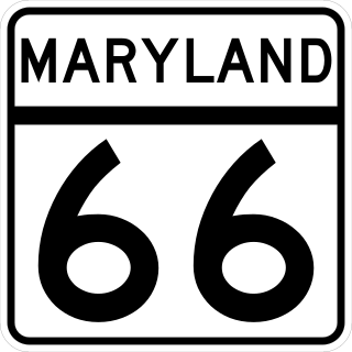
Maryland Route 66 is a state highway in the U.S. state of Maryland. Known for most of its length as Mapleville Road, the state highway runs 12.84 miles (20.66 km) from U.S. Route 40 Alternate in Boonsboro north to MD 64 near Smithsburg. MD 66 parallels the western flank of South Mountain in eastern Washington County, connecting Boonsboro and Smithsburg with Interstate 70 (I-70) and US 40. MD 66 was constructed in the late 1920s and early 1930s from Boonsboro to Cavetown. The state highway was extended north through Smithsburg after MD 64 bypassed the town in the late 1950s.
Maryland Route 34 is a state highway in the U.S. state of Maryland. Known for most of its length as Shepherdstown Pike, the state highway begins at the West Virginia state line at the Potomac River, where the highway continues south as West Virginia Route 480 through Shepherdstown. The state highway runs 9.95 miles (16.01 km) east to U.S. Route 40 Alternate in Boonsboro. MD 34 is the main east–west highway of southern Washington County, connecting Shepherdstown and Boonsboro with Sharpsburg and Keedysville. The state highway, which was preceded by the Boonsboro and Sharpstown Turnpike, was constructed as a modern highway in the late 1910s and early 1920s. MD 34's bypass of Keedysville opened around 1960. The western end of the state highway has had three bridges. A 19th-century bridge was destroyed in a 1936 flood and replaced by the James Rumsey Bridge in 1939. The present bridge, also named for James Rumsey, opened in 2005.
Maryland Route 67 is a state highway in the U.S. state of Maryland. Known as Rohrersville Road, the state highway runs 12.20 miles (19.63 km) from U.S. Route 340 in Weverton north to US 40 Alternate in Boonsboro. MD 67 parallels the western flank of South Mountain in southeastern Washington County, connecting Boonsboro with Weverton and Rohrersville. In conjunction with US 340 and US 40 Alternate, MD 67 connects Hagerstown and Harpers Ferry, West Virginia, a link that made the highway one of the original state roads marked for improvement in 1909. The first section of the state highway was constructed through Rohrersville around 1920. The remainder of the highway was built between Boonsboro and Weverton in the late 1920s and early 1930s. MD 67 was reconstructed with multiple relocations starting in the late 1950s, culminating in a relocation at the southern terminus to tie into the US 340 freeway in the late 1960s.

Maryland Route 68 is a state highway in the U.S. state of Maryland. The state highway runs 18.50 miles (29.77 km) from U.S. Route 40 in Clear Spring east to US 40 Alternate in Boonsboro. MD 68 crosses central Washington County to the south of Hagerstown, connecting Clear Spring and Boonsboro with Williamsport, where the highway runs concurrently with MD 63. A small segment of MD 68 west of Boonsboro was constructed around 1920, using as part of the route two early 19th-century stone bridges. The remainder of the highway between Boonsboro and Williamsport was constructed in the second half of the 1920s. MD 68 was extended west from Williamsport to Clear Spring in the mid-1950s. The state highway was relocated south of Williamsport for the construction of Interstate 81 (I-81) in the mid-1960s. Since the early 1990s, I-68 has also existed in Washington County; signs on I-70 aim to avoid confusion between I-68 and MD 68.

Maryland Route 117 is a state highway in the U.S. state of Maryland. The highway runs 12.40 miles (19.96 km) from MD 28 near Dawsonville east to West Diamond Avenue next to MD 355 in Gaithersburg. MD 117 is an L-shaped highway that connects the rural western Montgomery County communities of Dawsonville and Boyds with Germantown, Gaithersburg, and Interstate 270 (I-270) in the suburban central part of the county. The highway also provides access to Seneca Creek State Park, the National Institute of Standards and Technology, and several commuter rail stations along MARC's Brunswick Line, which the highway parallels. MD 117 was the inspiration for the 1971 hit song "Take Me Home, Country Roads".

Maryland Route 118 is a state highway in the U.S. state of Maryland. Known as Germantown Road, the highway runs 7.08 miles (11.39 km) from MD 28 in Darnestown north to MD 355 in Germantown. MD 118 is the four- to six-lane main highway through the central Montgomery County community of Germantown. The highway also connects Germantown and Darnestown with Interstate 270 (I-270). The northernmost part of MD 118 was paved by 1910. The highway was extended south through Germantown in the early 1920s and extended to Darnestown in the early 1930s. MD 118 was relocated and expanded to a divided highway through Germantown in the late 1980s and late 1990s, and near its northern end in the mid-1990s.
Maryland Route 212 is a state highway in the U.S. state of Maryland. The highway runs 10.43 miles (16.79 km) from the District of Columbia boundary in Chillum north and east to U.S. Route 1 near Beltsville. MD 212 connects the northern Prince George's County communities of Chillum, Langley Park, Adelphi, Hillandale, Calverton, and Beltsville. The highway was constructed from Washington, D.C. to Adelphi in the early 1910s and extended north through Adelphi to Hillandale in the early 1930s. A separate portion of MD 212 was built from west of US 1 through Beltsville to what is now MD 201 in the early 1930s; the two sections were unified in the early 1940s. The route was expanded to a divided highway south of Langley Park in the early 1960s and at Interstate 95 (I-95) in the early 1970s. MD 212's eastern terminus was relocated north of Beltsville after a series of county highways were upgraded and brought into the state highway system in the 2000s and early 2010s; the old highway through Beltsville to MD 201 became MD 212A.
Maryland Route 121 is a state highway in the U.S. state of Maryland. Known as Clarksburg Road, the highway runs 3.96 miles (6.37 km) from MD 117 in Boyds north to Stringtown Road between Interstate 270 (I-270) and MD 355 in Clarksburg. MD 121 connects Boyds and Clarksburg in northern Montgomery County. The highway was paved from Clarksburg to Boyds in the early to mid-1910s. MD 121 was extended to north of Clarksburg in the late 1920s and early 1930s. MD 121 was relocated through Clarksburg in the mid-1950s when I-270 was constructed through the area. The highway's northern end was rolled back to MD 355 in the mid-1970s. MD 121 was relocated in Boyds in the mid-1980s. The highway's northern end was moved to its present terminus just north of I-270 when Stringtown Road was constructed in the mid-2000s. In addition to the Boyds–Clarksburg route, MD 121 has also included three disjoint segments in Dawsonville and Germantown. All three of these routes were segments of the original MD 119.
Maryland Route 258 is a state highway in the U.S. state of Maryland. Known as Bay Front Road, the route runs 7.13 miles (11.47 km) from Wrighton Road in Bristol east to MD 256 in Deale. MD 258 is the main connection between MD 4 and the southern Anne Arundel County bayside communities of Deale and Shady Side. MD 258 was constructed from MD 2 at Tracys Landing west to Bristol in the late 1920s and early 1930s. The highway was rebuilt at its western end and extended east from MD 2 to MD 256 in the early 1960s.
Maryland Route 383 is a state highway in the U.S. state of Maryland. Known as Broad Run Jefferson Road, the state highway runs 5.48 miles (8.82 km) from MD 180 in Jefferson north to MD 17 near Burkittsville. MD 383 was built in four sections from MD 17 toward Jefferson between 1929 and 1953.


