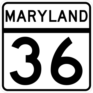
Maryland Route 36 is a 29.43-mile (47.36 km) state highway located in Allegany County, Maryland, United States. MD 36's southern terminus is at the West Virginia Route 46 (WV 46) bridge in Westernport and its northern terminus at U.S. Route 40 Alternate near Cumberland. Between Westernport and Frostburg, it is known as Georges Creek Road, and from Frostburg to Cumberland it is known as Mount Savage Road. Like the majority of Maryland state highways, MD 36 is maintained by the Maryland State Highway Administration (MDSHA).

Maryland Route 7 (MD 7) is a collection of state highways in the U.S. state of Maryland. Known for much of their length as Philadelphia Road, there are five disjoint mainline sections of the highway totaling 40.23 miles (64.74 km) that parallel U.S. Route 40 (US 40) in Baltimore, Harford, and Cecil counties in northeastern Maryland. The longest section of MD 7 begins at US 40 just east of the city of Baltimore in Rosedale and extends through eastern Baltimore County and southern Harford County to US 40 in Aberdeen. The next segment of the state highway is a C-shaped route through Havre de Grace on the west bank of the Susquehanna River. The third mainline section of MD 7 begins in Perryville on the east bank of the Susquehanna River and ends at US 40 a short distance west of the start of the fourth section, which passes through Charlestown and North East before ending at US 40, just west of Elkton. The fifth segment of the highway begins at South Street and passes through the eastern part of Elkton before reconnecting with US 40 east of Elkton and west of the Delaware state line.

Maryland Route 144 is a collection of state highways in the U.S. state of Maryland. These highways are sections of old alignment of U.S. Route 40 between Cumberland and Baltimore. Along with US 40 Scenic, US 40 Alternate, and a few sections of county-maintained highway, MD 144 is assigned to what was once the main highway between the two cities, connecting those endpoints with Hancock, Hagerstown, Frederick, New Market, Mount Airy, Ellicott City, and Catonsville. MD 144 has seven disjoint sections of mainline highway that pass through the Appalachian Mountains in Allegany and Washington counties and the rolling Piedmont of Frederick, Carroll, Howard, and Baltimore counties.

Maryland Route 564 is a state highway in the U.S. state of Maryland. Known for most of its length as Lanham Severn Road, the state highway runs 6.73 miles (10.83 km) from MD 450 in Lanham east to a dead end near a connection to MD 197 in Bowie. MD 564 was constructed from Lanham to Old Town Bowie in the mid-1930s. In the early 1990s, the highway was extended east over part of MD 197 when that highway was relocated through Bowie.
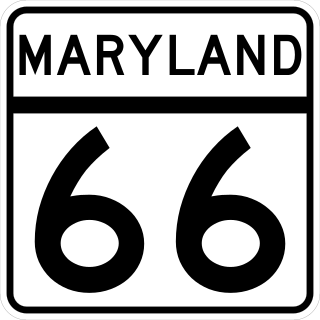
Maryland Route 66 is a state highway in the U.S. state of Maryland. Known for most of its length as Mapleville Road, the state highway runs 12.84 miles (20.66 km) from U.S. Route 40 Alternate in Boonsboro north to MD 64 near Smithsburg. MD 66 parallels the western flank of South Mountain in eastern Washington County, connecting Boonsboro and Smithsburg with Interstate 70 (I-70) and US 40. MD 66 was constructed in the late 1920s and early 1930s from Boonsboro to Cavetown. The state highway was extended north through Smithsburg after MD 64 bypassed the town in the late 1950s.

Maryland Route 35 is a state highway in the U.S. state of Maryland. Known as Ellerslie Road, the state highway runs 2.37 miles (3.81 km) north from MD 36 in Corriganville to the Pennsylvania state line in Ellerslie. There the highway continues north as Pennsylvania Route 96.
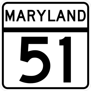
Maryland Route 51 is a state highway in the U.S. state of Maryland. Known for most of its length as Oldtown Road, the state highway runs 25.53 miles (41.09 km) from an interchange with Interstate 68 (I-68) in Cumberland south to the West Virginia state line at the Potomac River, where the highway continues east as West Virginia Route 9 toward Paw Paw. Around Cumberland, MD 51 is a major highway that provides a bypass of the South End neighborhood of that city and access to industrial areas along the North Branch Potomac River. South of North Branch, MD 51 is a rural highway connecting small communities along the river in southeastern Allegany County, including Oldtown. Documentation from the Maryland State Highway Administration depict the highway as following an east-west alignment, but all signage indicates a north-south road.

Maryland Route 53 is a state highway in the U.S. state of Maryland. Known as Winchester Road, the state highway runs 3.33 miles (5.36 km) from U.S. Route 220 in Cresaptown north to US 40 Alternate in La Vale. MD 53 is the northernmost part of the Winchester Road, a colonial era road between Cumberland and Winchester, Virginia. The modern MD 53 was constructed in the mid-1920s and updated in the 1950s.

Maryland Route 55 (MD 55) is a state highway in the U.S. state of Maryland. Known as Vale Summit Road, the state highway runs 2.53 miles (4.07 km) from MD 36 in Vale Summit north to U.S. Route 40 Alternate in Clarysville. MD 55 connects the La Vale area with Midland in the upper Georges Creek Valley in northwestern Allegany County. MD 55 was paved from Clarysville to Vale Summit around 1921 and extended south to Midland in the late 1930s. The southern terminus of the state highway was truncated at Vale Summit when MD 36 took over part of the highway for a new alignment in the early 1970s.

Maryland Route 638 is a state highway in the U.S. state of Maryland. Known as Parkersburg Road, the state highway runs 2.34 miles (3.77 km) from MD 743 in Eckhart Mines north to MD 36 near Mount Savage in northwestern Allegany County. MD 638 was constructed in the late 1930s.

Maryland Route 936 is a state highway in the U.S. state of Maryland. Known for most of its length as Upper Georges Creek Road, the state highway runs 5.04 miles (8.11 km) from Church Street in Midland north to U.S. Route 40 Alternate and MD 36 in Frostburg. MD 936 is the old alignment of MD 36 between Midland and Frostburg in the upper Georges Creek Valley of western Allegany County. The state highway was designated when MD 36 moved to a new alignment between the two communities in the early 1970s.

Maryland Route 937 is an unsigned state highway in the U.S. state of Maryland. The state highway runs 1.53 miles (2.46 km) from MD 135 north to MD 36 within Westernport. MD 937 is the old alignment of MD 36 through Westernport in the Georges Creek Valley of western Allegany County. The state highway was designated when MD 36 moved to a new alignment through the community in the early 1980s.

Maryland Route 47 is a state highway located in Allegany County in the U.S. state of Maryland. Known as Barrelville Road, the state highway runs 1.67 miles (2.69 km) from MD 36 in Barrelville north to the Pennsylvania state line, where the highway continues north as Pennsylvania Route 160. While it is a minor route today, MD 47 was once part of the main highway between Cumberland and Somerset, Pennsylvania. The state highway was constructed in its modern form in the early 1920s.

Maryland Route 807 is an unsigned state highway in the U.S. state of Maryland. Known as Bedford Road, the state highway runs 3.52 miles (5.66 km) from the city limits of Cumberland north to U.S. Route 220 in Dickens. MD 807 is the original alignment of US 220 north of Cumberland. The state highway was assigned to the portion of highway between the city line and Naves Cross Road, presently MD 144, after US 220 was moved to Interstate 68 through downtown Cumberland in 1982. MD 807 was extended to its present northern terminus when the US 220 Bedford Road bypass opened in 2000.

Maryland Route 62 is a state highway in the U.S. state of Maryland. Known for most of its length as Little Antietam Road, the state highway runs 3.88 miles (6.24 km) from MD 804 in Chewsville north to MD 60 in Leitersburg in northeastern Washington County. MD 62 was constructed in two sections in the mid 1910s and the early 1930s.

Maryland Route 639 is a state highway in the U.S. state of Maryland. The state highway runs 2.79 miles (4.49 km) from MD 51 in Evitts Creek north to Interstate 68 (I-68), U.S. Route 40, US 220, and US 40 Alternate in Cumberland. MD 639 provides access to Allegany College of Maryland and UPMC Western Maryland hospital, which opened in November 2009. The Willowbrook Road portion of the state highway was constructed in the late 1960s. MD 639 was extended south to MD 51 in 2008.

U.S. Route 220 is a part of the U.S. Highway System that runs from Rockingham, North Carolina, to South Waverly, Pennsylvania. In Maryland, the federal highway runs 27.30 miles (43.94 km) from the West Virginia state line at the North Branch Potomac River in McCoole north to the Pennsylvania state line in Dickens. Known as McMullen Highway for much of its length in Maryland, US 220 is the primary north–south route in central Allegany County, connecting Cumberland with its southern suburbs and Keyser, West Virginia, to the south and Bedford, Pennsylvania, to the north. The federal highway is part of the National Highway System between the West Virginia state line and Maryland Route 53 in Cresaptown and between Interstate 68 (I-68), with which it is concurrent through Cumberland, and the Pennsylvania state line.

Maryland Route 381 is a state highway in the U.S. state of Maryland. Known as Brandywine Road, the highway runs 15.91 miles (25.60 km) from MD 231 at Patuxent north to U.S. Route 301 in Brandywine. MD 381 connects Brandywine with the southeastern corner of Prince George's County and the northeastern corner of Charles County. The highway was constructed from MD 5 through Brandywine in the 1910s. MD 381 was extended southeast to MD 231 in the late 1920s and early 1930s. When MD 5 was relocated between Camp Springs and Brandywine in the mid-1950s, MD 381 was extended north along the old road to Camp Springs. The highway was rolled back to its present terminus at US 301 in the mid-1960s. The route can serve as an alternate route to the more heavily traveled MD 5 for those wanting to go from St. Mary's, Calvert, and eastern Charles counties to Brandywine.

U.S. Route 40 Scenic (US 40 Scenic) is a scenic route of US 40 in the U.S. state of Maryland. US 40 Scenic, which is known for most of its route as National Pike, is the old alignment of US 40 over Town Hill in eastern Allegany County and Sideling Hill in far western Washington County. The highway was originally constructed as part of a turnpike connecting Baltimore with the eastern end of the National Road at Cumberland in the early 19th century. The highway was paved as a modern road in the mid-1910s and designated US 40 in the late 1920s. US 40 was relocated over Sideling Hill in the early 1950s and over Town Hill in the mid-1960s. The US 40 Scenic designation was first applied to the old highway over Town Hill in 1965. Following the completion of Interstate 68 (I-68) at Sideling Hill, US 40 Scenic was extended east along old US 40's crossing of the mountain in the late 1980s. US 40 Scenic is the only scenic route in the U.S. Highway System; formerly, there was a second, US 412 Scenic in Oklahoma, but this has since been redesignated to a more conventional "Alternate" route.


