Klyuchevskaya Sopka is a stratovolcano, the highest mountain on the Kamchatka Peninsula of Russia and the highest active volcano of Eurasia. It is the highest mountain in Siberia. Its steep, symmetrical cone towers about 100 kilometres (60 mi) from the Bering Sea. The volcano is part of the natural Volcanoes of Kamchatka UNESCO World Heritage Site.

Atlasov Island, known in Russian as Ostrov Atlasova (Остров Атласова), or in Japanese as Araido (阿頼度島), is the northernmost island and volcano and also the highest volcano of the Kuril islands, part of the Sakhalin Oblast in Russia. The Russian name is sometimes rendered in English as Atlasova Island. Other names for the island include Uyakhuzhach, Oyakoba and Alaid, the name of the volcano on the island.

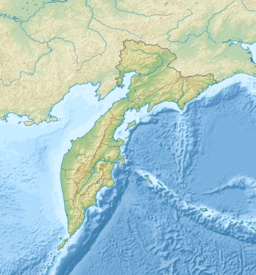
The Kamchatka Peninsula is a 1,250-kilometre-long (780 mi) peninsula in the Russian Far East, with an area of about 270,000 km2 (100,000 sq mi). The Pacific Ocean and the Sea of Okhotsk make up the peninsula's eastern and western coastlines, respectively. Immediately offshore along the Pacific coast of the peninsula runs the 10,500-metre-deep (34,400 ft) Kuril–Kamchatka Trench.

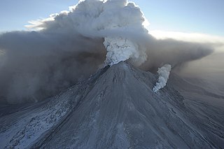
Bezymianny is an active stratovolcano in Kamchatka, Russia. Bezymianny volcano had been considered extinct until 1955. Activity started in 1955, culminating in a dramatic eruption on 30 March 1956. This eruption, similar to that of Mount St. Helens in 1980, produced a large horseshoe-shaped crater that was formed by collapse of the summit and an associated lateral blast. Subsequent episodic but ongoing lava dome growth, accompanied by intermittent explosive activity and pyroclastic flows, has largely filled the 1956 crater. The most recent eruption of lava flows occurred in February 2013. An explosive eruption on 20 December 2017 released an ash plume rising to a height of 15 kilometres (49,000 ft) above sea level, which drifted for 320 kilometres (200 mi) NE.

Tolbachik is a volcanic complex on the Kamchatka Peninsula in the far east of Russia. It consists of two volcanoes, Plosky (flat) Tolbachik and Ostry (sharp) Tolbachik, which as the names suggest are respectively a flat-topped shield volcano and a peaked stratovolcano. As Ostry is the mountain's highest point, the entire mountain is often referred to as "Ostry Tolbachik", not to be confused with Ostry, a separate volcano to the north also on the Kamchatka Peninsula.

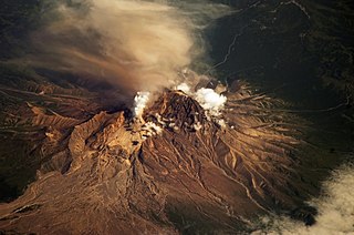
Shiveluch is the northernmost active volcano in Kamchatka Krai, Russia. It, and Karymsky are Kamchatka's largest, and most active and most continuous erupting volcanoes.

Koryaksky or Koryakskaya Sopka is an active volcano on the Kamchatka Peninsula in the Russian Far East. It lies within sight of Kamchatka Krai's administrative center, Petropavlovsk-Kamchatsky. Together with neighbouring Avachinsky, it has been designated a Decade Volcano, worthy of particular study in light of its history of explosive eruptions and proximity to populated areas.

Avachinsky is an active stratovolcano on the Kamchatka Peninsula in the far east of Russia. It lies within sight of the capital of Kamchatka Krai, Petropavlovsk-Kamchatsky. Together with neighboring Koryaksky volcano, it has been designated a Decade Volcano, worthy of particular study in light of its history of explosive eruptions and proximity to populated areas.

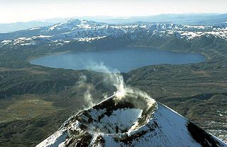
Kronotsky is a major stratovolcano on Kamchatka Peninsula, Russia. It is located in Kronotsky Nature Reserve to the east of Lake Kronotskoye. It has a particularly symmetrical conical shape, comparable to Mount Fuji in Japan and to Mayon Volcano in the Philippines. The summit crater is plugged by a volcanic neck, and the summit itself is ice-capped. It exhibits the classic radial drainage pattern, extending downward from its crater. Kronotsky is considered to be one of the most scenic volcanos in Kamchatka.

A somma volcano is a volcanic caldera that has been partially filled by a new central cone. The name comes from Mount Somma, a stratovolcano in southern Italy with a summit caldera in which the upper cone of Mount Vesuvius has grown.

Kamchatka Krai is a federal subject of Russia. It is geographically located in the Far East region of the country, and it is administratively part of the Far Eastern Federal District. Kamchatka Krai has a population of 322,079 (2010).

Karymsky is an active stratovolcano on the Kamchatka Peninsula, Russia. It is currently the most active volcano on the Kamchatka Peninsula, as well as the most active volcano of Kamchatka's eastern volcanic zone.

Ichinsky is a large stratovolcano located in the central part of Kamchatka Peninsula, Russia. At 3,607 metres (11,834 ft), it is the highest peak of the Sredinny Range, the central range of the peninsula. Ichinsky is also among the largest volcanoes in Kamchatka, with a volume of about 450 cubic kilometres (110 cu mi).

Sredinny Range is a mountain range on the Kamchatka Peninsula of Russia at 56°N158°E. It stretches from northeast to southwest along the center of the peninsula and is made up of volcanoes, mostly shield volcanoes and stratovolcanoes. The highest peak of the range is Ichinsky, a stratovolcano some 3,607 metres (11,834 ft)) high. The Sredinny Range is separated from the north-south running coastal Eastern Range (Vostochny) to the east, by the Central Kamchatka Depression.

Udina is a volcanic massif located in the central part of Kamchatka Peninsula, Russia. It comprises two conical stratovolcanoes: Bolshaya Udina and Malaya Udina.

The volcanoes of Kamchatka are a large group of volcanoes situated on the Kamchatka Peninsula, in eastern Russia. The Kamchatka River and the surrounding central side valley are flanked by large volcanic belts containing around 160 volcanoes, 29 of them still active. The peninsula has a high density of volcanoes and associated volcanic phenomena, with 29 active volcanoes being included in the six UNESCO World Heritage List sites in the Volcanoes of Kamchatka group, most of them on the Kamchatka Peninsula.

Kronotsky (Кроноцкий) Nature Reserve is a nature area reserved for the study of natural sciences in the remote Russian Far East, on the coast of the Kamchatka Peninsula. It was created in 1934 and its current boundary contains an area of 10,990 km2 (4,240 sq mi). The largest lake in the reserve is Lake Kronotskoye, which covers an area of 246 square kilometres (95 sq mi). It also has Russia's only geyser basin, plus several mountain ranges with numerous volcanoes, both active and extinct. Due to its often harsh climate and its mix of volcanoes and geysers, it is frequently described as the Land of Fire and Ice.

Eastern Range is a mountain range on the Kamchatka Peninsula, Kamchatka Krai, Russian Far East. It is a complex range mainly consisting of volcanic peaks. Together with the Middle Range, it is one of the two main mountain systems of the peninsula.


