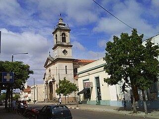
Artigas is the capital of the Artigas Department of Uruguay. Its name comes from that of the national hero, José Gervasio Artigas, who fought for the emancipation of the River Plate, and sought to create a federative nation from these colonies. As of the census of 2011, it is the eleventh most populous city in the country.
Artigas Department is the northernmost department of Uruguay, located in its northwestern region. Its capital is the city of Artigas, which borders on the Brazilian city of Quaraí. Artigas Department has an area of 11,928 square kilometres (4,605 sq mi), making it the fifth largest in the country. The population is 73,378 inhabitants, according to the 2011 census.

Cerro Largo Department is a department of Uruguay. Its capital is Melo. It is located in the east of the country, bordering Brazil to its northeast with Yaguaron River as the natural border, Treinta y Tres Department to its south, Durazno Department to its west and the departments of Tacuarembó and Rivera to its northwest with Negro River as its natural border with them.

Rivera is the capital of Rivera Department of Uruguay. The border with Brazil joins it with the Brazilian city of Santana do Livramento, which is only a block away from it, at the north end of Route 5. Together, they form an urban area of around 200,000 inhabitants. As of the census of 2011, it is the sixth most populated city of Uruguay.
Rivera Department is a department of the northern region of Uruguay. It has an area of 9,370 km2 (3,620 sq mi) and a population of 103,493. Its capital is the city of Rivera. It borders Brazil to the north and east, Cerro Largo Department to the southeast, Tacuarembó Department to the south and west and Salto Department to the northwest.

Bella Unión is a city in the north part of Artigas Department of Uruguay.
The Battle of Masoller, which occurred on September 1, 1904, was the final battle of the Aparicio Saravia revolt, resulting in the victory of the Colorado forces.

Santana do Livramento, also spelled Sant'Ana do Livramento, is a city in the state of Rio Grande do Sul, Brazil. It is located along the border with the city of Rivera, Uruguay, forming together an international city of almost 170,000 inhabitants. Santana do Livramento was founded on 30 July 1823, and in 1857 was emancipated from Alegrete as a city. In 2009, the city was officially declared by the Brazilian government as the symbolic city of Brazilian integration with the Mercosur member states.

Aparicio Saravia da Rosa was a Uruguayan politician and military leader. He was a member of the Uruguayan National Party and was a revolutionary leader against the Uruguayan government.

Brazil–Uruguay relations encompass many complex relations over the span of three centuries, beginning in 1680 with the establishment of the Colónia do Sacramento, to the present day, between the Federative Republic of Brazil and the Oriental Republic of Uruguay. Brazil and Uruguay are neighbouring countries in South America, and share close political, economic and cultural ties. The singularity of the bilateral relationship between the two countries originates from a strong historical connection, as both countries having been territories of the Portuguese Empire and sharing the same language – marked by important events, such as the establishment of the Colónia do Sacramento in 1680, the invasion of the Banda Oriental by Brazil in 1815 and the subsequent creation of the Província Cisplatina, and Uruguay's independence from Brazil in 1828. The bilateral relationship was further defined by the Uruguayan Civil War (1839–1851) and the Paraguayan War (1864–1870).

The borders of Brazil are the international borders that Brazil shares with neighbouring countries. Brazil has terrestrial boundaries with nine countries of South America, and with the French Department of Guiana. Brazil has borders with every country in South America with the exception of Chile and Ecuador, totalling 16,885 kilometres (10,492 mi). Brazil has the world's third longest land border, behind China and Russia.
Las Piedras is a suburb of Bella Unión in the Artigas Department of northern Uruguay.
Topador is a populated centre in the north of the Artigas Department of northern Uruguay, near the borders with Brazil.
Sarandí del Arapey is a village or populated centre in the eastern part of the Salto Department of northwestern Uruguay.
Sequiera is a village ("pueblo") in the south of the Artigas Department in northwestern Uruguay.
Nico Pérez is a village in the Florida Department of central Uruguay. It is located on the border of the Lavalleja Department.
José Batlle y Ordóñez is a small town in the northwest of Lavalleja Department in Uruguay.
Lapuente is a village, or populated centre, in the Rivera Department of northeastern Uruguay.
Portones de Hierro y Campodónico is a populated rural area and suburb the city of Bella Unión in Artigas Department of northwestern Uruguay.

