Modes of transport in Gabon include rail, road, water, and air. The one rail link, the Trans-Gabon Railway, connects the port of Owendo with the inland town of Franceville. Most but not all of the country is connected to the road network, much of which is unpaved, and which centres on seven "national routes" identified as N1 to N7. The largest seaports are Port-Gentil and the newer Owendo, and 1,600 km of inland waterways are navigable. There are three international airports, eight other paved airports, and over 40 with unpaved runways. Nearly 300 km of pipelines carry petroleum products, mainly crude oil.

Guinea, officially the Republic of Guinea, is a west-coastal country in West Africa. Formerly known as French Guinea, the modern country is sometimes referred to as Guinea-Conakry to distinguish it from other countries with "Guinea" in the name and the eponymous region, such as Guinea-Bissau and Equatorial Guinea. Guinea has a population of 12.4 million and an area of 245,857 square kilometres (94,926 sq mi).

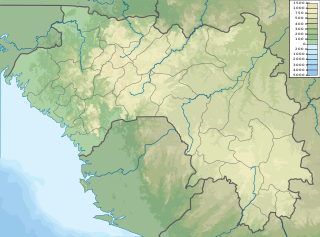
Transport in Guinea is composed by a variety of systems that people in the country use to get around as well as to and from domestic and international destinations.
Transport in Papua New Guinea is in many cases heavily limited by the mountainous terrain. The capital, Port Moresby, is not linked by road to any of the other major towns and many highland villages can only be reached by light aircraft or on foot.

There are a number of systems of transport in Sierra Leone, a country in West Africa, which possess road, rail, air and water infrastructure, including a network of highways and several airports.

Dabola is a in central Guinea. As of 2014 it had a population of 38,617 people. It grew around the railway line from Conakry to Kankan and is known for the Tinkisso Falls and for its important dam.

Forécariah is a sub-prefecture and town located in western Guinea. Population 21,710.
Iron ore production in Africa is dominated by South Africa, Mauritania and Algeria. Many countries possess iron ore deposits that are as yet untapped/unmined. Countries and companies currently involved in production are listed here; measurements are in tonnes per annum(year).
Simandou is a 110-kilometre-long (68 mi) range of hills located in the Nzérékoré and Kankan regions of southeastern Guinea, in the country's mountainous, forested Guinée Forestière region. At the southern end of the range the site of a large iron ore deposit is currently being developed.
The Transguinean Railways is a proposed set of heavy duty standard gauge railways in Guinea to support heavy duty haulage of primarily iron ore and bauxite.
Railway stations in Sierra Leone include:
Railway stations in the Republic of the Congo (Congo) include:
Railway stations in Guinea include:
Railway stations in Mali include:
Kalia is one of two towns in Guinea with this name. This is the one in Faranah Prefecture. It is east of the capital Conakry near Faranah and near to the border with Sierra Leone.
Moussaya is a town and sub-prefecture in the Forécariah Prefecture in the Kindia Region of western Guinea.

Guinea has 1,086 km of railways. This includes 279 km at 1,435 mm gauge and 807 km at 1,000 mm gauge. The latter includes 662 km in common carrier service from Kankan to Conakry.
Naigaya is a village in southwest Guinea. It is near the border with Sierra Leone. Its elevation 411.0 metres (1,348.4 ft). It is in the Prefecture of Kindia.
The Simandou mine is a large iron mine located in the Simandou mountain range of southern Guinea's Nzérékoré Region. Simandou represents one of the largest iron ore reserves in Guinea and in the world, having estimated reserves of 2.4 billion tonnes of ore grading 65% iron metal.
