
The administrative units of Pakistan comprise four provinces, one federal territory, and two disputed territories: the provinces of Punjab, Sindh, Khyber Pakhtunkhwa, and Balochistan; the Islamabad Capital Territory; and the administrative territories of Azad Jammu and Kashmir and Gilgit–Baltistan. As part of the Kashmir conflict with neighbouring India, Pakistan has also claimed sovereignty over the Indian-controlled territories of Jammu and Kashmir and Ladakh since the First Kashmir War of 1947–1948. It also has a territorial dispute with India over Junagadh, but has never exercised administrative authority over either regions. All of Pakistan's provinces and territories are subdivided into divisions, which are further subdivided into districts, and then tehsils, which are again further subdivided into union councils.

Hyderabad District, is a district of Sindh, Pakistan. Its capital is the city of Hyderabad. The district is the second most urbanized in Sindh, after Karachi, with 80% of its population residing in urban areas.

Sanghar District (Sindhi: ضلعو سانگھڙ, Urdu: ضلع سانگھڑ) is one of the largest districts of Sindh province, Pakistan. This district lies between 25058'13 N latitudes and 69024'4E longitudes. It was a village before Mallah tribe were settled there. This district has the largest Mallah population. It has an area of 9874 square kilometres. It is located in the centre of Sindh and is bounded to the east by India. The district capital, Sanghar, is itself a small city roughly 35 miles (56 km) east-south-east of the city of Nawabshah and the same distance north of Mirpur Khas. Its primary industry is agriculture.
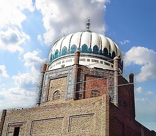
Hala is a city and taluka of Matiari district of Sindh, Pakistan. According to the Revenue record, Hala was given the status of Taluka of Hyderabad District in 1848. In 2005, it became part of Matiari District. Hala is located on the N-5 National Highway of Pakistan at a distance of about 62 kilometers from Hyderabad. Hala is also located on the Tando Adam - Mehrabpur Railway Line but that railway line has been discontinued by Pakistan Railways. As of the 2023 census, the Hala Municipal Corporation has a population of 71,094. The total population of Hala Taluka is 286,155 (2023) which includes Hala Municipal Corporation, Hala Old, Bhit Shah, Bhanote and surrounding areas.

Dadu District, is a district of Sindh Province, Pakistan. With headquarters in the city of Dadu, the district was created in 1931 by merging Kotri and Mahal Kohistan tehsils from Karachi District and Mehar, Khairpur Nathan Shah, Dadu, Johi and Sehwan tehsils from Larkana District. In 2004, several talukas in the south were split off to create the new Jamshoro District. Its boundary touches four districts of Sindh: Jamshoro, Naushahro Feroze, Shaheed Benazirabad and Kamber Shahdadkot.

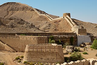
Jacobabad District is a district in the province of Sindh, Pakistan. According to 2023 Census population of Jacobabad District is 1,174,097 It is located in the north of Sindh, by the provincial boundary with Balochistan. Its headquarters is the town of Jacobabad, which was founded by General John Jacob in 1847.
Jamshoro District is a district of Sindh province, Pakistan. Jamshoro city is the capital while Kotri is the largest city of the Jamshoro District. The district borders Dadu district to the north. To the east, the Indus separates it from Shaheed Benazirabad, Matiari and Hyderabad districts. Thatta district lies to the south, and Karachi district to the southwest. To the west is the Kirthar Range that mark the boundary between Pakistan's provinces of Balochistan and Sindh, separating Jamshoro from Hub district of Balochistan.

Naushahro Feroze District is a district in the province of Sindh, Pakistan. Its capital is Naushahro Feroze city. Administratively subdivided into five talukas and 51 union councils, according to the 2017 census of Pakistan it had a population of 1,612,373. The Naushahro Feroze was given the status of District on 15 November 1989 and. Before, it was Taluka of Nawabshah District. On given status as district, Naushahro Feroze was placed under administrative control of Sukkur Division however, it has been placed under Shaheed Benazirabad Division during 2011.

Qambar Shahdadkot District is a district of Sindh, Pakistan, originally named after Shahdad Khan Khuhawar the official founder. District Qambar Shahdadkot, with headquarters at Qambar, was established on 13 December 2004.
Matyari or Matiari is a city located in Sindh, Pakistan. It is 30 km (19 mi) north of Hyderabad on N-5 National Highway. Matiari is also the district headquarter of Matiari District.

Matiari District is a district in the Pakistani province of Sindh. Located on the left bank of the Indus River, Matiari became an independent district on 30 May 2004 during the military regime of Pervez Musharraf, when Hyderabad was divided into four districts — Tando Allahyar, Matiari, Tando Mohammad Khan and Hyderabad.

Tando Muhammad Khan District is a district located in the Sindh province of Pakistan.
Pakistan is a federal republic with three tiers of government: national, provincial and local. Local government is protected by the constitution in Articles 32 and 140-A, and each province also has its own local-government-enabling legislation and ministries responsible for implementation. District councils and metropolitan corporations are respectively the highest rural and urban tiers of local government in the provinces. Both urban and rural local government have two or three tiers in all provinces except Khyber Pakhtunkhwa, where councils are not identified as either urban or rural. There are 129 district councils across the four provinces, 619 urban councils made up of one city district, four metropolitan corporations, 13 municipal corporations, 96 municipal committees, 148 town councils, 360 urban union committees, and 1,925 rural councils. Additionally there are 3339 neighbourhood, ‘tehsil’ and village councils in Khyber Pakhtunkhwa.

Hyderabad City Tehsil is an administrative subdivision (tehsil) of Hyderabad District in the Sindh province of Pakistan. Hyderabad district is subdivided into 4 tehsils or talukas, the urban area around the capital Hyderabad is part of Hyderabad City Taluka.
Samaro is a tehsil in the Sindh province of Pakistan. The town is the headquarters of a tehsil of Umarkot District.
Thul Tehsil is an administrative Tehsil of Jacobabad District in the Sindh province of Pakistan. The subdivision is administratively subdivided into 24 Union Councils, two of which form the capital, Thul. Thul is one of the densely populated Taluka of District Jacobabad, spreading over 317,520 acres. It consists of about half of the population of whole district and its population is approximately 356,705. There are 19 union councils and 96 Dehs in this taluka. The headquarters of this taluka are about 33 km at the east side of district headquarters and connected with rail and road with other parts such as Kandhkot, Shikarpur and Baluchistan province.
Hala Tehsil is an administrative subdivision (Tehsil) of Matiari District in the Sindh province of Pakistan. As of the 2017 census, Hala Taluka has a population of 262,423. The rural population is 143,965 and urban population 118,458. Hala City is the headquarter of this Tehsil. Important towns/villages of this taluka include Hala old, Bhit Shah, Panj Moro, Khandu and Bhanoth.
New Saeedabad Tehsil is an administrative subdivision (Tehsil) of Matiari District in the Sindh province of Pakistan.
Kot Ghulam Muhammad is named after Ghulam Muhammad Khan Bhurgri, the Tehsil situated in south-east Mirpur Khas District of the Southern Province Sindh in Pakistan. Kot Ghlam Muhammad Bhurgri is situated west of Samaro and north of Digri. It is about 45 kilometres (28 mi) south of Mirpur Khas.
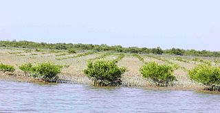
Sujawal District is a district of the Sindh province of Pakistan. It is located at 24°36'23" North and 68°4'19" East and is bordered in the northwest by the Indus River, which separates it from Thatta District. The district has an area of 7,335 km2.
