History
18th–19th century CE
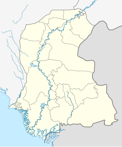
Nawabshah lies near the Indus River in central Sindh, long inhabited since the Indus Valley era. [3] Archaeological surveys note prehistoric and Harappan remains in the area, and the region later passed under various Muslim dynasties. [3] In particular, the 18th–19th-century Kalhora and Talpur dynasties left many mosques and tombs with characteristic Sindhi and Islamic architecture. [3]
British Raj
Under British rule, Nawabshah was carved out of Hyderabad District. Its taluka (subdivision) was established in 1903, and on 1 November 1912, Nawabshah was upgraded to full district status in Sindh. [2] The town was named for Syed Nawab Shah, a local landowner who migrated there in 1881, his family donated land of 60 acres for colonial-era district offices, and in recognition of this generosity, the British named the town after him.
After independence of 1947
After 1947, Nawabshah became part of independent Pakistan. In 2008, the district was officially renamed Shaheed Benazirabad in memory of Benazir Bhutto. In recent years, the city has grown rapidly. [2]
Climate
| Nawabshah |
|---|
| Climate chart (explanation) |
|---|
J | F | M | A | M | J | J | A | S | O | N | D | | | | | | | | | | | | | | █ Average max. and min. temperatures in °C | | █ Precipitation totals in mm | | Source: Hong Kong Observatory |
|
| Imperial conversion |
|---|
| J | F | M | A | M | J | J | A | S | O | N | D | | | | | | | | | | | | | | █ Average max. and min. temperatures in °F | | █ Precipitation totals in inches |
|
Nawabshah has a hot arid climate (Köppen BWh). The city is considered one of the hottest cities in Pakistan, with summer temperatures soaring as high as 53 °C or 127.4 °F. Temperatures above 45 °C or 113 °F are fairly common during late May and June. Winters start late, around mid-November, lasting to around mid-February, with night-time temperatures often reaching 4 °C or 39.2 °F, and temperatures below 0 °C or 32 °F occurring two or three times on average in January.
The highest temperatures each year in Pakistan, typically rising to above 50 °C (122 °F), are usually recorded in Nawabshah District and Sibi from May to August. The climate is generally dry and hot, but sometimes the temperature falls to 0 °C (32 °F). On 26 May 2010 record breaking severe heat wave hit the city and the mercury level reached 52 °C (126 °F) which was the highest temperature ever recorded in Nawabshah at the time. [9] The climate is generally dry and hot, but sometimes the temperature falls to 0 °C (32 °F). On 7 January 2011, temperatures dropped to 4 °C (39 °F) in the city. [10] The highest annual rainfall ever is 685 millimetres or 27 inches, recorded in 2022.
| Climate data for Nawabshah (1991–2020) |
|---|
| Month | Jan | Feb | Mar | Apr | May | Jun | Jul | Aug | Sep | Oct | Nov | Dec | Year |
|---|
| Record high °C (°F) | 33.7
(92.7) | 38.0
(100.4) | 45.5
(113.9) | 49.0
(120.2) | 51.0
(123.8) | 50.5
(122.9) | 47.5
(117.5) | 48.9
(120.0) | 44.5
(112.1) | 43.0
(109.4) | 41.0
(105.8) | 35.0
(95.0) | 51.0
(123.8) |
|---|
| Mean daily maximum °C (°F) | 24.1
(75.4) | 28.1
(82.6) | 34.1
(93.4) | 40.6
(105.1) | 44.6
(112.3) | 44.1
(111.4) | 41.0
(105.8) | 39.1
(102.4) | 38.9
(102.0) | 37.9
(100.2) | 32.2
(90.0) | 26.2
(79.2) | 35.9
(96.6) |
|---|
| Daily mean °C (°F) | 15.4
(59.7) | 18.7
(65.7) | 24.5
(76.1) | 30.4
(86.7) | 34.8
(94.6) | 35.4
(95.7) | 34.2
(93.6) | 32.6
(90.7) | 31.7
(89.1) | 28.6
(83.5) | 22.7
(72.9) | 17.2
(63.0) | 27.2
(80.9) |
|---|
| Mean daily minimum °C (°F) | 6.6
(43.9) | 9.4
(48.9) | 14.8
(58.6) | 20.3
(68.5) | 25.0
(77.0) | 27.5
(81.5) | 27.4
(81.3) | 26.2
(79.2) | 24.4
(75.9) | 19.3
(66.7) | 13.1
(55.6) | 8.3
(46.9) | 18.5
(65.3) |
|---|
| Record low °C (°F) | −2.6
(27.3) | −3.6
(25.5) | 3.0
(37.4) | 7.0
(44.6) | 15.0
(59.0) | 17.0
(62.6) | 20.0
(68.0) | 18.9
(66.0) | 14.6
(58.3) | 7.5
(45.5) | 2.8
(37.0) | −1.0
(30.2) | −3.6
(25.5) |
|---|
| Average rainfall mm (inches) | 2.5
(0.10) | 4.9
(0.19) | 3.2
(0.13) | 12.2
(0.48) | 22.8
(0.90) | 39.2
(1.54) | 69.1
(2.72) | 87.2
(3.43) | 32.7
(1.29) | 13.1
(0.52) | 0.4
(0.02) | 3.3
(0.13) | 247.6
(9.75) |
|---|
| Average rainy days (≥ 1.0 mm) | 0.6 | 0.6 | 0.7 | 0.5 | 0.4 | 3.5 | 4.7 | 5.5 | 2.2 | 0.3 | 0.1 | 0.4 | 19.5 |
|---|
| Mean monthly sunshine hours | 230.1 | 240.1 | 267.0 | 274.4 | 293.8 | 268.8 | 229.4 | 240.9 | 261.1 | 280.0 | 256.1 | — | — |
|---|
| Source: NOAA [11] [12] Ogimet [13] |
This page is based on this
Wikipedia article Text is available under the
CC BY-SA 4.0 license; additional terms may apply.
Images, videos and audio are available under their respective licenses.