Matlock, Victoria

Last updated

Matlock
Victoria
Matlock Victoria 001.JPG
Australia Victoria Mansfield Shire location map.svg
Red pog.svg
Matlock
Coordinates 37°36′S146°13′E / 37.600°S 146.217°E / -37.600; 146.217
Population7 (2021 census) [1]
Established1863
Postcode(s) 3723
Elevation1,213 m (3,980 ft)
Location
LGA(s)
State electorate(s) Eildon
Federal division(s) Indi

Matlock is a rural locality in Victoria, Australia, located about 140 kilometres north-east of Melbourne, located within the Shires of Mansfield and Yarra Ranges local government areas. Matlock recorded a population of 7 at the 2021 census. [1]

Contents

The locality is named after the township that existed at two separate locations from the early 1860s to about the 1930s. The rural locality is along the Walhalla Road (between Marysville and Walhalla), about 140 kilometres north-east of Melbourne, high in the Victorian alpine region on the Great Dividing Range. The location of Matlock township from the early 1860s to 1873 is on a barren hilltop known as the Matlock Hill Historical Area, marked by a snow shelter at the roadside picnic area and the remnants of a cemetery. At 1,213 metres (3,979 feet) above sea-level at its first location Matlock was the highest township in Victoria. [2]

History

The hilltop township

Matlock township - illustration published in Australian News for Home Readers, 19 April 1865. Matlock township April1865 Austn News.jpg
Matlock township – illustration published in Australian News for Home Readers, 19 April 1865.

In December 1863 the policeman Sub-Inspector Brook Smith was travelling in the region of recently opened goldfields in the Victorian alpine country and reported that “quite a township has sprung up halfway between Jericho and Wood’s Point called Emerald Hill”. The settlement had “two stores and restaurants besides several other buildings being erected [including] a large sized hotel of planks with shingle roof”. [3]

The township of Emerald Hill (later Matlock) arose in the early 1860s as a trading centre between the Woods Point and Jordan goldfields. It was situated in an exposed location on the top of a hill above the Upper Goulburn and Jordan valleys and was itself flanked by three nearby gold-mines, the Loch Fyne, All Nations and Emerald Reef. A number of tracks converged at Emerald Hill: the Jamieson Track from Wood's Point, the Yarra Track to Melbourne, McEvoy's Track from Gippsland and the B.B. Track to the Jericho gold-field. Totally exposed on the crown of the hill, the settlement was subject to extremes of weather, particularly in winter when deep snow, sleet and gale-force winds were commonplace. [4] [5]

In February 1864 the settlement was surveyed and allotments and roads marked out. The Assistant Commissioner for Lands and Survey determined that 'Matlock' would be a more suitable name for the township as 'Emerald Hill' was already being used for a Melbourne suburb (later South Melbourne). In April two police constables were stationed at Matlock, accommodated initially in the Royal Mail Hotel. [5] In July 1864 a post office was established at Matlock under the charge of Theophilus Singleton. [6]

At its peak, the town had a population of around 300, and included several suburbs including Thackery, Alhambra, Mutton Town, and Harpers Creek. During the early 1860s the specimens of gold found in the Matlock area were described as “splendid” and the “crushings were for the most part sensational”, but in the end “the gold either pinched out or became unremunerative”. [7]

In the 1871 Census Matlock had a population of 257. [2]

Destruction by fire

On 15 December 1873, with a “terrific wind” blowing and a bushfire burning nearby, embers started a fire in the roof of the Royal Mail Hotel at Matlock. The alarm was raised, “but owing to the high winds and the scarcity of water the whole street was quickly in a blaze”. The fire quickly spread through the wooden buildings in the town until the whole of Matlock, with the exception of Donaldson's store, was left as “a mass of ruins”. Two children died in the fire and “many persons were severely burned in their endeavours to save life and property”. [8] [9] [5]

A year after the destructive fire, in late December 1874, a visitor to the region recorded his impressions of the devastated township, describing the scene as presenting “a most deplorable appearance”. The whole of Matlock township “with the exception of two or three houses having been burned to the ground… and the ruins have never been touched from that day to this”. He concluded: “It is a sad wreck, and shows but too plainly how soon even a flourishing gold mining township in Gippsland can vanish into obscurity”. [10]

In March 1882, in an article regarding the discovery of “a wonderfully rich” gold-bearing reef half a mile from Matlock, the following was written about the settlement: “Ever since the great rush, some twenty years ago, the silence of desolation has brooded over this bare, bleak hill”. Matlock was described as “three or four huts” together with “the traces of some few others which have been left in the shape of ruined chimneys”. [11] The reports of a "rich" discovery in 1882 failed to revive significant interest. Mining activities remained relatively subdued in the Matlock district until the mid-1890s.

Revival and decline

In July 1895 it was reported that “after a lapse of many years a slight mining revival has set in at Matlock”. The old Loch Fyne and All Nations mines “are now attracting attention”. [7] In August a traveller to the area wrote: “New stores, shops, and residences are going up, and competent judges say that the mines at Matlock are only the beginning of enormous discoveries, and there certainly seems to be good indications”. [12] By the following October Matlock was described as “the scene of bustle and activity and reminds you of earlier days”. [13]

In the 1901 Census Matlock had a population of 303. [2]

Matlock began to decline after the First World War, “but there were still a lot of buildings here in 1925." [14]

The following description of Matlock was published in January 1933:

As Matlock is approached the timber disappears, revealing the remains of the settlement. In the background the summit of Mount Matlock (4500 ft.) rises as a bald hill, which commands a fine view of Mount Buller, the Baw Baws, and other peaks. The "settlement," once a prosperous hamlet, consists of three houses. One of them is a post-office. A painted notice on another proclaims in faltering characters that the proprietress is the possessor of a licence to sell colonial wines. At the foot of the hill a pile of stones and other debris mark the site of a school. Near by a mining shaft driven into the hillside remains a visible memorial to unsuccessful search for payable stone. [15]

The Matlock Post Office closed in 1934. [16]

In January 1939 bushfires “sweeping through the ranges from three directions” caused destruction “at the Matlock Mills where a large number of men were employed”. The fires “devastated the whole forest, reducing it to a blackened ruin and taking terrible toll of human lives”, including at Fitzpatrick's saw-mill in the Matlock Forest where fifteen people were killed (including the owner and his two sons). [17] [18]

By 1967 the sole remaining resident of Matlock was Mrs. J. Sutcliffe. Mrs. Sutcliffe's grandmother, Emily Fletcher, had been a licensed wine-seller in the township. [14] In 1953 a saw-mill opened at Matlock, reviving the settlement somewhat, with 10 timber-cutters and millhands and two families occupying some of the old houses and three newly constructed dwellings. [19] The sawmill operated until 1975. The Matlock Post Office reopened in 1956 (after the sawmill was established) and closed in 1970. [16]

Related Research Articles

<span class="mw-page-title-main">Victorian gold rush</span> Period in the history of Victoria, Australia

The Victorian gold rush was a period in the history of Victoria, Australia, approximately between 1851 and the late 1860s. It led to a period of extreme prosperity for the Australian colony and an influx of population growth and financial capital for Melbourne, which was dubbed "Marvellous Melbourne" as a result of the procurement of wealth.

<span class="mw-page-title-main">Shire of Baw Baw</span> Local government area in Victoria, Australia

The Shire of Baw Baw is a local government area in Victoria, Australia, in the eastern part of the state. It covers an area of 4,028 square kilometres (1,555 sq mi) and in 2021 had a population of 57,626.

<span class="mw-page-title-main">Walhalla, Victoria</span> Town in Victoria, Australia

Walhalla is a town in Victoria, Australia, founded as a gold-mining community in late 1862, and at its peak, home to around 4,000 residents. As of 2023, the town has a population of 20 permanent residents, though it has a large proportion of houses owned as holiday properties. It attracts large numbers of tourists and is a major focus of the regional tourism industry. The town's name is taken from an early gold mine in the area, named for the German hall of fame, the Walhalla temple.

<span class="mw-page-title-main">Aberfeldy, Victoria</span> Town in Victoria, Australia

Aberfeldy is a locality in Victoria, Australia on Mount Lookout, northeast of the Thomson Dam, 125 km (78 mi) east of Melbourne.

<span class="mw-page-title-main">Neerim South</span> Town in Victoria, Australia

Neerim South is a town in West Gippsland, Victoria, Australia, located in the Shire of Baw Baw, 110 kilometres (68 mi) east of Melbourne and 20 kilometres (12 mi) north of Warragul. At the 2021 census, Neerim South had a population of 1,599.

<span class="mw-page-title-main">Amherst, Victoria</span> Town in Victoria, Australia

Amherst is a locality situated within the Shire of Central Goldfields in Victoria, Australia. Much of the original township has been destroyed by fire, and little remains other than Amherst Cemetery at 235 Avoca Road, Talbot.

<span class="mw-page-title-main">Walhalla Goldfields Railway</span> Narrow gauge tourist railway in Victoria, Australia

The Walhalla Goldfields Railway is a 2 ft 6 in narrow gauge tourist railway located in the Thomson River and Stringers Creek valleys in Gippsland, Victoria, Australia, near the former gold-mining town and tourist destination of Walhalla.

<span class="mw-page-title-main">Gippsland railway line</span> Railway line in Victoria, Australia

The Gippsland line is a railway line serving the Latrobe Valley and Gippsland regions of Victoria, Australia. It runs east from the state capital Melbourne through the cities of Moe, Morwell, Traralgon, Sale and terminating at Bairnsdale.

<span class="mw-page-title-main">Thomson River (Victoria)</span> River in Victoria, Australia

The Thomson River, a perennial river of the West Gippsland catchment, is located in the Gippsland region of the Australian state of Victoria.

West Gippsland, a region of Gippsland in Victoria, Australia, extends from the southeastern limits of metropolitan Melbourne and Western Port Bay in the west to the Latrobe Valley in the east, and is bounded by the Strzelecki Ranges to the south and the Mount Baw Baw Plateau in the Great Dividing Range to the north.

Toongabbie is a town located in the City of Latrobe and Shire of Baw Baw, Victoria, Australia, 177 kilometres (110 mi) from Melbourne and just north of Traralgon. The railway station was closed in 1986 and the former railway line has now been incorporated into the Gippsland Plains Rail Trail. At the 2016 census, Toongabbie had a population of 500.

The Noojee railway line is a closed railway line in Victoria, Australia. Branching off from the Gippsland line at Warragul station, it was built to service the timber industry in the upper Latrobe River area, transporting timber as well as providing a general goods and passenger service to townships in the area. The final section of the line between Neerim South and Noojee traversed increasingly hilly terrain and featured a number of large timber trestle bridges. Extensively and repeatedly damaged by bushfires over the years, the line was closed in the 1950s and dismantled. The last remaining large trestle bridge on the line has been preserved and has become a popular local tourist attraction.

The regions of Victoria vary according to the different ways that the Australian state of Victoria is divided into distinct geographic regions. The most commonly used regions are those created by the state government for the purposes of economic development.

The Thomson River Diversion Tunnel, also known as the Horseshoe Bend Tunnel or the Chinese Tunnel, is located on the Thomson River near the junction with Coopers Creek, approximately 4 kilometres (2.5 mi) south-west of Walhalla, Victoria, Australia. The site is listed on the Victorian Heritage Register and covered by a Heritage Overlay.

The Jordan River Diversion Tunnel, a relic of the Victorian gold rush, is on the Jordan River near the locality of Jericho, about 7 km (4.3 mi) south of Woods Point in Gippsland, Victoria, Australia. The tunnel is about 30 m long x 4 m high x 3 m wide, cut through rock. The river still runs through it.

The Jordan River, a perennial river of the West Gippsland catchment, is located in the Alpine region of the Australian state of Victoria.

Frederick Charles Porter (1832–1869) was an Australian miner and explorer of the Gippsland region of Victoria. His exploration work in early 1862 was critical in helping open up the Jordan goldfields.

James Frederick Porter (1855-1919) was an Australian engineer and mine manager of the Gippsland region of Victoria.

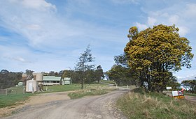
Coopers Creek is a locality and mine in the Gippsland region of Victoria, Australia. In the 1860s, Coopers Creek was settled during the Victorian gold rush and, throughout its history, gold, copper and lime have been mined there. Today, Coopers Creek is effectively limited to two camping sites, the first near the site of the mining town and the second to the east at Bruntons Bridge. Ruins from the locality's mining history, and the Copper Mine Hotel are all of the locality's history which survives. In August 2022, the 21 properties that comprise the town were listed for sale.

References

  1. 1 2 Australian Bureau of Statistics (28 June 2022). "Matlock (Suburbs and Localities)". 2021 Census QuickStats. Retrieved 9 July 2022. OOjs UI icon edit-ltr-progressive.svg
  2. 1 2 3 "Matlock". Victorian Places. Monash University & University of Queensland. Retrieved 6 March 2021.
  3. Correspondence dated 20 January 1864, Sub-Inspector Brook Smith to Victorian Commissioner of Police Frederick Standish, Public Record Office of Victoria, Police Correspondence, Gippsland.
  4. 'Matlock: An Alpine Gold Mining Town' by Anne V. Bailey & Robin A. Bailey, The Victorian Historical Journal, vol. 48, 1977.
  5. 1 2 3 Bailey, Anne; Bailey, Robin (1998). A Windy Morn of Matlock: the History of a Victorian Mountain Goldfield. Mountain Home Press. ISBN   0-9587409-0-9.
  6. On the 21st, The Age (Melbourne), 12 July 1864, page 4.
  7. 1 2 Mining at Matlock, The Argus (Melbourne), 24 July 1895, page 7.
  8. Fatal Fire at Matlock, Illustrated Australian News for Home Readers, 31 December 1873, page 222.
  9. Fatal and Destructive Fire at Matlock, The Age (Melbourne), 16 December 1873, page 3.
  10. A Tour Through Gippsland (Letter No. 4), letter to the Editor by 'Pedestriano', The Record and Emerald Hill and Sandridge Advertiser, 4 March 1875, page 3.
  11. A Rich Find of Gold at Matlock, Leader (Melbourne), 18 March 1882, page 5.
  12. A Trip to Matlock, Warragul Guardian, 13 August 1895, page 3
  13. A Trip to Matlock, Warragul Guardian, 25 October 1895, page 3.
  14. 1 2 Mrs. J. Sutcliffe, sole remaining resident of Matlock, interviewed in July 1952; Lone lady of the snow, The Herald (Melbourne), 26 July 1952, page 14.
  15. The Road to Jericho: A Storied Trail, Kalgoorlie Miner, 10 January 1933, page 2.
  16. 1 2 Phoenix Auctions History, Post Office List , retrieved 20 January 2021
  17. Death and Desolation at Matlock: Men Incinerated; Mills Destroyed; Forest Ruined, Healesville and Yarra Glen Guardian, 21 January 1939, page 4.
  18. 16 Men Dead in Matlock Mills: Terrible Scene for Rescue Party, The Argus (Melbourne), 16 January 1939, page 2.
  19. "Ghost Town" is Living Again, The Herald (Melbourne), 10 January 1953, page 5.