Related Research Articles

San Juan del Puerto was a Spanish Franciscan mission founded before 1587 on Fort George Island, near the mouth of the St. Johns River in what is now Jacksonville, Florida. It was founded to serve the Saturiwa, a Timucua tribe who lived around the mouth of the St. Johns. It was organized by separating them into nine smaller villages. It has an important place in the study of the Timucua, as the place where Francisco Pareja undertook his work on the Timucua language.
Tocobaga was the name of a chiefdom of Native Americans, its chief, and its principal town during the 16th century. The chiefdom was centered around the northern end of Old Tampa Bay, the arm of Tampa Bay that extends between the present-day city of Tampa and northern Pinellas County. The exact location of the principal town is believed to be the archeological Safety Harbor site. This is the namesake for the Safety Harbor culture, of which the Tocobaga are the most well-known group.

Indigenous peoples of the Southeastern Woodlands, Southeastern cultures, or Southeast Indians are an ethnographic classification for Native Americans who have traditionally inhabited the area now part of the Southeastern United States and the northeastern border of Mexico, that share common cultural traits. This classification is a part of the Eastern Woodlands. The concept of a southeastern cultural region was developed by anthropologists, beginning with Otis Mason and Franz Boas in 1887. The boundaries of the region are defined more by shared cultural traits than by geographic distinctions. Because the cultures gradually instead of abruptly shift into Plains, Prairie, or Northeastern Woodlands cultures, scholars do not always agree on the exact limits of the Southeastern Woodland culture region. Shawnee, Powhatan, Waco, Tawakoni, Tonkawa, Karankawa, Quapaw, and Mosopelea are usually seen as marginally southeastern and their traditional lands represent the borders of the cultural region.
The Jaega were Native Americans living in a chiefdom of the same name, which included the coastal parts of present-day Martin County and northern Palm Beach County, Florida at the time of initial European contact, and until the 18th century. The name Jobé, or Jové, has been identified as a synonym of Jaega, a sub-group of the Jaega, or a town of the Jaega.

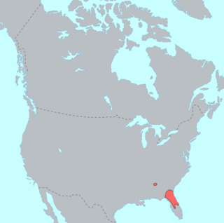
Timucua is a language isolate formerly spoken in northern and central Florida and southern Georgia by the Timucua peoples. Timucua was the primary language used in the area at the time of Spanish colonization in Florida. Differences among the nine or ten Timucua dialects were slight, and appeared to serve mostly to delineate band or tribal boundaries. Some linguists suggest that the Tawasa of what is now northern Alabama may have spoken Timucua, but this is disputed.

The Mocama were a Native American people who lived in the coastal areas of what are now northern Florida and southeastern Georgia. A Timucua group, they spoke the dialect known as Mocama, the best-attested dialect of the Timucua language. Their heartland extended from about the Altamaha River in Georgia to south of the mouth of the St. John's River, covering the Sea Islands and the inland waterways, Intracoastal. and much of present-day Jacksonville. At the time of contact with Europeans, there were two major chiefdoms among the Mocama, the Saturiwa and the Tacatacuru, each of which evidently had authority over multiple villages. The Saturiwa controlled chiefdoms stretching to modern day St. Augustine, but the native peoples of these chiefdoms have been identified by Pareja as speaking Agua Salada, which may have been a distinct dialect.

Saturiwa was chief of the Saturiwa tribe, a Timucua chiefdom centered at the mouth of the St. Johns River in Florida, during the 16th century. His main village, also known as Saturiwa, was located on the south bank of the river near its mouth, and according to French sources he was sovereign over thirty other village chiefs. Chief Saturiwa was a prominent figure in the early days of European settlement in Florida, forging friendly relations with the French Huguenot settlers, who founded Fort Caroline in his territory.

Volusia is an unincorporated community in Volusia County, Florida, United States, on the eastern shore of the St. Johns River. It is about three miles south of Lake George and across the river from the town of Astor in Lake County. Established by Spanish missionaries, Volusia is one of the oldest European settlements in Florida. The main route through the town is State Road 40, which crosses the St. Johns on the Astor Bridge.

Beginning in the second half of the 16th century, the Kingdom of Spain established a number of missions throughout Spanish Florida in order to convert the Native Americans to Roman Catholicism, to facilitate control of the area, and to obstruct regional colonization by other Protestants, particularly, those from England and France. Spanish Florida originally included much of what is now the Southeastern United States, although Spain never exercised long-term effective control over more than the northern part of what is now the State of Florida from present-day St. Augustine to the area around Tallahassee, southeastern Georgia, and some coastal settlements, such as Pensacola, Florida. A few short-lived missions were established in other locations, including Mission Santa Elena in present-day South Carolina, around the Florida peninsula, and in the interior of Georgia and Alabama.
The Surruque people lived along the middle Atlantic coast of Florida during the 16th and 17th centuries. They may have spoken a dialect of the Timucua language, but were allied with the Ais. The Surruque became clients of the Spanish government in St. Augustine, but were not successfully brought into the Spanish mission system.
Acuera was the name of both an indigenous town and a province or region in central Florida during the 16th and 17th centuries. The indigenous people of Acuera spoke a dialect of the Timucua language. In 1539 the town first encountered Europeans when it was raided by soldiers of Hernando de Soto's expedition. French colonists also knew this town during their brief tenure (1564–1565) in northern Florida.

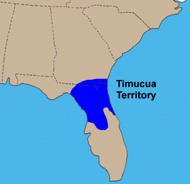
The Timucua were a Native American people who lived in Northeast and North Central Florida and southeast Georgia. They were the largest indigenous group in that area and consisted of about 35 chiefdoms, many leading thousands of people. The various groups of Timucua spoke several dialects of the Timucua language. At the time of European contact, Timucuan speakers occupied about 19,200 square miles (50,000 km2) in the present-day states of Florida and Georgia, with an estimated population of 200,000. Milanich notes that the population density calculated from those figures, 10.4 per square mile (4.0/km2) is close to the population densities calculated by other authors for the Bahamas and for Hispaniola at the time of first European contact. The territory occupied by Timucua speakers stretched from the Altamaha River and Cumberland Island in present-day Georgia as far south as Lake George in central Florida, and from the Atlantic Ocean west to the Aucilla River in the Florida Panhandle, though it reached the Gulf of Mexico at no more than a couple of points.
The Indigenous peoples of Florida lived in what is now known as Florida for more than 12,000 years before the time of first contact with Europeans. However, the indigenous Floridians living east of the Apalachicola River had largely died out by the early 18th century. Some Apalachees migrated to Louisiana, where their descendants now live; some were taken to Cuba and Mexico by the Spanish in the 18th century, and a few may have been absorbed into the Seminole and Miccosukee tribes.

The Saturiwa were a Timucua chiefdom centered on the mouth of the St. Johns River in what is now Jacksonville, Florida. They were the largest and best attested chiefdom of the Timucua subgroup known as the Mocama, who spoke the Mocama dialect of Timucuan and lived in the coastal areas of present-day northern Florida and southeastern Georgia. They were a prominent political force in the early days of European settlement in Florida, forging friendly relations with the French Huguenot settlers at Fort Caroline in 1564 and later becoming heavily involved in the Spanish mission system.

The Agua Dulce or Agua Fresca (Freshwater) were a Timucua people of northeastern Florida. They lived in the St. Johns River watershed north of Lake George, and spoke a dialect of the Timucua language also known as Agua Dulce.
Tacatacuru was a Timucua chiefdom located on Cumberland Island in what is now the U.S. state of Georgia in the 16th and 17th centuries. It was one of two chiefdoms of the Timucua subgroup known as the Mocama, who spoke the Mocama dialect of Timucuan and lived in the coastal areas of southeastern Georgia and northern Florida.

The Northern Utina, also known as the Timucua or simply Utina, were a Timucua people of northern Florida. They lived north of the Santa Fe River and east of the Suwannee River, and spoke a dialect of the Timucua language known as "Timucua proper". They appear to have been closely associated with the Yustaga people, who lived on the other side of the Suwannee. The Northern Utina represented one of the most powerful tribal units in the region in the 16th and 17th centuries, and may have been organized as a loose chiefdom or confederation of smaller chiefdoms. The Fig Springs archaeological site may be the remains of their principal village, Ayacuto, and the later Spanish mission of San Martín de Timucua.

The Ibi, also known as the Yui or Ibihica, were a Timucua chiefdom in the present-day U.S. state of Georgia during the 16th and 17th centuries. They lived in southeastern Georgia, about 50 miles from the coast. Like their neighbors, the Icafui tribe, they spoke a dialect of the Timucua language called Itafi.
The Yustaga were a Timucua people of what is now northwestern Florida during the 16th and 17th centuries. The westernmost Timucua group, they lived between the Aucilla and Suwannee Rivers in the Florida Panhandle, just east of the Apalachee people. A dominant force in regional tribal politics, they may have been organized as a loose regional chiefdom consisting of up to eight smaller local chiefdoms.
Pohoy was a chiefdom on the shores of Tampa Bay in present-day Florida in the late sixteenth century and all of the seventeenth century. Following slave-taking raids by people from the Lower Towns of the Muscogee Confederacy at the beginning of the eighteenth century, the surviving Pohoy people lived in several locations in peninsular Florida. The Pohoy disappeared from historical accounts after 1739.
References
- Hann, John H. (1993). "The Mayaca and Jororo and Missions to Them", in McEwan, Bonnie G. ed. The Spanish Missions of La Florida. University Press of Florida. ISBN 0-8130-1232-5.
- Hann, John H. (2003). Indians of Central and South Florida: 1513-1763. University Press of Florida. ISBN 0-8130-2645-8
- Milanich, Jerald T. (1996) "The Timucua". Blackwell Publishers. ISBN 978-1-55786-488-8