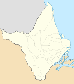
Amapá is one of the 26 states of Brazil. It is in the North Region of Brazil. It is the second-least populous state and the eighteenth-largest state by area. Located in the far northern part of the country, Amapá is bordered clockwise by French Guiana to the north, the Atlantic Ocean to the east, Pará to the south and west, and Suriname to the northwest. The capital and largest city is Macapá. The state has 0.4% of the Brazilian population and is responsible for only 0.22% of the Brazilian GDP.
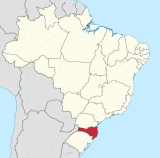
Santa Catarina is a state in the South Region of Brazil. Of Brazil's 26 states, it is the 7th smallest state in total area and the 11th most populous. Additionally, it is the 9th largest settlement, with 295 municipalities. The state, with 3.4% of the Brazilian population, generates 3.8% of the national GDP.

Belém often called Belém of Pará, is a Brazilian city, capital and largest city of the state of Pará in the country's north. It is the gateway to the Amazon River with a busy port, airport, and bus/coach station. Belém lies approximately 100 km upriver from the Atlantic Ocean, on the Pará River, which is part of the greater Amazon River system, separated from the larger part of the Amazon delta by Ilha de Marajó. With an estimated population of 1,499,641 people — or 2,491,052, considering its metropolitan area — it is the 11th most populous city in Brazil, as well as the 16th by economic relevance. It is the second largest in the North Region, second only to Manaus, in the state of Amazonas.

Macapá is a city in Brazil with a population of 512,902. It is the capital of Amapá state in the country's North Region. It is located on the northern channel of the Amazon River near its mouth on the Atlantic Ocean. The city is on a small plateau on the Amazon in the southeast of the state of Amapá. The only access by road from outside the province is from the overseas French department of French Guiana, although there are regular ferries to Belem, Brazil. Macapá is linked by road with some other cities in Amapá. The equator runs through the middle of the city, leading residents to refer to Macapá as "The capital of the middle of the world." It covers 6,407.12 square kilometres (2,473.80 sq mi) and is located northwest of the large inland island of Marajó and south of the border with French Guiana.

Goiás is a municipality in the state of Goiás in Brazil. Its population was 22,381 and its area is 3,108 km2. It is the former capital of the state and preserves much of its colonial heritage. In 2002, it became a UNESCO World Heritage Site.

The North Region of Brazil is the largest region of Brazil, corresponding to 45.27% of the national territory. It is the second least inhabited of the country, and contributes with a minor percentage in the national GDP and population. It comprises the states of Acre, Amapá, Amazonas, Pará, Rondônia, Roraima and Tocantins.

The Brazilian Highway System is a network of trunk roads administrated by the Ministry of Infrastructure of Brazil (MINFRA). It is constructed, managed and maintained by the National Department of Transport Infrastructure (DNIT), federal agency linked to the Ministry of Infrastructure, and the public works departments of state governments.
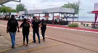
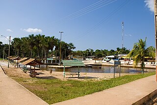
Fazendinha is a district in the Brazilian municipality of Macapá in the state of Amapá. It is the main beach for the capital Macapá.
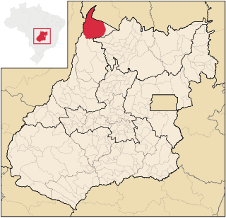
São Miguel do Araguaia is a city in northeastern Goiás state, Brazil. It is the northernmost municipality in Goiás, one of the largest too, and a major producer of cattle.

Mazagão is a municipality located in the south of the state of Amapá in Brazil. Its population is 22,053 and its area is 13,131 square kilometres (5,070 sq mi). Mazagão Velho located in the municipality of Mazagão is known for the Festival of São Tiago which takes place between 16 and 28 July, and re-enacts the war between the Moors and Christians.
For São Vicente's main port, see Porto Grande, Cape Verde

Santana is a municipality located in the southeast of the state of Amapá in Brazil. Its population is 123,096 and its area is 1,541 square kilometres, which makes it the smallest municipality of Amapá. Santana is a suburb of Macapá, the state capital, and the two cities make up the Metropolitan Area of Macapá. Its location is nearly on the equator. The planet's second longest river, the Amazon is to the south.
Amazonian Jews are the Jews of the Amazon basin, mainly descendants of Moroccan Jews who migrated to northern Brazil and Peru in the 19th and early 20th centuries. The migrants were attracted to the growing trade in the Amazon region, especially during the rubber boom, as well as to the newly established religious tolerance. They settled in localities along the Amazon River, such as Belém, Cametá, Santarém, Óbidos, Parintins, Itacoatiara and Manaus in Brazil, some venturing as far as Iquitos in Peru.

São José do Xingu is a municipality in the state of Mato Grosso, in the Central-West Region of Brazil.

TABA – Transportes Aéreos Regionais da Bacia Amazônica was a Brazilian airline founded in 1976. It ceased operations in 1999.
Mantena is a municipality in the state of Minas Gerais in the Southeast region o Brazil.

Ilha de Santana is an island and district in the Brazilian municipality of Santana, in the state of Amapá. It is located in the Amazon River across the city of Santana. The island measures 2,005 hectares.

Carvão is a district in the Brazilian municipality of Mazagão, in the state of Amapá. It is located along the Mutuacá River.

The Siege of Mazagan of 1769 was the last engagement between Morocco and the Portuguese in Mazagan. The Moroccan army under Sultan Mohammed ben Abdallah was victorious and the Portuguese evacuated their last garrison in Morocco, bringing an end to their 354-year-long conflict.

