
Lake Mweru is a freshwater lake on the longest arm of Africa's second-longest river, the Congo. Located on the border between Zambia and Democratic Republic of the Congo, it makes up 110 kilometres (68 mi) of the total length of the Congo, lying between its Luapula River (upstream) and Luvua River (downstream) segments.

Bangweulu — 'where the water sky meets the sky' — is one of the world's great wetland systems, comprising Lake Bangweulu, the Bangweulu Swamps and the Bangweulu Flats or floodplain. Situated in the upper Congo River basin in Zambia, the Bangweulu system covers an almost completely flat area roughly the size of Connecticut or East Anglia, at an elevation of 1,140 m straddling Zambia's Luapula Province and Northern Province. It is crucial to the economy and biodiversity of northern Zambia, and to the birdlife of a much larger region, and faces environmental stress and conservation issues.

The Luapula River is a section of Africa's second-longest river, the Congo. It is a transnational river forming for nearly all its length part of the border between Zambia and the DR Congo. It joins Lake Bangweulu to Lake Mweru and gives its name to the Luapula Province of Zambia.
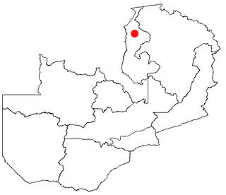
Kawambwa is a town in the Zambian province of Luapula located on thedge of the northern Zambian plateau above the Luapula valley at an altitude of 1300 m. It was chosen as an administrative district of the same name by the British colonial authorities who preferred the climate of the plateau rather than the hotter valley where most of the district's population live, and it continues as an administrative district today.
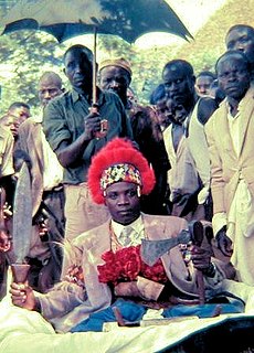
Kazembe is a traditional kingdom in modern-day Zambia, Southeastern Congo. For more than 250 years, Kazembe has been an influential kingdom or chieftainship of the Kiluba-Chibemba, speaking the Swahili language or the language of the Eastern Luba-Lunda people of south-central Africa. Its position on trade routes in a well-watered, relatively fertile and well-populated area of forestry, fishery and agricultural resources drew expeditions by traders and explorers who called it variously Kasembe, Cazembe and Casembe.

Kazembe is a name used for Mwata Kazembe's town in the Luapula Province of Zambia, especially on maps and in the Zambian postal service. However, the correct name for the town is Mwansabombwe and this is the one used by its or Luba or Chibemba-speaking inhabitants. They may refer in English to "Kazembe's Village" or just "Kazembe", as traditionally a settlement is named after the chief or headman, rather than the location. The Luba-Lunda shared with many tribes the custom of moving to another village or a new site on the death of the chief. Historical references to a village or town may actually be to a different location. For instance when the explorer David Livingstone visited Mwata Kazembe in 1867 and 1868, "Casembe's town", as he wrote it, was further north at the town now called Kanyembo.
Kanyembo is the principal centre of the population on the Mofwe Lagoon, the largest of several lagoons in the Luapula River swamps south of Lake Mweru, in the Luapula Province of Zambia. It takes its name from its traditional ruler, Chief Kanyembo, one of the senior chiefs of the Kazembe-Lunda under Mwata Kazembe. In the past the incumbent Chief has been promoted to Mwata, and Kanyembo was the site of Mwata Kazembe's capital when it was visited by David Livingstone in 1867.
A dambo is a class of complex shallow wetlands in central, southern and eastern Africa, particularly in Zambia and Zimbabwe. They are generally found in higher rainfall flat plateau areas, and have river-like branching forms which in themselves are not very large, but combined add up to a large area. Dambos have been estimated to comprise 12.5% of the area of Zambia. Similar African words include mbuga, matoro (Mashonaland), vlei, fadama (Nigeria), and bolis ; the French bas-fond and German Spültal have also been suggested as referring to similar grassy wetlands.
The Mbereshi River drains the northern Zambian plateau north of Kawambwa and flows west into the Luapula valley. It enters the Luapula swamps near the Mofwe Lagoon. It gives its name to the village and former mission of Mbereshi situated near its south bank.
This page gives lists of the National Monuments and other historic sites of Zambia, with a one- or two-line description providing links to details given on other pages.
Macha Mission is a mission station in the Choma District of the Southern Province of Zambia. While it started out as a place to convert the local population to Christianity, it has grown into a community centre with a church, five schools, a hospital and a malaria research centre.
Kafulwe is a fishing village on Lake Mweru in the Luapula Province of Zambia, situated just north of the mouth of the Kalungwishi River, and 3 km west of the Nchelenge-Chiengi road. The population of the area is increased considerably by temporary fishing camps on the white sandy beaches when kapenta, a small sardine-like fish is in season. Some of the fish is transported across the lake for sale in the DR Congo and some is trucked south to the Copperbelt.

Karla Poewe is an anthropologist and historian. She is the author of ten academic books and fifty peer reviewed articles in international journals. Currently Poewe is Professor Emeritus in Anthropology at the University of Calgary, Calgary, Alberta, Canada and Adjunct Research Professor at Liverpool Hope University, Liverpool, England. She is married to Irving Hexham.
Chembe is a new District pronounced by President Michael Sata in the Luapula Province of Zambia. It once had the Chembe Ferry as a means of crossing the Luapula River from DR Congo to Zambia; but now, it is the home of the Mwanawasa Bridge, named after former president Levy Mwanawasa. The Mwanawasa Bridge connects the principal Luapula highway to the Congo Pedicle road, a dirt highway maintained by Zambia through Congolese territory to link Mansa to the Copperbelt.
Zambia, officially known as the Republic of Zambia, is a landlocked country in Southern Africa. The neighbouring countries are the Democratic Republic of the Congo to the north, Tanzania to the north-east, Malawi to the east, Mozambique, Zimbabwe, Botswana, and Namibia to the south, and Angola to the west. The capital city is Lusaka, located in the southeast of the country. The population is concentrated mainly around the capital and the Copperbelt to the northwest.
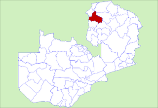
Kawambwa District is a district of Zambia, located in Luapula Province. The capital lies at Kawambwa, which lies at the intersection of three roads: D19, M13, and Kawambwa-Mbereshi. The Luapula River forms its boundary with the Democratic Republic of the Congo. As of the 2000 Zambian Census, the district had a population of 102,503 people.

Frederick Stanley Arnot was a Scottish missionary who did much to establish missions in what are now Angola, Zambia and the Democratic Republic of the Congo (DRC).
The Apostolic Vicariate of Bangueolo was a vicariate established by the Catholic White Fathers missionary society in 1913 located in what is now Zambia.
The Church Missionary Society in China was a branch organisation established by the Church Missionary Society (CMS), which was founded in Britain in 1799 under the name the Society for Missions to Africa and the East; as a mission society working with the Anglican Communion, Protestant, and Orthodox Christians around the world. In 1812, the organization was renamed the Church Missionary Society. The missions were financed by the CMS with the local organisation of a mission usually being under the oversight of the Bishop of the Anglican diocese in which the CMS mission operated.
Mbereshi Girls' School was a mission boarding school at Mbereshi. As "the earliest girls' school in Northern Rhodesia ... this school gained an international reputation."
