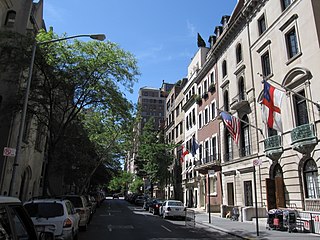
The Upper East Side, sometimes abbreviated UES, is a neighborhood in the borough of Manhattan in New York City, bounded by 96th Street to the north, the East River to the east, 59th Street to the south, and Central Park and Fifth Avenue to the west. The area incorporates several smaller neighborhoods, including Lenox Hill, Carnegie Hill, and Yorkville. Once known as the Silk Stocking District, it has long been the most affluent neighborhood in New York City.

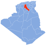
M'sila ; is the capital of M'Sila Province, Algeria, and is co-extensive with M'sila District. It has a population of 132,975 as per the 2008 census. M'sila University is also located in this city.

OpenStreetMap (OSM) is a free, open geographic database updated and maintained by a community of volunteers via open collaboration. Contributors collect data from surveys, trace from aerial imagery and also import from other freely licensed geodata sources. OpenStreetMap is freely licensed under the Open Database License and as a result commonly used to make electronic maps, inform turn-by-turn navigation, assist in humanitarian aid and data visualisation. OpenStreetMap uses its own topology to store geographical features which can then be exported into other GIS file formats. The OpenStreetMap website itself is an online map, geodata search engine and editor.

Bing Maps is a web mapping service provided as a part of Microsoft's Bing suite of search engines and powered by the Bing Maps Platform framework which also support Bing Maps for Enterprise APIs and Azure Maps APIs. Since 2020, the map data is provided by TomTom, OpenStreetMap and others.

Boyer-Ahmad County is in Kohgiluyeh and Boyer-Ahmad province, Iran. Its capital is the city of Yasuj.
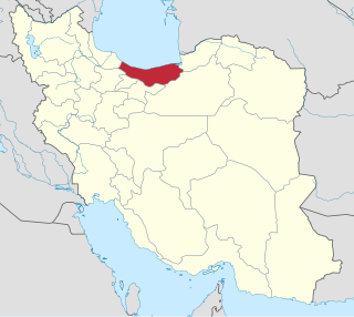
Tonekabon County is in Mazandaran province, Iran. Its capital is the city of Tonekabon.

M'Sila is a province (wilaya) of northern Algeria. It has a population of 1 million people and an area of 18,718 km², while its capital, also called M'Sila, home to M'Sila University, has a population of about 100,000.
Buger is a village in Armand Rural District of Armand District, Khanmirza County, Chaharmahal and Bakhtiari province, Iran.
Beyranvand District, formerly Chaghalvandi District, is in Khorramabad County, Lorestan province, Iran. Its capital is the city of Beyranshahr.

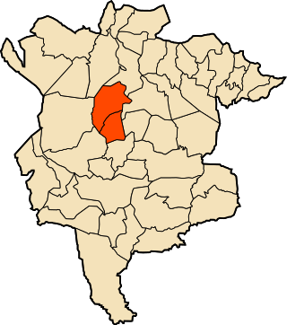
Khanmirza County is in Chaharmahal and Bakhtiari province, Iran. Its capital is the city of Aluni.
Armand Rural District is in Armand District of Khanmirza County, Chaharmahal and Bakhtiari province, Iran. Its capital is the village of Armand.
Javanmardi Rural District is in the Central District of Khanmirza County, Chaharmahal and Bakhtiari province, Iran. Its capital is the village of Javanmardi.
Khanmirza Rural District is in the Central District of Khanmirza County, Chaharmahal and Bakhtiari province, Iran. Its capital is the village of Do Makan.
Shahrak-e Sunk is a village in, and the capital of, Sepidar Rural District of Armand District, Khanmirza County, Chaharmahal and Bakhtiari province, Iran.
Poshtkuh Rural District is in Poshtkuh District of Khash County, Sistan and Baluchestan province, Iran. Its capital is the village of Afzalabad.

The Tigzirt district is an Algerian administrative district in the Tizi-Ouzou province and the region of Kabylie. Its chief town is located on the eponymous namesake of Tigzirt.

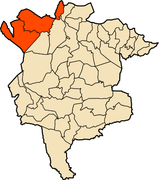
Ouled Derradj district is an Algerian administrative district in the M'Sila province. Its capital is the town of Ouled Derradj.
Ouled Sidi Brahim district is an Algerian administrative district in the M'Sila province. Its capital is the town of Ouled Sidi Brahim.
Ouled Sidi Brahim district is an Algerian administrative district in the M'Sila province. Its capital is the town of Sidi Aïssa.

Sidi Ameur district is an Algerian administrative district in the M'Sila province. Its capital is town of Sidi Ameur.