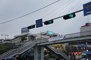
Noryangjin Station (노량진역) is a metro station in central Seoul, South Korea. The station is located in the Noryangjin-dong (neighborhood) of Dongjak-gu (ward) and is also a stop on Seoul Subway Line 1 and Seoul Subway Line 9. This stop is a popular destination for those seeking to eat raw fish, and other assorted seafood, as a large, covered sea food market is located next to the station, accessible by foot bridge. The Line 1 station is also notable in that Exit 1 and 2 have the same number as Exit 1 and 2 of Line 9's station.

Kłopoty-Stanisławy is a village in north-eastern Poland, located in the administrative district of Gmina Siemiatycze, within Siemiatycze County, Podlaskie Voivodeship. It lies approximately 11 kilometres (7 mi) north-west of Siemiatycze and 72 km (45 mi) south of the regional capital Białystok.
Pustelnik is a village in the administrative district of Gmina Brzeźnio, within Sieradz County, Łódź Voivodeship, in central Poland. It lies approximately 3 kilometres (2 mi) north of Brzeźnio, 14 km (9 mi) south-west of Sieradz, and 66 km (41 mi) south-west of the regional capital Łódź.
Leonardów is a village in the administrative district of Gmina Zgierz, within Zgierz County, Łódź Voivodeship, in central Poland. It lies approximately 8 kilometres (5 mi) east of Zgierz and 11 km (7 mi) north of the regional capital Łódź.
Niziny is a village in the administrative district of Gmina Sobków, within Jędrzejów County, Świętokrzyskie Voivodeship, in south-central Poland. It lies approximately 5 kilometres (3 mi) south-east of Sobków, 16 km (10 mi) east of Jędrzejów, and 24 km (15 mi) south of the regional capital Kielce.
Brzeście is a village in the administrative district of Gmina Wodzisław, within Jędrzejów County, Świętokrzyskie Voivodeship, in south-central Poland. It lies approximately 5 kilometres (3 mi) west of Wodzisław, 18 km (11 mi) south-west of Jędrzejów, and 54 km (34 mi) south-west of the regional capital Kielce.
Ostrówek is a village in the administrative district of Gmina Repki, within Sokołów County, Masovian Voivodeship, in east-central Poland.
Bielsko is a village in the administrative district of Gmina Orchowo, within Słupca County, Greater Poland Voivodeship, in west-central Poland.
Żalewo is a village in the administrative district of Gmina Szamotuły, within Szamotuły County, Greater Poland Voivodeship, in west-central Poland. It lies approximately 9 kilometres (6 mi) south-east of Szamotuły and 24 km (15 mi) north-west of the regional capital Poznań.
Chocicza Wielka is a village in the administrative district of Gmina Września, within Września County, Greater Poland Voivodeship, in west-central Poland.
Zemsko is a village in the administrative district of Gmina Bledzew, within Międzyrzecz County, Lubusz Voivodeship, in western Poland. It lies approximately 5 kilometres (3 mi) north-east of Bledzew, 14 km (9 mi) north-west of Międzyrzecz, 27 km (17 mi) south-east of Gorzów Wielkopolski, and 67 km (42 mi) north of Zielona Góra.
Osowo Małe is a settlement in the administrative district of Gmina Studzienice, within Bytów County, Pomeranian Voivodeship, in northern Poland. It lies approximately 6 kilometres (4 mi) south-west of Studzienice, 9 km (6 mi) south of Bytów, and 81 km (50 mi) south-west of the regional capital Gdańsk.
Grapiczki is a village in the administrative district of Gmina Potęgowo, within Słupsk County, Pomeranian Voivodeship, in northern Poland. It lies approximately 7 kilometres (4 mi) north-west of Potęgowo, 25 km (16 mi) east of Słupsk, and 82 km (51 mi) west of the regional capital Gdańsk.
Bieszkowice is a village in the administrative district of Gmina Wejherowo, within Wejherowo County, Pomeranian Voivodeship, in northern Poland. It lies approximately 10 kilometres (6 mi) south of Wejherowo and 28 km (17 mi) north-west of the regional capital Gdańsk.
Biała Leśniczówka is a settlement in the administrative district of Gmina Tolkmicko, within Elbląg County, Warmian-Masurian Voivodeship, in northern Poland. It lies approximately 4 kilometres (2 mi) south of Tolkmicko, 24 km (15 mi) north of Elbląg, and 86 km (53 mi) north-west of the regional capital Olsztyn.
Wilcze is a village in the administrative district of Gmina Srokowo, within Kętrzyn County, Warmian-Masurian Voivodeship, in northern Poland, close to the border with the Kaliningrad Oblast of Russia.
Suszka is a settlement in the administrative district of Gmina Sianów, within Koszalin County, West Pomeranian Voivodeship, in north-western Poland. It lies approximately 15 kilometres (9 mi) east of Sianów, 23 km (14 mi) east of Koszalin, and 156 km (97 mi) north-east of the regional capital Szczecin.

Phước Hoà is a commune (xã) and village in Tân Thành District, Bà Rịa–Vũng Tàu Province, in Vietnam.

Der Große Stern is the central square of the Großer Tiergarten park in Berlin; the Berlin Victory Column is sited in it.
Hillesluis is a neighborhood of Rotterdam, Netherlands.


