Gmina Naruszewo is a rural gmina in Płońsk County, Masovian Voivodeship, in east-central Poland. Its seat is the village of Naruszewo, which lies approximately 11 kilometres south of Płońsk and 55 km north-west of Warsaw.

Koziminy-Stachowo is a village in the administrative district of Gmina Płońsk, within Płońsk County, Masovian Voivodeship, in east-central Poland. It lies approximately 4 kilometres (2 mi) north-east of Płońsk and 63 km (39 mi) north-west of Warsaw.
Kiniki is a village in the administrative district of Gmina Raciąż, within Płońsk County, Masovian Voivodeship, in east-central Poland. It lies approximately 4 kilometres (2 mi) east of Raciąż, 21 km (13 mi) north-west of Płońsk, and 84 km (52 mi) north-west of Warsaw.
Kocięcin-Tworki is a village in the administrative district of Gmina Raciąż, within Płońsk County, Masovian Voivodeship, in east-central Poland. It lies approximately 13 kilometres (8 mi) north-east of Raciąż, 28 km (17 mi) north of Płońsk, and 89 km (55 mi) north-west of Warsaw.
Kruszenica is a village in the administrative district of Gmina Raciąż, within Płońsk County, Masovian Voivodeship, in east-central Poland. It lies approximately 10 kilometres (6 mi) east of Raciąż, 19 km (12 mi) north-west of Płońsk, and 81 km (50 mi) north-west of Warsaw.
Unieck is a village in the administrative district of Gmina Raciąż, within Płońsk County, Masovian Voivodeship, in east-central Poland. It lies approximately 12 kilometres (7 mi) north-east of Raciąż, 29 km (18 mi) north-west of Płońsk, and 91 km (57 mi) north-west of Warsaw.
Falbogi Wielkie is a village in the administrative district of Gmina Załuski, within Płońsk County, Masovian Voivodeship, in east-central Poland. It lies approximately 5 kilometres (3 mi) east of Załuski, 21 km (13 mi) south-east of Płońsk, and 43 km (27 mi) north-west of Warsaw.
Koryciska is a village in the administrative district of Gmina Załuski, within Płońsk County, Masovian Voivodeship, in east-central Poland. It lies approximately 6 kilometres (4 mi) north-east of Załuski, 17 km (11 mi) south-east of Płońsk, and 46 km (29 mi) north-west of Warsaw.
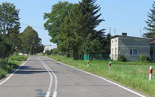
Kroczewo is a village in the administrative district of Gmina Załuski, within Płońsk County, Masovian Voivodeship, in east-central Poland. The village has a population of 202. It lies approximately 4 kilometres (2 mi) south-east of Załuski, 21 km (13 mi) south-east of Płońsk, and 42 km (26 mi) north-west of Warsaw.

Naborowiec is a village in the administrative district of Gmina Załuski, within Płońsk County, Masovian Voivodeship, in east-central Poland. It lies approximately 3 kilometres (2 mi) south-west of Załuski, 19 km (12 mi) south-east of Płońsk, and 46 km (29 mi) north-west of Warsaw.
Niepiekła is a village in the administrative district of Gmina Załuski, within Płońsk County, Masovian Voivodeship, in east-central Poland. It lies approximately 3 kilometres (2 mi) east of Załuski, 19 km (12 mi) south-east of Płońsk, and 44 km (27 mi) north-west of Warsaw.
Przyborowice Górne is a village in the administrative district of Gmina Załuski, within Płońsk County, Masovian Voivodeship, in east-central Poland. It lies approximately 5 kilometres (3 mi) north of Załuski, 13 km (8 mi) south-east of Płońsk, and 50 km (31 mi) north-west of Warsaw.
Słotwin is a village in the administrative district of Gmina Załuski, within Płońsk County, Masovian Voivodeship, in east-central Poland. It lies approximately 7 kilometres (4 mi) north-west of Załuski, 11 km (7 mi) south-east of Płońsk, and 53 km (33 mi) north-west of Warsaw.

Szczytno is a village in the administrative district of Gmina Załuski, within Płońsk County, Masovian Voivodeship, in east-central Poland. It lies approximately 8 kilometres (5 mi) north of Załuski, 11 km (7 mi) south-east of Płońsk, and 53 km (33 mi) north-west of Warsaw.
Wilamy is a village in the administrative district of Gmina Załuski, within Płońsk County, Masovian Voivodeship, in east-central Poland. It lies approximately 5 kilometres (3 mi) north-east of Załuski, 18 km (11 mi) south-east of Płońsk, and 46 km (29 mi) north-west of Warsaw.
Wojny is a village in the administrative district of Gmina Załuski, within Płońsk County, Masovian Voivodeship, in east-central Poland. It lies approximately 4 kilometres (2 mi) east of Załuski, 20 km (12 mi) south-east of Płońsk, and 44 km (27 mi) north-west of Warsaw.

Załuski is a village in Płońsk County, Masovian Voivodeship, in east-central Poland. It is the seat of the gmina called Gmina Załuski. It lies approximately 18 kilometres (11 mi) south-east of Płońsk and 46 km (29 mi) north-west of Warsaw.
Złotopolice is a village in the administrative district of Gmina Załuski, within Płońsk County, Masovian Voivodeship, in east-central Poland. It lies approximately 6 kilometres (4 mi) south of Załuski, 21 km (13 mi) south-east of Płońsk, and 44 km (27 mi) north-west of Warsaw.
Jordanowo is a village in the administrative district of Gmina Świebodzin, within Świebodzin County, Lubusz Voivodeship, in western Poland. It lies approximately 10 kilometres (6 mi) north of Świebodzin, 44 km (27 mi) north of Zielona Góra, and 49 km (30 mi) south-east of Gorzów Wielkopolski.


