Gmina Naruszewo is a rural gmina in Płońsk County, Masovian Voivodeship, in east-central Poland. Its seat is the village of Naruszewo, which lies approximately 11 kilometres south of Płońsk and 55 km north-west of Warsaw.

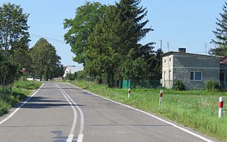
Sosenkowo is a village in the administrative district of Gmina Naruszewo, within Płońsk County, Masovian Voivodeship, in east-central Poland. It lies approximately 15 kilometres (9 mi) south-west of Płońsk and 62 km (39 mi) north-west of Warsaw.
Charzyny is a village in the administrative district of Gmina Raciąż, within Płońsk County, Masovian Voivodeship, in east-central Poland. It lies approximately 11 kilometres (7 mi) north-east of Raciąż, 30 km (19 mi) north-west of Płońsk, and 91 km (57 mi) north-west of Warsaw.
Kocięcin-Brodowy is a village in the administrative district of Gmina Raciąż, within Płońsk County, Masovian Voivodeship, in east-central Poland. It lies approximately 10 kilometres (6 mi) north-east of Raciąż, 28 km (17 mi) north-west of Płońsk, and 89 km (55 mi) north-west of Warsaw.
Kossobudy is a village in the administrative district of Gmina Raciąż, within Płońsk County, Masovian Voivodeship, in east-central Poland. It lies approximately 6 kilometres (4 mi) east of Raciąż, 21 km (13 mi) north-west of Płońsk, and 84 km (52 mi) north-west of Warsaw.
Unieck is a village in the administrative district of Gmina Raciąż, within Płońsk County, Masovian Voivodeship, in east-central Poland. It lies approximately 12 kilometres (7 mi) north-east of Raciąż, 29 km (18 mi) north-west of Płońsk, and 91 km (57 mi) north-west of Warsaw.
Falbogi Wielkie is a village in the administrative district of Gmina Załuski, within Płońsk County, Masovian Voivodeship, in east-central Poland. It lies approximately 5 kilometres (3 mi) east of Załuski, 21 km (13 mi) south-east of Płońsk, and 43 km (27 mi) north-west of Warsaw.
Karolinowo is a village in the administrative district of Gmina Załuski, within Płońsk County, Masovian Voivodeship, in east-central Poland. It lies approximately 5 kilometres (3 mi) north of Załuski, 15 km (9 mi) south-east of Płońsk, and 49 km (30 mi) north-west of Warsaw.
Koryciska is a village in the administrative district of Gmina Załuski, within Płońsk County, Masovian Voivodeship, in east-central Poland. It lies approximately 6 kilometres (4 mi) north-east of Załuski, 17 km (11 mi) south-east of Płońsk, and 46 km (29 mi) north-west of Warsaw.
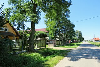
Kroczewo is a village in the administrative district of Gmina Załuski, within Płońsk County, Masovian Voivodeship, in east-central Poland. The village has a population of 202. It lies approximately 4 kilometres (2 mi) south-east of Załuski, 21 km (13 mi) south-east of Płońsk, and 42 km (26 mi) north-west of Warsaw.

Naborowiec is a village in the administrative district of Gmina Załuski, within Płońsk County, Masovian Voivodeship, in east-central Poland. It lies approximately 3 kilometres (2 mi) south-west of Załuski, 19 km (12 mi) south-east of Płońsk, and 46 km (29 mi) north-west of Warsaw.
Niepiekła is a village in the administrative district of Gmina Załuski, within Płońsk County, Masovian Voivodeship, in east-central Poland. It lies approximately 3 kilometres (2 mi) east of Załuski, 19 km (12 mi) south-east of Płońsk, and 44 km (27 mi) north-west of Warsaw.
Przyborowice Górne is a village in the administrative district of Gmina Załuski, within Płońsk County, Masovian Voivodeship, in east-central Poland. It lies approximately 5 kilometres (3 mi) north of Załuski, 13 km (8 mi) south-east of Płońsk, and 50 km (31 mi) north-west of Warsaw.
Słotwin is a village in the administrative district of Gmina Załuski, within Płońsk County, Masovian Voivodeship, in east-central Poland. It lies approximately 7 kilometres (4 mi) north-west of Załuski, 11 km (7 mi) south-east of Płońsk, and 53 km (33 mi) north-west of Warsaw.

Szczytno is a village in the administrative district of Gmina Załuski, within Płońsk County, Masovian Voivodeship, in east-central Poland. It lies approximately 8 kilometres (5 mi) north of Załuski, 11 km (7 mi) south-east of Płońsk, and 53 km (33 mi) north-west of Warsaw.
Wojny is a village in the administrative district of Gmina Załuski, within Płońsk County, Masovian Voivodeship, in east-central Poland. It lies approximately 4 kilometres (2 mi) east of Załuski, 20 km (12 mi) south-east of Płońsk, and 44 km (27 mi) north-west of Warsaw.

Załuski is a village in Płońsk County, Masovian Voivodeship, in east-central Poland. It is the seat of the gmina called Gmina Załuski. It lies approximately 18 kilometres (11 mi) south-east of Płońsk and 46 km (29 mi) north-west of Warsaw.
Złotopolice is a village in the administrative district of Gmina Załuski, within Płońsk County, Masovian Voivodeship, in east-central Poland. It lies approximately 6 kilometres (4 mi) south of Załuski, 21 km (13 mi) south-east of Płońsk, and 44 km (27 mi) north-west of Warsaw.
Twierdzielewo is a village in the administrative district of Gmina Przytoczna, within Międzyrzecz County, Lubusz Voivodeship, in western Poland. It lies approximately 7 kilometres (4 mi) south-west of Przytoczna, 10 km (6 mi) north of Międzyrzecz, 32 km (20 mi) south-east of Gorzów Wielkopolski, and 67 km (42 mi) north of Zielona Góra.


