
Regions of the Czech Republic are higher-level territorial self-governing units of the Czech Republic.
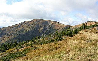
Liberec Region is an administrative unit of the Czech Republic, located in the northernmost part of its historical region of Bohemia. It is named after its capital Liberec. The region shares international borders with Germany and Poland. Domestically the region borders the Ústí nad Labem Region to the west, the Central Bohemian Region to the south and the Hradec Králové Region to the east.

The Central Bohemian Region is an administrative unit of the Czech Republic, located in the central part of its historical region of Bohemia. Its administrative centre is in the Czech capital Prague, which lies in the centre of the region. However, the city is not part of it but is a region of its own.

The Vysočina Region is an administrative unit of the Czech Republic. Its capital is Jihlava.

The Karlovy Vary Region is an administrative unit of the Czech Republic, located in the westernmost part of the country. It is named after its capital Karlovy Vary. It is known for spas, which include Karlovy Vary and Mariánské Lázně.

Districts of the Czech Republic are territorial units, formerly used as second-level administrative divisions of the Czech Republic. After their primary administrative function has been abolished in 2003, they still exist for the activities of specific authorities and as statistical units. Their administrative function was moved to selected municipalities.
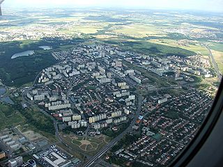
Prague 11 is a municipal district in Prague, Czech Republic. It is located in the south eastern part, 8 km from the City Center.

Běchovice is a suburb of Prague, currently a municipal district in the administrative district Prague 21. It is located about 13 km east of the city centre. The main road and railway line connecting Prague and Kolín pass through Běchovice. The population as of 2008 was 4,038.

Prague 7 is a municipal district in Prague, Czech Republic.

Prague 8 is a municipal district in Prague, Czech Republic.

Prague 10 is both a municipal and administrative district in Prague, Czech Republic with more than 110,000 inhabitants.
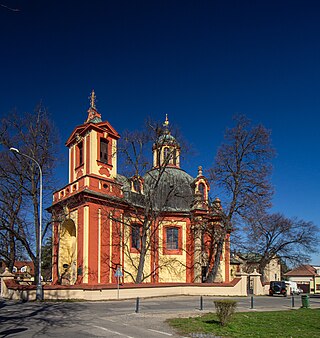
Kunratice is a municipal district and cadastral area in Prague. It is located in the southern part of the city. As of 2021, there were 10,091 inhabitants living in Kunratice.
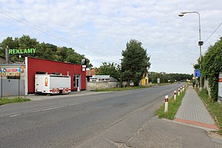
Písková Lhota is a municipality and village in Nymburk District in the Central Bohemian Region of the Czech Republic. It has about 500 inhabitants.

Břevnov is a cadastral district in the west of Prague, located in Prague 6. The district is home to the Břevnov Monastery. On the territory of Břevnov stems Brusnice brook. Břevnov was first mentioned in the 10th century. In 1907 was promoted to the city and since 1921 then became part of the City of Prague.

Vršovice is a cadastral district of Prague. All of Vršovice lies within the Prague 10 administrative district. Vršovice is located south-east of the city centre. It borders Vinohrady to the north, Nusle to the south-west, Michle to the south and Strašnice to the east. The name is first mentioned in 1088 in the founding document of the Vyšehrad Chapter. In 1922 the district was incorporated into the city of Prague. It has 107 streets and 1,611 addresses and has about 38,700 inhabitants.

Strašnice is a cadastral district in Prague. It became part of Prague on 1 January 1922. It lies mostly in the municipal and administrative district of Prague 10 while a small part is in Prague 3. The district is bordered by Vršovice, Vinohrady, Žižkov, Malešice, Hostivař, Záběhlice and Michle.

The Stolpersteine in Prague-Michle lists the Stolpersteine in cadastral area Michle of Prague. Since 2002, the district belongs to Praha 4. Stolpersteine is the German name for stumbling blocks collocated all over Europe by German artist Gunter Demnig. They remember the fate of the Nazi victims being murdered, deported, exiled or driven to suicide.

The Czech village of Štěrboholy was founded in 1371, and became part of Prague in 1968. Now it is its own cadastral area, part of the administrative district Prague 10.
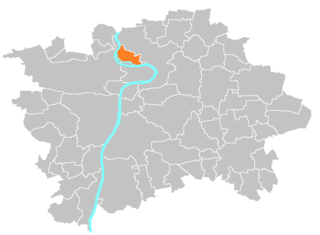
Troja became part of Prague in 1922. Now it is part of the district of Prague 7 and its own cadastral area.

Malešice is a cadastral district in Prague. The earliest reference about the village is from 1309. It became a part of Prague on 1 January 1922. It lies mostly in the administrative district of Prague 10 while a small part is in Prague 9. The district is bordered by Strašnice, Žižkov, Hrdlořezy, Kyje, Štěrboholy and Hostivař. The population is over 11,000 as of the 2021 census.


