Prague has a local-government structure of two or three tiers, depending on the area of town. At the top is the Magistrate of the Capital City of Prague, which is responsible for public transport; waste collection; municipal police; firefighting; ambulance services; cultural activities; care of historical sites; the Prague Zoo; and other activities of citywide significance.

Josefov is a town quarter and the smallest cadastral area of Prague, Czech Republic, formerly the Jewish ghetto of the town. It is surrounded by the Old Town. The quarter is often represented by the flag of Prague's Jewish community, a yellow Magen David on a red field.

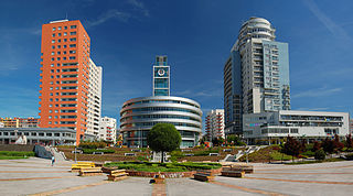
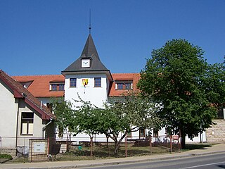
Letňany is a cadastral area of Prague, Czech Republic. It was founded in 1307, and became part of Prague in 1968. It has been part of Prague 18 since 2001, having previously been in the local government district of Prague-Letňany, and it has its own cadastral area. There is a large shopping mall, "Obchodní centrum Letňany", which has a shopping area in excess of 125,000 m2.

Prague 3, is a second-tier municipality in Prague. It is geographically identical to the national administrative district and city administrative district of the same name.

Jinonice is a cadastral district of Prague, mostly part of Prague 5, but a small area is part of Prague 13. It is located on the north edge of Prokopské údolí national park. Jinonice has been a part of Prague city since 1922.

Kobylisy is a cadastral district in the north of Prague, located in Prague 8. The eastern part of the district is home to a large panel housing estate with over 10,000 residents. The area is served by Kobylisy and Ládví stations on the Prague Metro, both of which opened in 2004.
Stodůlky, Czech pronunciation:[ˈstoduːlkɪ], is a cadastral area in Prague, Czech Republic. Originally a village, later municipality, it remained a predominantly agricultural settlement until the 1960s. Stodůlky became part of Prague in 1974 and the large housing estate of Jihozápadní Město gradually arose on fields in vicinity of the old village in the late 1970s through mid-1990s. Nowadays Stodůlky covers an area of 9.63 square kilometres (3.72 sq mi) and has over 60 thousand inhabitants. Západní Město, a western extension of the built-up area is currently under construction.

Prague 14 is a municipal district in Prague since 1994. It is located in the north-eastern part of the city, east of district Prague 9. It consists of four cadastres: Hloubětín (part), Kyje, Černý Most and Hostavice.

Benice is a municipal district and cadastral area in Prague. It is located in the south-eastern part of the city. As of 2021, there were 729 inhabitants living in Benice.

Březiněves is a municipal district and cadastral area in Prague. It is located in the northern part of the city. As of 2018, there were 1576 inhabitants living in Březiněves.
Ďáblice is a municipal district and cadastral area in Prague. It is located in the northern part of the city. As of 2021, there were 3,750 inhabitants living in Ďáblice.

Dolní Měcholupy is a municipal district and cadastral area in Prague. It is located in the eastern part of the city. As of 2021, there were 4,132 inhabitants living in Dolní Měcholupy.
Dolní Počernice is a municipal district and cadastral area in Prague. It is located in the eastern part of the city. As of 2021, there were 2,802 inhabitants living in Dolní Počernice.
Dubeč is a municipal district and cadastral area in Prague. It is located in the eastern part of the city. As of 2021, there were 4,175 inhabitants living in Dubeč.

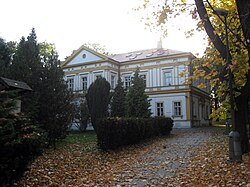
Koloděje is a municipal district and cadastral area in Prague. It is located in the eastern part of the city. As of 2021, there were 1,626 inhabitants living in Koloděje.

Střížkov is a cadastral area of Prague, Czech Republic, divided between the districts of Prague 8 and Prague 9. Střížkov has 15,705 inhabitants as of 2021.

Motol is a cadastral area of Prague, the capital of the Czech Republic. It is located in the administrative district of Prague 5.

Zadní Kopanina is a cadastral district of Prague, Czech Republic. It is the least populated cadastral area of Prague, with 110 inhabitants as of 31 December 2021.

Háje is a district and cadastral area of Prague, capital of the Czech Republic, part of the municipal district of Prague 11.

Holyně is a village and cadastral area in Prague. It is located in the western part of the city. As of 2021, there were 463 inhabitants living in Holyně.