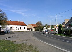
Prague is the capital and largest city of the Czech Republic and the historical capital of Bohemia. Situated on the Vltava river, Prague is home to about 1.4 million people.
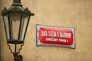
Prague has a local-government structure of two or three tiers, depending on the area of town. At the top is the Magistrate of the Capital City of Prague, which is responsible for public transport; waste collection; municipal police; firefighting; ambulance services; cultural activities; care of historical sites; the Prague Zoo; and other activities of citywide significance.
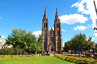
Vinohrady is a cadastral district in Prague. It is so named because the area was once covered in vineyards dating from the 14th century. Vinohrady lies in the municipal and administrative districts of Prague 2, Prague 3 and Prague 10, little parts also of Prague 1 and Prague 4.

Prague 1, formally the Prague 1 Municipal District, is a second-tier municipality in Prague. It is co-extensive with the national administrative district of the same name.

Prague 3, is a second-tier municipality in Prague. It is geographically identical to the national administrative district and city administrative district of the same name.

Kunice is a municipality and village in Prague-East District in the Central Bohemian Region of the Czech Republic. It has about 1,900 inhabitants.

Střešovice is a cadastral area in the west of Prague, located in the Prague 6 district. Střešovice is often called the "local Beverly Hills" because it has been home to some famous residents, including Czech President Václav Havel. The neighborhood is made up of green, quiet, village-like streets and is a 10-minute walk from Prague Castle, and the Dejvice district. The major sights include Villa Müller by functionalist architect Adolf Loos (1930) and The Church of St Norbert in Romanesque Revival (1890-1891) style.
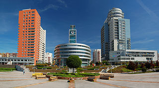
Stodůlky, Czech pronunciation:[ˈstoduːlkɪ], is a cadastral area in Prague, Czech Republic. Originally a village, later municipality, it remained a predominantly agricultural settlement until the 1960s. Stodůlky became part of Prague in 1974 and the large housing estate of Jihozápadní Město gradually arose on fields in vicinity of the old village in the late 1970s through mid-1990s. Nowadays Stodůlky covers an area of 9.63 square kilometres (3.72 sq mi) and has over 60 thousand inhabitants. Západní Město, a western extension of the built-up area is currently under construction.
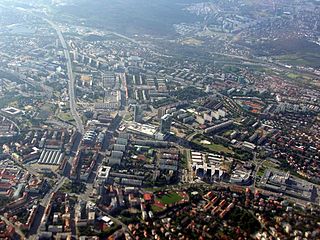
Prague 4, formally the Prague 4 Municipal District, is a second-tier municipality in Prague. The administrative district of the same name consists of municipal districts Prague 4 and Kunratice.

Prague-Petrovice is a municipal district of Prague, Czech Republic. Petrovice is located in the southeastern part of the city. Petrovice is an independent municipality with its own city hall and city assembly. It is part of the Prague 15 administrative district. It has about 5,700 inhabitants. Petrovice used to be a village founded in the 13th century, while today it is an integrated part of Prague. There is a chateau here as well.

Klánovice is a municipal district and cadastral area in Prague, Czechia. Originally a village, later a municipality, it became a district of Prague in 1974.

Prague 12 is a municipal district in Prague, Czech Republic. It consists of the following cadastral subdivisions: Cholupice, Kamýk, Komořany, Modřany and Točná.

Modřany is a suburb of Prague south of the city centre on the banks of the Vltava. It belongs to the municipal district Prague 12. Before being joined with the capital Prague in year 1974, Modřany was de facto a town.
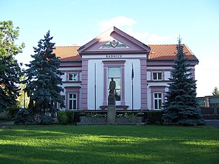
Čakovice is a municipal district in Prague. It is located in the north-eastern part of the city. As of 2021, there were 11,984 inhabitants living in Čakovice. The municipal district consists of three cadastral areas : Čakovice, Miškovice and Třeboradice.
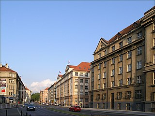
Bubeneč is a district in the north-west of Prague. 52% of the district is in Prague 7, but most of the built-up area is in Prague 6. Sparta Prague football club and their stadium Generali Arena is situated at the south-eastern edge of Bubeneč, and the district also covers Stromovka park and a convention centre Výstaviště. The name Bubeneč is masculine, although Czech grammar rules also allow its use as a feminine.

Točná is a village, and a cadastral subdivision of the municipal district of Prague 12. There are 31 streets and 413 addresses registered, and a population of 679.
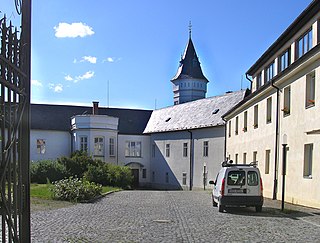
Komořany is a former village which is now a cadastral subdivision of the municipal district of Prague 12.

Písnice is a borough of the city of Prague, and a cadastral subdivision of Libuš and the municipal district of Prague 12. It was an independent municipality until its amalgamation into Prague in 1974. There are 42 streets and 496 addresses registered, and a population of over 4,000.

The Modřany Gully nature reserve is located in the districts of Modřany, Cholupice and Libuš of Prague, Czech Republic on the east side of the Vltava river. It was formed by erosion from the Libuš creek, which, in several places has exposed geologic profiles. It was granted protected status due to the riparian forest in the area near the creek, and the occurrence of thermophilic meadow ecologies on the slopes, but in recent years has suffered from encroachment of foreign flora, in particular the Black Locust tree. It is also an important recreational area between two housing estates, containing a nature trail and several cycling routes.

Třebonice is a village in Prague, capital of the Czech Republic. It was founded in the thirteenth century, and became part of Prague in 1968. It is now part of the Prague 5 administrative district, and the local government districts of Prague 13 and Prague 17. Třebonice is part of Zličín and Řeporyje. It has about 700 inhabitants
