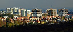
The Karlovy Vary Region is an administrative unit of the Czech Republic, located in the westernmost part of the country. It is named after its capital Karlovy Vary. It is known for spas, which include Karlovy Vary and Mariánské Lázně.
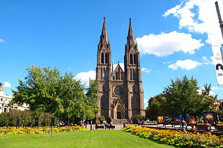
Vinohrady is a cadastral district in Prague. It is so named because the area was once covered in vineyards dating from the 14th century. Vinohrady lies in the municipal and administrative districts of Prague 2, Prague 3 and Prague 10, little parts also of Prague 1 and Prague 4.

Chodov is a district and cadastral area of Prague, capital of the Czech Republic. It lies in the south-east of the city, and became part of the Prague municipality in 1968. In terms of the Prague districts defined in 1960, it lay in administrative district 4, and its postal address is still Prague 4. However, since 2001 it has been placed in the administrative district Prague 11; within that, it lies in the Prague 11 municipal district. It has a Metro station, on the C line. It is principally an area of large high-rise post-Second World War housing developments, but since the Velvet Revolution of 1989 there has been rapid development of commercial sites such as car dealerships; there are also some areas of detached housing. There are a number of hotels in the district, some of them large establishments catering to the congress and package holiday trade.
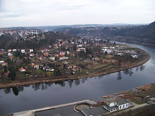
Husinec is a municipality and village in Prague-East District in the Central Bohemian Region of the Czech Republic. It has about 1,600 inhabitants. It lies on the Vltava River. The Nuclear Physics Institute of the Czech Academy of Sciences is located in Řež within the municipality.
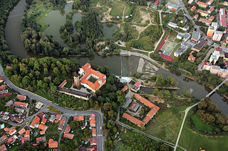
Sázava is a town in Benešov District in the Central Bohemian Region of the Czech Republic. It has about 3,900 inhabitants.
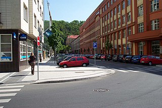
Karlín is a cadastral area of Prague, part of Prague 8 municipal district, formerly an independent town. It is bordered by the river Vltava and Holešovice to the north, Vítkov hill and Žižkov to the south, New Town to the west and Libeň to the east.

Nusle is a district of Prague. It became part of the city in 1922.
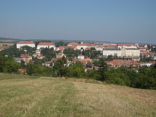
Rosice is a town in Brno-Country District in the South Moravian Region of the Czech Republic. It has about 6,700 inhabitants.

Střešovice is a neighborhood of green, quiet, village-like streets in the west of Prague. It is located in the Prague 6 district. Střešovice is often called the "local Beverly Hills" because it has been home to some famous residents, including Czech President Václav Havel. The neighborhood is a 10-minute walk from Prague Castle, and the Dejvice district. The major sights include Villa Müller by functionalist architect Adolf Loos (1930) and The Church of St Norbert in Romanesque Revival (1890-1891) style.

Kobylisy is a cadastral district in the north of Prague, located in Prague 8. The eastern part of the district is home to a large panel housing estate with over 10,000 residents. The area is served by Kobylisy and Ládví stations on the Prague Metro, both of which opened in 2004.

Vysočany is a part of Prague in the Prague 9 administrative district, Czech Republic. It lays in the eastern part of Prague around the valley with Rokytka river.History

Rožmitál pod Třemšínem is a town in Příbram District in the Central Bohemian Region of the Czech Republic. It has about 4,300 inhabitants. The historic town centre is well preserved and is protected by law as an urban monument zone.

Úvaly is a town in Prague-East District in the Central Bohemian Region of the Czech Republic. It has about 7,500 inhabitants.

Prague 6, officially known as the Municipal District of Prague 6, is the largest district in Prague. Located in the northwest, it covers 41.54 km2 and had a population of 100,600 as of 31 December 2008.
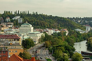
Podolí is a district in Prague located south of the city centre, on the right (east) riverbank. It borders Vyšehrad in the north, Pankrác in the east and Braník in the south. The river Vltava separates Podolí from Smíchov and Hlubočepy on the other riverbank.

Březová-Oleško is a municipality in Prague-West District in the Central Bohemian Region of the Czech Republic. It has about 1,400 inhabitants. It is located on a promontory above the Vltava River.

Červený Újezd is a municipality and village in Prague-West District in the Central Bohemian Region of the Czech Republic. It has about 1,700 inhabitants.

Vršovice is a cadastral district of Prague. All of Vršovice lies within the Prague 10 administrative district. Vršovice is located south-east of the city centre. It borders Vinohrady to the north, Nusle to the south-west, Michle to the south and Strašnice to the east. The name is first mentioned in 1088 in the founding document of the Vyšehrad Chapter. In 1922 the district was incorporated into the city of Prague. It has 107 streets and 1,611 addresses and has about 38,700 inhabitants.

Strašnice is a cadastral district in Prague. It became part of Prague on 1 January 1922. It lies mostly in the municipal and administrative district of Prague 10 while a small part is in Prague 3. The district is bordered by Vršovice, Vinohrady, Žižkov, Malešice, Hostivař, Záběhlice and Michle.

Prosek is a district and cadastral area in the north of Prague, Czech Republic. It is part of the Prague 9 administrative district and is bordered by Střížkov to the west, Letňany to the north, Vysočany to the south, Libeň to the southwest, and Prague–Kbely Airport to the east. Prosek has a population of 17,463 (2011).
