Mingo, Ohio

Last updated

Location of Mingo, Ohio OHMap-doton-Mingo.png
Location of Mingo, Ohio

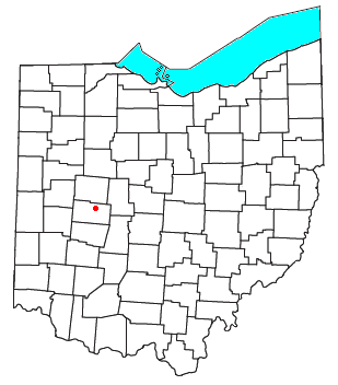
Mingo is an unincorporated community in northern Wayne Township, Champaign County, Ohio, United States. [1] It has the ZIP code 43047. [2] It is located along State Route 245.

Buildings on Stevenson Road Stevenson Road in Mingo.jpg
Buildings on Stevenson Road

Mingo was originally known as Mulberry, and under the latter name was platted in 1866. [3] [4] It was later renamed for the historic Iroquoian Mingo people.

Related Research Articles

<span class="mw-page-title-main">Roundhead, Ohio</span> Unincorporated community in Ohio, U.S.

Roundhead is an unincorporated community in southeastern Roundhead Township, Hardin County, Ohio, United States. It has a post office with the ZIP code 43346.

<span class="mw-page-title-main">Oceola, Ohio</span>

Oceola is a census-designated place (CDP) in central Tod Township, Crawford County, Ohio, United States. As of the 2020 census its population was 156. It has a post office with the ZIP code 44860. It is located along the road that was U.S. Route 30 until being upgraded to a freeway.

<span class="mw-page-title-main">Westville, Ohio</span> Unincorporated community in Ohio, U.S.

Westville is an unincorporated community in northeastern Mad River Township, Champaign County, Ohio, United States. It has a post office with the ZIP code 43083. It lies at the intersection of U.S. Route 36 with State Route 560.

<span class="mw-page-title-main">Rosewood, Ohio</span>

Rosewood is an unincorporated community and census-designated place (CDP) in northwestern Adams Township, Champaign County, Ohio, United States. As of the 2020 census it had a population of 224. It has a post office with the ZIP code 43070. It lies along State Route 29, an east–west highway.

<span class="mw-page-title-main">Cable, Ohio</span> Unincorporated community in Ohio, U.S.

Cable is an unincorporated community in central Wayne Township, Champaign County, Ohio, United States. It has a post office with the ZIP code 43009.

<span class="mw-page-title-main">Wolf Run, Ohio</span> Unincorporated community in Ohio, U.S.

Wolf Run is an unincorporated community in eastern Springfield Township, Jefferson County, Ohio, United States. It has a post office with the ZIP code 43970. The stream of Wolf Run, which flows northward past the community, is a tributary of Goose Creek, which in turn flows southward to meet Cross Creek in Harrison County's German Township, which in turn flows eastward to meet the Ohio River at Mingo Junction.

<span class="mw-page-title-main">Springhills, Ohio</span> Unincorporated community in Ohio, U.S.

Springhills is an unincorporated community in northwestern Harrison Township, Champaign County, Ohio, United States. It lies at the intersection of State Route 245 with Crowl and Springhill-DeGraff Roads. Graves Creek, a subsidiary of the Great Miami River through Stony Creek, runs along the western edge of Springhills. It is located 6 miles (9.5 km) west of West Liberty and 11.5 miles (18.5 km) northwest of Urbana, the county seat of Champaign County.

<span class="mw-page-title-main">Hepburn, Ohio</span> Unincorporated community in Ohio, U.S.

Hepburn is an unincorporated community in northern Dudley Township, Hardin County, Ohio, United States. It lies at the intersection of County Roads 144 and 227, 7+12 miles (12.1 km) east of the center of the city of Kenton, the county seat of Hardin County. Along the south side of the community runs the Scioto River. The community is served by the Kenton (43326) post office.

<span class="mw-page-title-main">Millerstown, Champaign County, Ohio</span> Unincorporated community in Ohio, U.S.

Millerstown is an unincorporated community in eastern Johnson Township, Champaign County, Ohio, United States. It lies at the intersection of Heck Hill, Ward, and Zimmerman Roads, 2+12 miles (4.0 km) north of U.S. Route 36. Nettle Creek, a tributary of the Mad River, flows past Millerstown. It is located approximately 4 miles northeast of the city of St. Paris and 10 miles (16 km) west-northwest of the city of Urbana, the county seat of Champaign County.

<span class="mw-page-title-main">Thackery, Ohio</span> Unincorporated community in Ohio, U.S.

Thackery is an unincorporated community in southeastern Jackson and southwestern Mad River Townships in Champaign County, Ohio, United States. It lies along State Route 55, southwest of the city of Urbana, the county seat of Champaign County.

Carysville is an unincorporated community in Adams Township, Champaign County, in the U.S. state of Ohio.

Crayon is an unincorporated community in Champaign County, in the U.S. state of Ohio.

Darnell is an unincorporated community in Champaign County, in the U.S. state of Ohio.

Eris is an unincorporated community in Champaign County, in the U.S. state of Ohio.

Fountain Park is an unincorporated community in Champaign County, in the U.S. state of Ohio.

Kingscreek is an unincorporated community in Champaign County, in the U.S. state of Ohio.

<span class="mw-page-title-main">Middletown, Champaign County, Ohio</span> Unincorporated community in Ohio, U.S.

Middletown is an unincorporated community in Champaign County, in the U.S. state of Ohio.

Northville is an unincorporated community in Champaign County, in the U.S. state of Ohio.

Powhattan is an unincorporated community in Champaign County, in the U.S. state of Ohio.

Terre Haute is an unincorporated community in Champaign County, in the U.S. state of Ohio.

References

  1. U.S. Geological Survey Geographic Names Information System: Mingo
  2. USPS – Cities by ZIP Code
  3. Middleton, Evan P. (1917). History of Champaign County, Ohio: Its People, Industries and Institutions, Volume 1. B.F. Bowen. p. 242.
  4. The History of Champaign County, Ohio. W.H. Beers & Company. 1881. pp.  558.

40°12′29″N83°38′18″W / 40.20806°N 83.63833°W / 40.20806; -83.63833