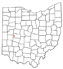
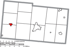
St. Paris, Ohio

Last updated

St. Paris, Ohio
Monitor House.jpg
The Monitor House, a historic site in the village
OHMap-doton-St. Paris.png
Location of St. Paris, Ohio
Map of Champaign County Ohio Highlighting Saint Paris Village.png
Location of St. Paris in Champaign County
Coordinates: 40°07′29″N83°57′52″W / 40.12472°N 83.96444°W / 40.12472; -83.96444
Country United States
State Ohio
County Champaign
Government
   Mayor Brenda Cook
Area
[1]
  Total1.62 sq mi (4.20 km2)
  Land1.62 sq mi (4.20 km2)
  Water0.00 sq mi (0.00 km2)
Elevation
[2]
1,217 ft (371 m)
Population
 (2020)
  Total1,882
  Density1,161.73/sq mi (448.50/km2)
Time zone UTC-5 (Eastern (EST))
  Summer (DST) UTC-4 (EDT)
ZIP code
43072
Area code(s) 937, 326
FIPS code 39-69708 [3]
GNIS feature ID2399170 [2]
Website Village website

St. Paris or Saint Paris [2] is a village in Champaign County, Ohio, United States. The population was 1,882 at the 2020 census.

Contents

History

The area where St. Paris now stands was originally inhabited by Native Americans. The first white settlers arrived in 1797 and the village was founded in Johnson Township [4] in 1831 by David Huffman, who originally named it New Paris, after the French capital city of Paris. Upon learning that another town in Ohio already had that name, he changed the name to St. Paris. [5]

In 1846 and 1847 the Columbus and Piqua Railroad was built along the southern boundary of the village, greatly increasing its advantages compared to other communities in the surrounding area. [5] After reorganization, when the Columbus, Piqua and Indiana Railroad between Columbus, Ohio, and Union City, Indiana opened on March 25, 1859, the local station was the most efficient transport option for area agricultural products and travellers. The railroad operated as part of the Bee Line, [6] eventually becoming part of the Pennsylvania Railroad and then Conrail before abandonment in 1983. [7] [8]

St. Paris was incorporated as a village in 1858. [9] The village increased in area, and now straddles to boundary between Johnson Township and Jackson Township.

One of the houses in the village, known as the "Monitor House", has been declared a historic site and is listed on the National Register of Historic Places. [10]

Geography

According to the United States Census Bureau, the village has a total area of 1.68 square miles (4.35 km2), all of it land. [11]

Kiser Lake and the Kiser Lake State Park are located about 4 miles (6.4 km) north of St. Paris.

Demographics

Historical population
CensusPop.Note
1880 1,099
1890 1,1454.2%
1900 1,2226.7%
1910 1,2613.2%
1920 1,226−2.8%
1930 1,177−4.0%
1940 1,30811.1%
1950 1,4228.7%
1960 1,4602.7%
1970 1,64612.7%
1980 1,7425.8%
1990 1,8425.7%
2000 1,9988.5%
2010 2,0894.6%
2020 1,882−9.9%
U.S. Decennial Census [12]

2010 census

As of the census [13] of 2010, there were 2,089 people, 795 households, and 549 families living in the village. The population density was 1,243.5 inhabitants per square mile (480.1/km2). There were 857 housing units at an average density of 510.1 per square mile (197.0/km2). The racial makeup of the village was 97.8% White, 0.2% African American, 0.1% Native American, 0.2% Pacific Islander, 0.1% from other races, and 1.4% from two or more races. Hispanic or Latino of any race were 0.5% of the population.

There were 795 households, of which 39.7% had children under the age of 18 living with them, 49.8% were married couples living together, 13.8% had a female householder with no husband present, 5.4% had a male householder with no wife present, and 30.9% were non-families. 27.3% of all households were made up of individuals, and 12.6% had someone living alone who was 65 years of age or older. The average household size was 2.63 and the average family size was 3.16.

The median age in the village was 33.7 years. 31.2% of residents were under the age of 18; 7.2% were between the ages of 18 and 24; 26.6% were from 25 to 44; 22.7% were from 45 to 64; and 12.3% were 65 years of age or older. The gender makeup of the village was 47.8% male and 52.2% female.

2000 census

As of the census [3] of 2000, there were 1,998 people, 781 households, and 556 families living in the village. The population density was 2,302.5 inhabitants per square mile (889.0/km2). There were 809 housing units at an average density of 932.3 per square mile (360.0/km2). The racial makeup of the village was 98.55% White, 0.10% African American, 0.60% Native American, 0.15% from other races, and 0.60% from two or more races. Hispanic or Latino of any race were 0.65% of the population.

There were 781 households, out of which 38.0% had children under the age of 18 living with them, 55.8% were married couples living together, 11.4% had a female householder with no husband present, and 28.8% were non-families. 25.9% of all households were made up of individuals, and 11.4% had someone living alone who was 65 years of age or older. The average household size was 2.56 and the average family size was 3.07.

In the village, the population was spread out, with 29.1% under the age of 18, 9.6% from 18 to 24, 29.6% from 25 to 44, 20.2% from 45 to 64, and 11.6% who were 65 years of age or older. The median age was 33 years. For every 100 females there were 87.1 males. For every 100 females age 18 and over, there were 82.8 males.

The median income for a household in the village was $39,917, and the median income for a family was $47,014. Males had a median income of $35,417 versus $22,326 for females. The per capita income for the village was $16,811. About 8.8% of families and 8.8% of the population were below the poverty line, including 10.8% of those under age 18 and 9.1% of those age 65 or over.

Education

St. Paris is served by Graham Local School District. Graham High School, a member of the Central Buckeye Conference, is located in St. Paris. There are also Graham Middle School and Graham Elementary School, both of which are newly built. The Board of Education offices were once located in the old Junior High School downtown, but have now been moved to a new location behind the high school. The Graham Digital Academy (GDA) and A. B. Graham Academy (ABGA) were also located in the building, until A. B. Graham Academy's closure in June 2014. All of these facilities are located on U.S. Route 36.

Government

As of March, 2024, the mayor of St. Paris is Susan Prince. [14] The members of the village council are Tony Hoyt, Frank Blair, Terry Ervin II, Steve Lett, and Joe Curran. [14]

Notes and references

  1. "ArcGIS REST Services Directory". United States Census Bureau. Retrieved September 20, 2022.
  2. 1 2 3 U.S. Geological Survey Geographic Names Information System: St. Paris, Ohio
  3. 1 2 "U.S. Census website". United States Census Bureau . Retrieved January 31, 2008.
  4. The History of Champaign County, Ohio. W.H. Beers & Company. 1881. pp.  11.
  5. 1 2 The History of Champaign County, Ohio. W.H. Beers & Company. 1881. pp.  451.
  6. Push and Pull of the Hoosier Partisans and Cleveland Clique: Consolidation of the Bee Line Railroads. By Andrew Olson, posted 2 June 2017. Accessed 30 September 2023.
  7. Columbus, Piqua & Indiana Railroad Overpasses (in Covington, Ohio). Bridges and Tunnels. Accessed 30 September 2023.
  8. Columbus, OH to Ridgeville, IN. Abandoned Rails. Accessed 30 Sep 2023.
  9. Middleton, Evan P. (1917). History of Champaign County, Ohio: Its People, Industries and Institutions, Volume 1. B.F. Bowen. p. 936.
  10. "National Register Information System". National Register of Historic Places . National Park Service. March 13, 2009.
  11. "US Gazetteer files 2010". United States Census Bureau. Archived from the original on January 25, 2012. Retrieved January 6, 2013.
  12. "Census of Population and Housing". Census.gov. Retrieved June 4, 2015.
  13. "U.S. Census website". United States Census Bureau . Retrieved January 6, 2013.
  14. 1 2 St. Paris Village Government, St. Paris, Ohio. Accessed 2016-10-09.

Further reading

Related Research Articles

<span class="mw-page-title-main">Miami County, Ohio</span> County in Ohio, United States

Miami County is a county located in the U.S. state of Ohio. As of the 2020 census, the population was 108,774. Its county seat is Troy. The county is named in honor of the Miami people.

<span class="mw-page-title-main">Champaign County, Ohio</span> County in Ohio, United States

Champaign County is a county located in the U.S. state of Ohio. As of the 2020 census, the population was 38,714. Its county seat and largest city is Urbana. The county takes its name from the French word for "open level country". Champaign County became the 18th of 88 Ohio counties on March 1, 1805. It was formed from parts of Greene and Franklin counties by legislative action.

<span class="mw-page-title-main">Buckland, Ohio</span> Village in Ohio, United States

Buckland is a village in Auglaize County, Ohio, United States. The population was 233 at the 2020 census. It is included in the Wapakoneta, Ohio Micropolitan Statistical Area. The village is served by the Wapakoneta City School District.

<span class="mw-page-title-main">Uniopolis, Ohio</span> Unincorporated community and Census-designated place in Ohio, United States

Uniopolis is an unincorporated community and former village in Auglaize County, Ohio, United States. The population was 188 at the 2020 census. It is included in the Wapakoneta, Ohio Micropolitan Statistical Area.

<span class="mw-page-title-main">Mechanicsburg, Ohio</span> Village in Ohio, United States

Mechanicsburg is a village in Champaign County, Ohio, United States. The population was 1,681 at the 2020 census.

<span class="mw-page-title-main">Mutual, Ohio</span> Village in Ohio, United States

Mutual is a village in Champaign County, Ohio, United States. The population was 127 at the 2020 census.

<span class="mw-page-title-main">North Lewisburg, Ohio</span> Village in Ohio, United States

North Lewisburg is a village in Champaign County, Ohio The population was 1,636 at the time of the 2020 census.

<span class="mw-page-title-main">Woodstock, Ohio</span> Village in Ohio, United States

Woodstock is a village in Champaign County, Ohio, United States. The population was 287 at the 2020 census.

<span class="mw-page-title-main">West Lafayette, Ohio</span> Village in Ohio, United States

West Lafayette is a village in Coshocton County, Ohio, United States. The population was 2,417 at the 2020 census.

<span class="mw-page-title-main">Hilliard, Ohio</span> City in Ohio, United States

Hilliard is a city in Franklin County, Ohio, United States. The population was 37,114 at the 2020 census. It is a suburb of Columbus and part of Norwich Township. Hilliard is home to the Early Television Museum, the second largest First Responders Park in the United States, and Heritage Rail Trail. Hilliard also has the only flag pole from the World Trade Center that is not in a museum. The flag pole is located in front of the fire department on Northwest Parkway. The Hilliard Historical Society maintains a historical village near the Franklin County Fairgrounds.

<span class="mw-page-title-main">Byesville, Ohio</span> Village in Ohio, United States

Byesville is a village in Guernsey County, Ohio, United States, along Wills Creek. The population was 2,364 at the 2020 census.

<span class="mw-page-title-main">Alexandria, Ohio</span> Village in Ohio, United States

Alexandria is a village in Licking County, Ohio, United States. The population was 483 at the 2020 census.

<span class="mw-page-title-main">Huntsville, Ohio</span> Village in Ohio, United States

Huntsville is a village in Logan County, Ohio, United States. The population was 408 at the 2020 census.

<span class="mw-page-title-main">Covington, Ohio</span> Village in Ohio, United States

Covington is a village in Miami County, Ohio, United States. The population was 2,548 at the 2020 census. It is part of the Dayton Metropolitan Statistical Area. The village was incorporated as Covington in 1835 on the site of the 1793 Fort Rowdy.

<span class="mw-page-title-main">Laura, Ohio</span> Village in Ohio, United States

Laura is a village in Miami County, Ohio, United States. The population was 398 at the 2020 census. It is part of the Dayton Metropolitan Statistical Area.

<span class="mw-page-title-main">Orient, Ohio</span> Census-designated place in Ohio, United States

Orient is a census-designated place and former village in Pickaway County, Ohio, United States. The population was 246 at the 2020 census.

<span class="mw-page-title-main">Columbus Grove, Ohio</span> Village in Ohio, United States

Columbus Grove is a village in Putnam County, Ohio, United States. The population was 2,160 at the 2020 census.

<span class="mw-page-title-main">Fort Loramie, Ohio</span> Village in Ohio, United States

Fort Loramie is a village in Shelby County, Ohio, United States, along Loramie Creek, a tributary of the Great Miami River in southwestern Ohio. It is 42 mi. north-northwest of Dayton and 20 mi. east of the Ohio/Indiana border. The population was 1,590 at the 2020 census. The village was founded in 1837 near the former site of a colonial fort of the same name.

<span class="mw-page-title-main">Dennison, Ohio</span> Village in Ohio, United States

Dennison is a village in Tuscarawas County, Ohio, United States. The population was 2,709 at the 2020 census.

<span class="mw-page-title-main">Bradford, Ohio</span> Village in Ohio, United States

Bradford is a village in Darke and Miami counties in the U.S. state of Ohio. The population was 1,796 at the 2020 census.