Mutual, Ohio

Last updated

Mutual, Ohio
Streetside in Mutual, Ohio.jpg
Along Mutual's main street
OHMap-doton-Mutual.png
Location of Mutual, Ohio
Map of Champaign County Ohio Highlighting Mutual Village.png
Location of Mutual in Champaign County
Coordinates: 40°04′46″N83°38′13″W / 40.07944°N 83.63694°W / 40.07944; -83.63694
Country United States
State Ohio
County Champaign
Township Union
Government
  TypeAdministrative Council
  Executive Chairman of Administrative CouncilKenneth Warfield[ citation needed ]
  Vice Chairman of Administrative CouncilBlake Heyder[ citation needed ]
  Deputy Chair of Administrative CouncilHarry Ball-Zucker[ citation needed ]
Area
[1]
  Total0.14 sq mi (0.35 km2)
  Land0.14 sq mi (0.35 km2)
  Water0.00 sq mi (0.00 km2)
Elevation
[2]
1,184 ft (361 m)
Population
 (2020)
  Total127
  Density940.74/sq mi (362.87/km2)
Time zone UTC-5 (Eastern (EST))
  Summer (DST) UTC-4 (EDT)
FIPS code 39-53480 [3]
GNIS feature ID2399433 [2]

Mutual is a village in Champaign County, Ohio, United States. The population was 127 at the 2020 census.

Contents

History

Mutual was laid out in the 1840s and incorporated as a village in 1869. [4] [5]

Geography

Mutual is located at the intersection of State Routes 29 and 161. The nearest stream is Buck Creek, a tributary of the Mad River, which flows about 1 mile (1½ km) west of the community. It is located approximately midway between the city of Urbana (the county seat of Champaign County) and the village of Mechanicsburg. [6]

According to the United States Census Bureau, the village has a total area of 0.13 square miles (0.34 km2), all of it land. [7]

Demographics

Historical population
CensusPop.Note
1880 189
1890 174−7.9%
1900 163−6.3%
1910 134−17.8%
1920 15717.2%
1930 129−17.8%
1940 120−7.0%
1950 17848.3%
1960 163−8.4%
1970 1778.6%
1980 159−10.2%
1990 126−20.8%
2000 1324.8%
2010 104−21.2%
2020 12722.1%
U.S. Decennial Census [8]

2010 census

As of the census [9] of 2010, there were 104 people, 48 households, and 32 families living in the village. The population density was 800.0 inhabitants per square mile (308.9/km2). There were 54 housing units at an average density of 415.4 per square mile (160.4/km2). The racial makeup of the village was 97.1% White and 2.9% African American.

There were 48 households, of which 25.0% had children under the age of 18 living with them, 52.1% were married couples living together, 6.3% had a female householder with no husband present, 8.3% had a male householder with no wife present, and 33.3% were non-families. 29.2% of all households were made up of individuals, and 23% had someone living alone who was 65 years of age or older. The average household size was 2.17 and the average family size was 2.69.

The median age in the village was 45.5 years. 23.1% of residents were under the age of 18; 1.9% were between the ages of 18 and 24; 24.1% were from 25 to 44; 25% were from 45 to 64; and 26% were 65 years of age or older. The gender makeup of the village was 51.0% male and 49.0% female.

2000 census

As of the census [3] of 2000, there were 132 people, 51 households, and 39 families living in the village. The population density was 969.6 inhabitants per square mile (374.4/km2). There were 51 housing units at an average density of 374.6 per square mile (144.6/km2). The racial makeup of the village was 100.00% White. Hispanic or Latino of any race were 1.52% of the population.

There were 51 households, out of which 37.3% had children under the age of 18 living with them, 70.6% were married couples living together, 5.9% had a female householder with no husband present, and 21.6% were non-families. 19.6% of all households were made up of individuals, and 13.7% had someone living alone who was 65 years of age or older. The average household size was 2.59 and the average family size was 2.90.

In the village, the population was spread out, with 23.5% under the age of 18, 6.8% from 18 to 24, 35.6% from 25 to 44, 18.9% from 45 to 64, and 15.2% who were 65 years of age or older. The median age was 37 years. For every 100 females there were 73.7 males. For every 100 females age 18 and over, there were 77.2 males.

The median income for a household in the village was $50,000, and the median income for a family was $51,875. Males had a median income of $30,750 versus $23,750 for females. The per capita income for the village was $16,722. There were no families and 1.0% of the population living below the poverty line, including no under eighteens and 14.3% of those over 64.

Related Research Articles

<span class="mw-page-title-main">Champaign County, Ohio</span> County in Ohio, United States

Champaign County is a county located in the U.S. state of Ohio. As of the 2020 census, the population was 38,714. Its county seat and largest city is Urbana. The county takes its name from the French word for "open level country". Champaign County became the 18th of 88 Ohio counties on March 1, 1805. It was formed from parts of Greene and Franklin counties by legislative action.

<span class="mw-page-title-main">Fort Shawnee, Ohio</span> CDP in Ohio, United States

Fort Shawnee is census-designated place (CDP) in Allen County, Ohio, United States. The population was 6,263 at the 2020 census. It is included in the Lima, Ohio Metropolitan Statistical Area. Fort Shawnee is adjacent to the city of Lima and the village of Cridersville in Auglaize County. In 2012, village residents voted to disincorporate the village. According to the United States Census Bureau, the village had a total area of 7.25 square miles (18.78 km2), of which 7.21 square miles (18.67 km2) is land and 0.04 square miles (0.10 km2) is water.

<span class="mw-page-title-main">Christiansburg, Ohio</span> Village in Ohio, United States

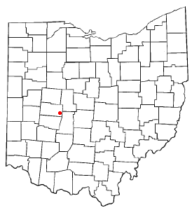
Christiansburg is a village in Champaign County, Ohio, United States. The population was 505 at the 2020 census.

<span class="mw-page-title-main">Mechanicsburg, Ohio</span> Village in Ohio, United States

Mechanicsburg is a village in Champaign County, Ohio, United States. The population was 1,681 at the 2020 census.

<span class="mw-page-title-main">North Lewisburg, Ohio</span> Village in Ohio, United States

North Lewisburg is a village in Champaign County, Ohio The population was 1,636 at the time of the 2020 census.

<span class="mw-page-title-main">St. Paris, Ohio</span> Village in Ohio, United States

St. Paris or Saint Paris is a village in Champaign County, Ohio, United States. The population was 1,882 at the 2020 census.

<span class="mw-page-title-main">Woodstock, Ohio</span> Village in Ohio, United States

Woodstock is a village in Champaign County, Ohio, United States. The population was 287 at the 2020 census.

<span class="mw-page-title-main">Gordon, Ohio</span> Village in Ohio, United States

Gordon is a village in Darke County, Ohio, United States. The population was 245 at the 2020 census.

<span class="mw-page-title-main">New Weston, Ohio</span> Village in Ohio, United States

New Weston is a village in Darke County, Ohio, United States. The population was 124 at the 2020 census.

<span class="mw-page-title-main">Palestine, Ohio</span> Village in Ohio, United States

Palestine is a village in Darke County, Ohio, United States. The population was 180 at the 2020 census.

<span class="mw-page-title-main">Addyston, Ohio</span> Village in Ohio, United States

Addyston is a village in Miami Township, Hamilton County, Ohio, United States. Located along the Ohio River, it is a western suburb of the neighboring city of Cincinnati. The population was 927 at the 2020 census.

<span class="mw-page-title-main">Cleves, Ohio</span> City in Ohio, United States

Cleves is a village in Miami Township, Hamilton County, Ohio, United States. Located along the Ohio River, it is a western suburb of Cincinnati. The population was 3,414 at the 2020 census.

<span class="mw-page-title-main">Evendale, Ohio</span> Village in Ohio, United States

Evendale is a village in Hamilton County, Ohio, United States, within the Cincinnati metropolitan area. The population was 2,669 at the 2020 census.

<span class="mw-page-title-main">North Bend, Ohio</span> Village in Ohio, United States

North Bend is a village in Miami Township, Hamilton County, Ohio, United States, along the Ohio River. It is a part of the Greater Cincinnati area. The population was 835 at the 2020 census.

<span class="mw-page-title-main">Gann, Ohio</span> Village in Ohio, United States

Brinkhaven, once known as Mount Holly and Gann, is a village in Knox County, Ohio, United States. The population was 114 at the 2020 census.

<span class="mw-page-title-main">Fletcher, Ohio</span> Village in Ohio, United States

Fletcher is a village in Miami County, Ohio, United States. The population was 451 at the 2020 census. It is part of the Dayton Metropolitan Statistical Area.

<span class="mw-page-title-main">Port Jefferson, Ohio</span> Village in Ohio, United States

Port Jefferson is a village in Salem Township, Shelby County, Ohio, United States. The population was 308 at the 2020 census.

<span class="mw-page-title-main">Wilson, Ohio</span> Village in Ohio, United States

Wilson is a village in Belmont and Monroe counties in the U.S. state of Ohio. The population was 129 at the 2020 census. It is part of the Wheeling metropolitan area.

<span class="mw-page-title-main">Burkettsville, Ohio</span> Village in Ohio, United States

Burkettsville is a village in Darke and Mercer counties in the U.S. state of Ohio. The population was 272 at the 2020 census.

<span class="mw-page-title-main">Verona, Ohio</span> Village in Ohio, United States

Verona is a village in Montgomery and Preble counties in the U.S. state of Ohio. The population was 403 at the 2020 census. It is part of the Dayton Metropolitan Statistical Area.

References

  1. "ArcGIS REST Services Directory". United States Census Bureau. Retrieved September 20, 2022.
  2. 1 2 U.S. Geological Survey Geographic Names Information System: Mutual, Ohio
  3. 1 2 "U.S. Census website". United States Census Bureau . Retrieved January 31, 2008.
  4. The History of Champaign County, Ohio: Containing a History of the County; Its Cities, Towns, Etc. W.H. Beers & Company. 1881. pp.  402.
  5. Middleton, Evan P. (1917). History of Champaign County, Ohio: Its People, Industries and Institutions, Volume 1. B.F. Bowen. p. 258.
  6. DeLorme, Ohio Atlas & Gazetteer, 7th ed., DeLorme, 2004, p. 56. ISBN   0-89933-281-1
  7. "US Gazetteer files 2010". United States Census Bureau. Archived from the original on February 20, 2011. Retrieved January 6, 2013.
  8. "Census of Population and Housing". Census.gov. Retrieved June 4, 2015.
  9. "U.S. Census website". United States Census Bureau . Retrieved January 6, 2013.