Mira River (Ecuador and Colombia)

Last updated
Mira River
Colombia relief location map.jpg
Red pog.svg
Mira River mouth
Location
Countries Ecuador, Colombia
Physical characteristics
Source 
  locationPuruanta Lake, Ecuador
Mouth  
  location
Pacific Ocean
  coordinates
1°36′00″N79°01′00″W / 1.6°N 79.016667°W / 1.6; -79.016667
  elevation
0 m (0 ft)

The Mira River originates in the Andes of Ecuador and flows to the Pacific Ocean in Colombia. For a few kilometers it forms the border between the two countries. The upper course of the Mira is called the Chota River and is notable for its Afro-Ecuadorian inhabitants, its bomba music, and the large number of internationally prominent soccer players it has produced. [1]

Contents

Course

Pedestrian foot bridge across the Chota River at Pusir. 0deg 27' 33' N 77deg 59' 50' W Ecuador June 2013 23508 f.jpg
Pedestrian foot bridge across the Chota River at Pusir. 0° 27′ 33′ N 77° 59′ 50′ W

High Andes. The most distant source of the Mira River may be Puruanta Lake, located at an elevation of 3,473 metres (11,394 ft) in the Cayambe Coca Ecological Reserve of northern Ecuador. The cities of Ibarra and Otavalo are in the upper drainage basin of the river which includes most of Imbabura and Carchi provinces. The borders of the two provinces run roughly along the course of the Mira. [2]

Chota River and Chota Valley. Several tributaries unite to form the Chota River north of the town of Pimampiro at an elevation of 1,700 metres (5,600 ft). The Chota valley, deep, but wide and fertile in places, extends along the river for about 35 kilometres (22 mi) to the village of Concepcion at an elevation of 1,300 metres (4,300 ft) Below the junction of the Chota and Piguchuela rivers, the river is called the Mira. The climate is semi-arid with precipitation on the valley floor as low as 500 millimetres (20 in) per year. Irrigation is necessary for most agriculture. [3] The relatively low elevation (for the Andes) of the Chota Valley has resulted since prehistoric times in the valley being used to grow warm-climate and semi-tropical crops: coca, cotton, chile peppers, maize, and fruits. A class of traders called mindaeles, exchanged the semi-tropical crops of the valley with the people of the Pais Caraqui chiefdoms of the surrounding higher and cooler elevations. Beginning in the 16th century, the Spanish introduced additional crops, especially sugar cane, olives. and grapes. [4]

Transition. A few miles north of Concepcion, the Mira begins its flow through a narrow, sparsely-populated canyon bordered by forested uplands which persist to near the Colombian border, dropping in elevation over the course of 100 kilometres (62 mi) from 1,200 metres (3,900 ft) near Conception to 100 metres (330 ft). [5] The Mira in this section and upstream in the Chota Valley is popular for rafting and kayaking as there are many Class III and IV rapids. [6]

Coastal. The Mira River is navigable for the 88 kilometres (55 mi) it flows through Nariño Department of Colombia to the Pacific The Mira is joined by the San Juan River, a major tributary. This is a rainforest region with only a small population devoted mostly to the cultivation of bananas and African oil Palm. [7]

Afro-Ecuadorians, bomba, and soccer

African slaves were brought to Ecuador beginning in the 16th century. In the 17th and 18th century Jesuit missionaries owned most of the land in the Chota valley and imported Africans to work as slaves on their sugar cane plantations. By 1767, when the Jesuits were expelled from Latin America, the Jesuits owned 10 plantations and 1,769 slaves in the Chota valley. [8] However, most of the Afro-Ecuadorians experienced little change with the departure of the Jesuits, continuing to be enslaved by the new owners of the plantations. [9]

Slavery was abolished in Ecuador in 1852 and most of the Afro-Ecuadorian residents of the Chota Valley became landless sharecroppers, a condition which continued until the late 20th century. The population of the Chota Valley in 1987 was almost entirely Afro-Ecuadorian concentrated in 10 to 15 villages and totaling less than 15,000. The surrounding highlands had a mestizo and Indigenous population. [10]

A few of the Afro-Ecuadorians obtained land after Land Reform legislation in 1964, but in the early 21st century, the majority of Afro-Ecuadorians in the Chota valley were still impoverished and landless or nearly landless. [11]

The Chota valley is known for its bomba music which features African drums mixed with indigenous and Spanish influences. It has also become known as the origin of many of Ecuador's finest soccer players. The 2002 Ecuadorian team, which qualified for the FIFA World Cup, had seven Afro-Ecuadorians from the Chota valley on its 23-man roster. This despite the absence of grass soccer fields and training facilities for young players in the Chota valley. [12]

See also

Related Research Articles

<span class="mw-page-title-main">Geography of Colombia</span>

The Republic of Colombia is situated largely in the north-west of South America, with some territories falling within the boundaries of Central America. It is bordered to the north-west by Panama; to the east by Brazil and Venezuela; to the south by Ecuador and Peru; and it shares maritime limits with Costa Rica, Nicaragua, Honduras, Jamaica, the Dominican Republic, and Haiti.

<span class="mw-page-title-main">Geography of Ecuador</span>

Ecuador is a country in western South America, bordering the Pacific Ocean at the Equator, for which the country is named. Ecuador encompasses a wide range of natural formations and climates, from the desert-like southern coast to the snowcapped peaks of the Andes mountain range to the plains of the Amazon Basin. Cotopaxi in Ecuador is one of the world's highest active volcanos. It also has a large series of rivers that follow the southern border and spill into the northwest area of Peru.

<span class="mw-page-title-main">Demographics of Ecuador</span>

Demographic features of the population of Ecuador include population density, ethnicity, education level, health of the populace, economic status, religious affiliations and other aspects of the population.

The music of Ecuador is a diverse aspect of Ecuadorian culture. Ecuadorian music ranges from indigenous styles such as pasillo to Afro-Ecuadorian styles like bomba to modern indie rock like "Cambio de Tonalidad" by Da Pawn.

<i>Zambo</i> Persons of mixed African and Amerindian ancestry

Zambo or Sambu is a racial term historically used in the Spanish Empire to refer to people of mixed Amerindian and African ancestry. Occasionally in the 21st century, the term is used in the Americas to refer to persons who are of mixed African and Indigenous American ancestry.

<span class="mw-page-title-main">Imbabura Province</span> Province of Ecuador

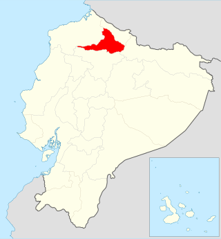
Imbabura is a province located in the Andes of northern Ecuador. The capital is Ibarra. The people of the province speak Spanish, and a large portion of the population also speaks the Imbaburan Kichwa variety of the Quechua language.

<span class="mw-page-title-main">Sucumbíos Province</span> Province of Ecuador

Sucumbíos is a province in northeast Ecuador. The capital and largest city is Nueva Loja. It is the fifth largest province in the country, with an area of 18,084 km2. In 2010, it had a population of 176,472 inhabitants.

<span class="mw-page-title-main">Chota, Ecuador</span>

The upper valley of the Mira River, called the Chota River in its upstream portion, in northern Ecuador, and the small villages in it are usually referred to as 'El Chota', and it runs east–west between the two ranges of the Andes. It lies in the provinces of Imbabura, Carchi and Esmeraldas. The river and its upper valley are situated about halfway between the equator and the Colombian border. Accessed off Route 35, the nearest major city is Quito, but Ibarra is the major market centre just south of the valley. It is reputed to be where the best soccer players in the country tend to be from.

<span class="mw-page-title-main">Afro-Ecuadorians</span> Ecuadorian ethnic group

Afro-Ecuadorians or Afroecuatorianos (Spanish), are Ecuadorians of predominantly Sub-Saharan African descent.

Bomba or Bomba del Chota is an Afro-Ecuadorian music and dance form from the Chota Valley area of Ecuador in the province of Imbabura and Carchi. Its origins can be traced back to Africa via the middle passage and the use of African slave labor during the country's colonial period. Africans brought to labor as slaves in Ecuador brought with them this music form heavily influenced from the Bantu cultures of the Congo. The people dance in pairs to the drums and use improvisation to build relationships between the dancer and lead drummer.

<span class="mw-page-title-main">Bolívar Canton, Carchi</span> Canton in Carchi Province, Ecuador

Bolívar Canton is a canton of Ecuador, located in Carchi Province. Its capital is the town of Bolívar. Its population at the 2001 census was 13,898 and in 2010 was 14,347.

<span class="mw-page-title-main">Espejo Canton</span> Canton in Carchi, Ecuador

Espejo is a canton of Ecuador, located in Carchi Province. Its capital is the town of El Ángel. Its population in the 2001 census was 13,515 and in the 2010 census was 13,364. Espejo is located in the Andes and El Ángel is situated at an elevation of 3,010 metres (9,880 ft) above sea level.

<span class="mw-page-title-main">Mira Canton</span> Canton in Carchi Province, Ecuador

Mira Canton is a canton of Ecuador, located in Carchi Province. Its capital is the town of Mira. Its population in the 2001 census was 12,919 and was 12,180 in the 2010 census. The area is 588 square kilometres (227 sq mi).

<span class="mw-page-title-main">Montúfar Canton</span> Canton in Carchi Province, Ecuador

Montúfar Canton is a canton of Ecuador, located in Carchi Province. Its capital is the city of San Gabriel. The canton's population in the 2001 census was 28,576 and was 30,511 in the 2010 census.

<span class="mw-page-title-main">San Pedro de Huaca Canton</span> Canton in Carchi Province, Ecuador

San Pedro de Huaca Canton is a canton of Ecuador, located in Carchi Province. Its capital is the town of Huaca. Its population in the 2001 census was 6,856 and in 2010 was 7,624. The area is 31 square kilometres (12 sq mi).

<span class="mw-page-title-main">Tulcán Canton</span> Canton in Carchi Province, Ecuador

Tulcán Canton is a canton of Ecuador, located in Carchi Province. Its capital is the city of Tulcán. The population of the canton in the 2001 census was 77,175 and 86,498 in the 2010 census. The area of the canton is 1,812 square kilometres (700 sq mi).

<span class="mw-page-title-main">Pimampiro Canton</span> Canton in Imbabura Province, Ecuador

Pimampiro Canton is a canton of Ecuador, located in Imbabura Province. Its population in the 2001 census was 12,951 and 12,970 in the 2010 census.

<span class="mw-page-title-main">San Miguel de Urcuquí Canton</span> Canton in Imbabura Province, Ecuador

San Miguel de Urcuquí Canton, or Urkuki, is a canton of Ecuador, located in the Imbabura Province. Its seat is the town of Urcuquí. Its population in the 2001 census was 14,381 and was 15,671 in the 2010 census. The area of the canton is 735.3 square kilometres (283.9 sq mi).

<span class="mw-page-title-main">Otavalo people</span> Indigenous people of northern Ecuador

The Otavalos are an indigenous people native to the Andean mountains of Imbabura Province in northern Ecuador. The Otavalos also inhabit the city of Otavalo in that province. Commerce and handcrafts are among the principal economic activities of the Otavalos, who enjoy a higher standard of living than most indigenous groups in Ecuador and many mestizos of their area.

The Inca-Caranqui archaeological site is located in the village of Caranqui on the southern outskirts of the city of Ibarra, Ecuador. The ruin is located in a fertile valley at an elevation of 2,299 metres (7,543 ft). The region around Caranqui, extending into the present day country of Colombia, was the northernmost outpost of the Inca Empire and the last to be added to the empire before the Spanish conquest of 1533. The archaeological region is also called the Pais Caranqui.

References

  1. "Mira River". GeoNames. Retrieved July 24, 2021.
  2. Google Earth
  3. Preston, D. A. (June, 1965), "Negro, Mestizo and Indian in an Andean Environment",The Geographical Journal, Vol. 131, No. 2, p. 225. Downloaded from JSTOR.
  4. La Cuenca del Rio Mira y Concepcion (PDF). pp. 31–42. Retrieved 19 July 2017. Preston, p. 228
  5. "Case study 4 - Study of the Santiago and Mira river basins, Ecuador". www.oas.org.
  6. ""Mira River," Barefoot Expeditions, accessed 20 Jul 2017".
  7. "Vertientes Hidrográficas de Colombia". Toda Colombia. Retrieved 20 Jul 2017.
  8. "Cuenca del Ro Mira y Concepcion" (PDF). Centro Afroecuatoriano.
  9. "Ecuador | Forgotten Territories, Unrealized Rights: A Report from the Rapoport Delegation on Afro-Ecuadorian Land Rights (Nov. 2009)" (PDF). University of Texas. Retrieved 21 July 2017.
  10. Lipski, John M. (1987), "The Chota Valley: Afro-Hispanic Language in Highland Ecuador," Latin American Research Review, Vol 22, No. 1, pp. 157-158. Downloaded from JSTOR.
  11. "Ecuador | Forgotten Territories, Unrealized Rights: A Report from the Rapoport Delegation on Afro-Ecuadorian Land Rights (Nov. 2009)" (PDF). University of Texas.
  12. Lonely Planet: Ecuador & the Galapagos Islands; (2006), Lonely Planet, 7th Edition, p. 134

Other coordinates: 0°28′N78°04′W / 0.467°N 78.067°W / 0.467; -78.067