Related Research Articles

Thurston Island is a largely ice-covered, glacially dissected island, 135 nautical miles long and 55 nautical miles wide, lying between Amundsen Sea and Bellingshausen Sea a short way off the northwest end of Ellsworth Land, Antarctica. The island is separated from the mainland by Peacock Sound, which is occupied by the west portion of Abbot Ice Shelf.

The Eternity Range is a range of mountains 28 nautical miles long, rising to 3,239 metres (10,627 ft), and trending north–south approximately in the middle of the Antarctic Peninsula. The range is divided into three main mountain blocks, the major summits in each from north to south being Mounts Faith, Hope and Charity.

Rothschild Island is a black rugged island 39 kilometres (24 mi) long, mainly ice-covered but surmounted by prominent peaks of Desko Mountains in Antarctica, 8 kilometres (5 mi) west of the north part of Alexander Island in the north entrance to Wilkins Sound.
The Lazarev Mountains are a chain of mountains in Antarctica. They extend along the west side of Matusevich Glacier southward of Eld Peak, and are about 25 nautical miles long.
Umber Island is a rocky island, 2.4 km (1.5 mi) long, lying 1.75 km (1.09 mi) southwest of Kamhi Point and 10 km (6.2 mi) northwest of Dint Island lying within Lazarev Bay, off the west side of Alexander Island, Antarctica. The island was mapped from air photos taken by the Ronne Antarctic Research Expedition (RARE) in 1947–48, by Searle of the Falkland Islands Dependencies Survey in 1960, it was so named by the United Kingdom Antarctic Place-Names Committee because on the RARE photos the island appears in deep shadow cast by the Havre Mountains to the north.
The Airy Glacier is a glacier 20 nautical miles (37 km) long and 6 nautical miles (11 km) wide, flowing west to the northeast portion of Forster Ice Piedmont, near the west coast of the Antarctic Peninsula.
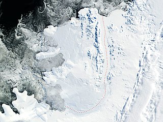
Lazarev Bay is a rectangular bay, 15 nautical miles (28 km) long and 13 nautical miles (24 km) wide, which separates Alexander Island from Rothschild Island and is bounded on the south side by the Wilkins Ice Shelf, which joins the east portion of Rothschild Island and the west portion of Alexander Island. Two minor islands, Dint Island and Umber Island, lie merged within the ice of the Wilkins Ice Shelf within Lazarev Bay.
The Lazarev Ice Shelf is that part of the ice shelf fringing the Princess Astrid Coast of Queen Maud Land, Antarctica, that lies between Leningradskiy Island and Verblyud Island. It is part of the western Riiser-Larsen Sea and is about 50 nautical miles (90 km) long, with Razlom Point at its western edge. The ice shelf was first photographed from the air and mapped by the Third German Antarctic Expedition, 1938–39. It was explored and mapped by the Soviet Antarctic Expedition in 1959, and named for Lieutenant Mikhail P. Lazarev, commander of the sloop Mirnyy.
The Desko Mountains are a west-northwest–east-southeast mountain range on Rothschild Island, off northwest Alexander Island in Antarctica. The mountain range spans 20 miles (32 km) from Bates Peak to Overton Peak and rises to about 1,000 metres (3,300 ft) at Enigma Peak, Fournier Ridge.
Enigma Peak is a peak, 1,000 metres (3,300 ft) high, surmounting Fournier Ridge in the Desko Mountains, on Rothschild Island in Antarctica. It was probably seen from a distance by F. Bellingshausen in 1821, Jean-Baptiste Charcot in 1909, and the British Graham Land Expedition in 1936. It was observed and photographed from the air by the U.S. Antarctic Service, 1939–41, and was mapped as the prominent northwestern peak of the island. It was mapped in greater detail from air photos taken by the Ronne Antarctic Research Expedition, 1947–48, by D. Searle of the Falklands Islands Dependencies Survey in 1960, and from U.S. Landsat imagery of February 1975. It was so named by the UK Antarctic Place-Names Committee because of difficulty in identifying the peak during the map compilation.

Wubbold Glacier is a steeply inclined glacier, 8 nautical miles (15 km) long, flowing south from the Havre Mountains, situated in the northern portion of Alexander Island, Antarctica. The glacier drains the north, west and southwest slopes of Mount Pontida, and flows into Lazarev Bay north of Mount Holt. It was photographed from the air by Ronne Antarctic Research Expedition in 1947 and was mapped from the photographs by Falkland Islands Dependencies Survey in 1960. Named by Advisory Committee on Antarctic Names for Commander J.H. Wubbold, USCG, commanding officer, USCGC Northwind, U.S. Navy Operation Deepfreeze, 1977.
Cape Vostok is a rocky headland which forms the west extremity of the Havre Mountains and the northwest extremity of Alexander Island in Antarctica. It was discovered by the First Russian Antarctic Expedition in 1821, led by Fabian Gottlieb von Bellingshausen and Mikhail Lazarev. It was mapped in detail from aerial photos taken by the Ronne Antarctic Research Expedition in 1947–48, and later by Searle of the Falkland Islands Dependencies Survey in 1960. Nearby Balgari Nunatak was visited in 1988 by the First Bulgarian Antarctic Expedition and chosen as the site of a future Bulgarian base in Antarctica, which however was eventually set up on Livingston Island instead.
Coulter Glacier is a steeply inclined glacier, 5 nautical miles (9 km) long, flowing south from the Havre Mountains, northern Alexander Island, into Kolokita Cove in Lazarev Bay, Antarctica. The glacier was photographed from the air by the Ronne Antarctic Research Expedition in 1947 and mapped from the photographs by the Falkland Islands Dependencies Survey in 1960. It was named by the Advisory Committee on Antarctic Names for R.W. Coulter, Master of USNS Alatna during U.S. Navy Operation Deepfreeze, 1969.
Dint Island is a rocky island, 3 kilometres (1.5 nmi) long. Probably first seen from the air by the United States Antarctic Service, 1939–41, it was first mapped from air photos taken by the Ronne Antarctic Research Expedition, 1947–48, by D. Searle of the Falkland Islands Dependencies Survey in 1960. It was so named by the UK Antarctic Place-Names Committee because a distinctive cirque makes a dent, or dint, on the south side of the island.
Mount Ethelwulf is a mainly ice-covered mountain, 2,590 metres (8,500 ft) high, standing between Mount Egbert and Mount Ethelred at the head of Tumble Glacier, in the Douglas Range of northeast Alexander Island, Antarctica. The mountain was probably first observed by Lincoln Ellsworth, who photographed the east side of the Douglas Range from the air on November 23, 1935; its east face was roughly surveyed in 1936 by the British Graham Land Expedition under John Rymill. It was resurveyed in 1948 by the Falkland Islands Dependencies Survey (FIDS) and named for Ethelwulf, Saxon King of England, 839–858. The west face of the mountain was mapped from air photos taken by the Ronne Antarctic Research Expedition, 1947–48, by D. Searle of the FIDS in 1960. Mount Ethelwulf is the fourth highest peak of Alexander Island, succeeded by Mount Paris and proceeded by Mount Huckle.
The Haslam Heights are a line of peaks trending north-northeast–south-southwest, rising to about 1,000 metres (3,300 ft) to the west of Vallot Glacier and Nye Glacier in Arrowsmith Peninsula, Graham Land, Antarctica. They were probably first seen by the French Antarctic Expedition, 1908–10 under Jean-Baptiste Charcot, which roughly charted the area in 1909. They were roughly mapped by the Falkland Islands Dependencies Survey (FIDS) in 1948, and named in 1985 by the UK Antarctic Place-Names Committee (UK-APC) after Rear Admiral Sir David W. Haslam, Hydrographer of the Navy, 1975–85.
The Lassus Mountains are a large group of mountains, 15 nautical miles (28 km) long and 3 nautical miles (6 km) wide, rising to 2,100 metres (6,900 ft) and extending south from Palestrina Glacier in the northwest part of Alexander Island, Antarctica. They overlook Lazarev Bay and a few minor islands within the bay such as Dint Island and Umber Island; Haydn Inlet lies to the south while the Havre Mountains lie immediately north.

Mirny was a 20-gun sloop-of-war of the Imperial Russian Navy, the second ship of the First Russian Antarctic Expedition in 1819–1821, during which Fabian Gottlieb von Bellingshausen and Mikhail Lazarev circumnavigated the globe, discovered the continent of Antarctica and twice circumnavigated it, and discovered a number of islands and archipelagos in the Southern Ocean and the Pacific.
Siegfried Glacier is a glacier flowing east-southeast into Lazarev Bay, south of Mirnyy Peak on Rothschild Island. It was named by the UK Antarctic Place-names Committee in association with the Wagner Ice Piedmont after Siegfried, the third part of the four-part festival play Der Ring des Nibelungen (1826) by Wagner.
References
- ↑ "Mirnyy Peak". Geographic Names Information System . United States Geological Survey, United States Department of the Interior . Retrieved 2013-10-23.
![]() This article incorporates public domain material from "Mirnyy Peak". Geographic Names Information System . United States Geological Survey.
This article incorporates public domain material from "Mirnyy Peak". Geographic Names Information System . United States Geological Survey.
| | This Palmer Land location article is a stub. You can help Wikipedia by expanding it. |