A cart or dray is a vehicle designed for transport, using two wheels and normally pulled by one or a pair of draught animals. A handcart is pulled or pushed by one or more people.

Birżebbuġa is a seaside town in the Southern Region of Malta, close to Marsaxlokk. It is approximately 13 kilometres from the capital Valletta, and it has a population of 9,736 as of March 2014.

Għarb is an administrative unit of Malta, located at the westernmost point of the island of Gozo, with a population of 1,539 people.

Siġġiewi, also called by its title Città Ferdinand, is a city and a local council in the Southern Region of Malta. It is the third largest council in Malta by surface area, after Rabat and Mellieħa. It is situated on a plateau, a few kilometers away from Mdina, the ancient capital city of Malta, and 10 kilometres away from Valletta, the contemporary capital. It is the home of 8,721 inhabitants as of January 2019. Until several decades ago, almost all of the population was employed in the fields which surround the city. In 1993, the city adopted the motto Labore et Virtute.
St. Paul's Bay is a town in the Northern Region of Malta, sixteen kilometres northwest of the capital Valletta. Saint Paul's Bay is the largest town in the Northern Region and the seat of the Northern Regional Committee. It is the most populous settlement in Malta.

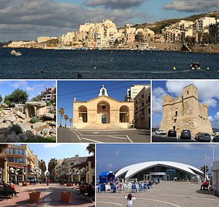
Qala is an administrative unit of Malta, on the island of Gozo, with a population of 1,929 as of September 2019. Nearby is Ħondoq ir-Rummien, a coastline with salt pans and caves.

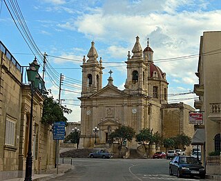
San Lawrenz is an administrative unit of Malta, on the island of Gozo. Its name is derived from Lawrence of Rome who is the patron saint for the locality. It has a population of 748, as of March 2014.
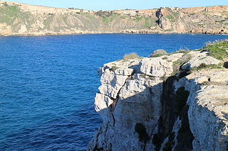
Sannat is an administrative unit of Malta, on the island of Gozo, with a population of 2,117 people. Ta' Sannat is in the south of Gozo, popular for its very high cliffs, ancient cart ruts, temples and dolmens, and rich fauna and flora. In 1951 The Duchess of Edinburgh of the United Kingdom visited a house called "The Lace house" located in a small square in Ta' Sannat called "Pjazza Tax-Xelina".

Xewkija is an administrative unit of Malta, on the island of Gozo. The population of Xewkija is 3,300 as of March 2014.
Clapham Junction is an urban locality around Clapham Junction railway station in London, England.
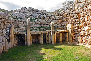
The Megalithic Temples of Malta are several prehistoric temples, some of which are UNESCO World Heritage Sites, built during three distinct periods approximately between 3600 BC and 2500 BC on the island country of Malta. They had been claimed as the oldest free-standing structures on Earth until the discovery of Göbekli Tepe in Turkey. Archaeologists believe that these megalithic complexes are the result of local innovations in a process of cultural evolution. This led to the building of several temples of the Ġgantija phase, culminating in the large Tarxien temple complex, which remained in use until 2500 BC. After this date, the temple-building culture disappeared.

Manikata is a small settlement in the limits of Mellieħa in the northwestern part of Malta. It oversees the farming areas in the valley between il-Ballut and il-Manikata. The village's population of 539 is spread among 40 families.
Fomm ir-Riħ, is a small bay in the limits of Mġarr on the western side of the island of Malta. The area is characterised by a fault line which creates an interesting landscape with vertical cliffs and a pebble beach. There is also an unusual syncline behind the beach.

The coastline of Malta consists of bays, sandy beaches, creeks, harbours, small villages, cities, cliffs, valleys, and other interesting sites. Here, there is a list of these different natural features that are found around the coast of Malta.

Gozo, in antiquity known as Gaulos, is an island in the Maltese archipelago in the Mediterranean Sea. The island is part of the Republic of Malta. After the island of Malta itself, it is the second-largest island in the archipelago.

In Malta most of the main roads are in the outskirts of the localities to connect one urban area with another urban area. The most important roads are those that connect the south of the island with the northern part, like Tal-Barrani Road, Aldo Moro Street in Marsa and Birkirkara Bypass.

Għar Qawqla is a limestone formation located off Marsalforn on the island of Gozo in Malta. It was formerly a natural arch connected to the mainland, but the span collapsed at some point during the 20th century. It has been speculated that the name Marsalforn might be partially derived from forna, referring to the natural sea caves of the area, of which Għar Qawqla was one of the best-known. The formations stands about 7.9 metres (26 ft) off the shore.

Għar il-Kbir is a complex of caves in Dingli, Malta. It is mostly known for several curt ruts which are located next to it. It is also commonly believed that several families of troglodytes inhabited the cave until 1835. The general structure of the cave system has eight caves spread across two levels.

