Mississippi Highway 308 | ||||
---|---|---|---|---|
Dubbs Road Limerick Road | ||||
Route information | ||||
Maintained by MSHC and Tunica County | ||||
Length | 8.8 mi (14.2 km) | |||
Existed | 1960–1967 | |||
Major junctions | ||||
West end | US 61 near Maud | |||
East end | MS 4 near White Oak | |||
Location | ||||
Counties | Tunica | |||
Highway system | ||||
|
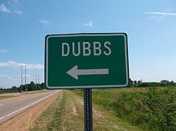
Mississippi Highway 308 (MS 308) was a state highway in northeastern Mississippi, United States. The route started at U.S. Route 61 (US 61) near Maud and traveled eastward through rural Tunica County. It then turned north near the community of Dubbs, and MS 308 ended at MS 4 near White Oak. The gravel road was designated as a state route around 1960, from US 61 to MS 4. It was then decommissioned by 1967.
The entire route was in Tunica County. [1] MS 308 started at an intersection with US 61 near Maud, and it traveled eastward along Dubbs Road. The route traveled through the unincorporated community of Dubbs near its intersection with Bly Road and Bill Pegram Road. [2] At Limerick Road, MS 308 turned north and continued through farmland. [3] The route ended at an intersection with MS 4 southeast of White Oak. [1] [2] The road was maintained by the Mississippi State Highway Commission (MSHC) and Tunica County, as part of the state highway system. [1]
MS 308 was designated around 1960, using an existing gravel road from US 61 to MS 4 within Tunica County. The route was maintained by the MSHC for the section near US 61, and by Tunica County for the section near MS 4. [4] [5] It was removed from the state highway system by 1967. [1] [6] The route is now known as Dubbs Road and Limerick Road, [2] [3] and continue to be maintained by Tunica County. [2]
The entire route was in Tunica County.
Location | mi [3] | km | Destinations | Notes | |
---|---|---|---|---|---|
| 0.0 | 0.0 | US 61 | Western terminus | |
| 8.8 | 14.2 | MS 4 | Eastern terminus | |
1.000 mi = 1.609 km; 1.000 km = 0.621 mi |
Mississippi Highway 555 is a state highway in southwestern Mississippi. The route has two sections, both in Adams County. The first section starts at Ogden Road and travels northwestward to its terminus at US 61. The second section starts at the concurrency of MS 930 and MS 932 and the concurrency of US 61 and US 84 in Natchez. MS 555 travels northward through Pine Ridge and ends at Anna's Bottom Road near the Anna Site. The route travels by a few historical locations, including the Pine Ridge Presbyterian Church.
Mississippi Highway 554 is a short highway near Natchez, Mississippi. The route starts at MS 555, and travels eastward. The road intersects the entrance to Natchez–Adams County Airport before ending at U.S. Route 61. The route was designated in 1957, and it included a separate route in southern Adams County. MS 554 was temporarily removed from the highway system in 1967, but was added back in 1973.
Mississippi Highway 469 is a state highway in central Mississippi, located in Simpson and Rankin counties. The route starts at MS 28 near Georgetown, and it travels north through western Simpson County. The road enters the community of Harrisville and enters Rankin County soon after. It intersects U.S. Route 49 in Florence, and it ends at MS 468 near Whitfield. The route was designated in 1953, and it was extended southwards to MS 20 in 1956. By 1960, all of the route was paved with asphalt.
Mississippi Highway 304 (MS 304) is east-west state highway in the northwestern part of the U.S. state of Mississippi, running for 40.4 miles (65.0 km) as a four-lane freeway from U.S. Route 61 in Tunica Resorts to the Tennessee state line near Collierville. It is mostly concurrent with Interstate 69 (I-69) and Interstate 269 (I-269).
Mississippi Highway 306 is a state highway in northern Mississippi. The route starts at U.S. Route 51 in Coldwater, and it travels eastward to an interchange at Interstate 55 (I-55) on the northern edge of the town. The road continues eastward across northern Tate County and ends at MS 305 near Independence. MS 306 was designated in 1952, and it was constructed in 1953 from US 51 to MS 305. The route was paved in asphalt by 1956, and an interchange was built at I-55 by 1967.
Mississippi Highway 465 is a highway in the southern region of the Mississippi Delta. The highway starts at U.S. Route 61 near Redwood. It travels westward towards the Mississippi River, and then northwards to the village of Eagle Bend. The highway then traverses on the Mississippi River levee on a one-lane road. Later, MS 465 leaves the levee, continues northward, and soon ends at MS 1.
Mississippi Highway 161 (MS 161) is a state highway designation for three highways in the U.S. state of Mississippi, consisting of old alignments of U.S. Route 61 (US 61). Totaling at 19.872 miles (31.981 km), the three sections are located in Bolivar, Coahoma, and Desoto counties. The Bolivar County section, designated in 2000, travels from Merigold to Mound Bayou and Shelby. In Coahoma County, MS 161 was designated in 2004 and runs through Clarksdale and Lyon. In Desoto County, MS 161 travels through the town of Walls and was created in 1999.
Mississippi Highway 498 is a state highway in eastern Mississippi. The highway starts at U.S. Route 45 near Porterville, and it travels eastward from its western terminus. One mile (1.6 km) later, MS 498 ends near a railroad crossing west of Porterville, and the road continues as Porterville–Alabama Road. The route was designated around 1957, from US 45 to the Alabama–Mississippi state line. MS 498 was truncated to Porterville by 1970.
Mississippi Highway 569 is a state highway in southwestern Mississippi. The route starts at the Mississippi–Louisiana state line, and it travels northeastward from that point. It intersects MS 48 southwest of Liberty, and MS 569 becomes concurrent with it. Inside Liberty, MS 569 is also concurrent with MS 24 briefly before travelling northeastward out of the city. It continues through Amite County and it ends at U.S. Route 98 in extreme southwestern Lincoln County.
Mississippi Highway 434 is a short state highway in western Mississippi. The route travels from U.S. Route 61 near Nitta Yuma and travels eastward. After crossing a creek, the road travels northeastward and enters Delta City, and the route ends inside the unincorporated community. The route was constructed around 1951, connecting from US 61 to Delta City. An extension along a county road to US 49W existed from 1957 to 1967.
Mississippi Highway 436 is a state highway in western Mississippi. The route starts at Eastside Lake Washington Road in Glen Allan and travels eastward. The road intersects MS 1 in Hampton and turns northeastward. It ends near Percy at U.S. Route 61. MS 436 was designated in 1957, along a road from US 61 to a point near the Washington–Sharkey county line. The route was extended westward to Glen Allan along a state-maintained road in 1958, and also eastward to Belzoni via a county road in 1967. The route east of US 61 was decommissioned by 1967.
Mississippi Highway 826 is a short state highway in western Mississippi. The route starts at U.S. Route 61 south of Rolling Fork. The road then travels northward through farmland, and MS 826 ends at its intersection with MS 14, west of the town. The road was constructed in 1955 to bypass Rolling Fork, and the route was designated around 1957, after a proposal by Sharkey County to transfer the road to state maintenance.
Mississippi Highway 382 is a state highway in eastern Mississippi. The route starts at U.S. Route 45 Alternate near Prairie and travels eastward. The road travels through farmland as it reaches Prairie. MS 382 then ends at MS 25 near Aberdeen. The road was constructed around 1951 from MS 45W west of Prairie to US 45 in Aberdeen, and it was designated by 1958. The eastern terminus was changed to MS 25 from US 45 by 1967.
Mississippi Highway 462 is a state highway in western Mississippi. The route starts at U.S. Route 61 near Port Gibson, and it travels eastward. The road then turns northeastward, and the route ends at Willows Road and Old Port Gibson Road near Willows. MS 462 was designated around 1958, as a gravel road extending eastward from US 61 near Port Gibson. The road was extended to MS 461 from 1960 to 1963, then to the Natchez Trace Parkway from 1967 to 1998.
Mississippi Highway 403 is a state highway in central Mississippi. The route starts at U.S. Route 82 and MS 15 in Mathiston, and it travels north away from the town. It then turns east near Natchez Trace Parkway and then travels below it. MS 403 ends at the intersection of Clarkson Road and Old US 82 near a county highway maintenance barn. The route was designated by 1960, after a paved road extending from Mathiston was constructed around 1958. An extension northwards to MS 50 and MS 341 existed from 1960 to 1967.
Mississippi Highway 600 was a state highway in southern Mississippi. The route started at U.S. Route 11 in Carriere and traveled eastward. The road crossed from Pearl River County to Hancock County and continued east until it reached MS 603 in Necaise. MS 600 was designated around 1958 from the Pearl River–Hancock county line to MS 603, and it was extended to US 11 by 1960. The route was removed from the state highway system by 1967.
Mississippi Highway 335 was a state highway in central Mississippi. The route started at MS 8 near Gore Springs, and it traveled northward over eastern Grenada County. MS 335 then crossed over the Grenada Lake and entered Yalobusha County. The route continued northward and ended at MS 330 near Gums. MS 335 was designated around 1958, from the Grenada–Yalobusha county line to MS 330. It was extended southwards in 1960 to MS 8, before being removed from the state highway system by 1967.
Mississippi Highway 489 is a state highway in eastern Mississippi. Starting on the south end in Lake, the highway travels mostly north into Newton County until it reaches Conehatta. At this point, it turns more northeastward, eventually terminating in Union.
Mississippi Highway 446 is a state highway in northwest Mississippi. The route starts at MS 1 near Lobdell, and it travels east through the Dahomey National Wildlife Refuge and Skene. The road enters Boyle, traveling through the center of the town as a boulevard. The route ends at U.S. Route 61 and US 278 on the eastern side of Boyle, and the road continues as Peavine Road. The highway was designated in 1955 along its current alignment, after the state had funded projects to improve the preexisting county road. The route was fully paved in asphalt by 1957.
Mississippi Highway 433 (MS 433) is a state highway in western Mississippi consisting of two segments. The western segment, running entirely in Sharkey County is unsigned and runs for about 10.5 miles (16.9 km). The eastern segment, at a length of 45.3 miles (72.9 km), runs from Satartia in Yazoo County to rural Holmes County.
Route map:
KML file (edit • help) |