
U.S. Highway 159 (US 159) is a 83.6-mile-long (134.5 km) auxiliary route of US 59. It travels from Nortonville, Kansas at US 59 to New Point, Missouri, also at US 59. The highway permits through traffic on US 59 to bypass the cities of Atchison, Kansas and Saint Joseph, Missouri, traveling instead through Falls City, Nebraska and Hiawatha, Kansas.

Route 7 is a state highway with its northern terminus at U.S. Route 24 in northeast Independence and its southern terminus at Interstate 44 southeast of Richland. The section between Harrisonville and Clinton provides an important link for traffic between Springfield and Kansas City.
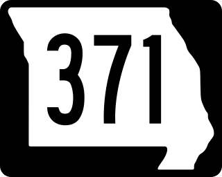
Route 371 is a highway in western Missouri. Its southern terminus is at Route 273 north of Tracy. Its northern terminus is at Route 752 in St. Joseph. It is a former alignment of U.S. Route 71 (US 71).

Route 99 is a short highway in southern Missouri. Its northern terminus is at U.S. Route 60 just north of Birch Tree in Shannon County; its southern terminus is at U.S. Route 160 south of Thomasville in Oregon County 18.3 miles (29.5 km) to the SSE. It crosses the Eleven Point River at Thomasville. Just south of Thomasville Route 99 provides access to the west end of the Eleven Point Wild and Scenic River portion of the Mark Twain National Forest.

Route 38 is a highway in southern Missouri. Its eastern terminus is at Route 17 ten miles (16 km) west of Houston; its western terminus is at U.S. Route 65 about ten miles (16 km) south of Buffalo.

Route 94 serves eastern and central Missouri. The entire route closely parallels the Missouri River. The eastern terminus is at U.S. Route 67 in West Alton; its western terminus is at the intersection of U.S. Route 54 and U.S. Route 63 in Jefferson City.

Route 116 is a highway in northwestern Missouri. Its eastern terminus is at Route A in Braymer; its western terminus is at U.S. Route 59 in Rushville.

Route 9 is a highway in the Kansas City, Missouri area. Its northern terminus is at Interstate 29/U.S. Route 71 in Kansas City North; its southern terminus is at Interstate 35/Interstate 70/U.S. Route 24/U.S. Route 40 in downtown Kansas City. Even though both termini are in Kansas City, it passes through other towns and cities. It is carried across the Missouri River by the Heart of America Bridge between downtown Kansas City, Missouri and North Kansas City, Missouri. In North Kansas City, the highway serves as a main thoroughfare, Burlington Street.

Route 34 is a highway in southeastern Missouri. Its eastern terminus is at the Illinois state line on the Mississippi River at Cape Girardeau where it overlaps Route 74. Its western terminus is at U.S. Route 60 near Van Buren. The road continues into Illinois as Illinois Route 146.
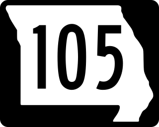
Route 105 is a highway in Mississippi County, Missouri. Its northern terminus is at Interstate 57/U.S. Route 60 in Charleston; its southern terminus is at Route 80 in East Prairie. Other than the two termini, no other towns are on the route.

Route 58 is a highway in western Missouri. Its eastern terminus is at U.S. Route 50 west of Warrensburg; its western terminus is at Route D west of Belton, Missouri. It is one of only a very few highways to end at a state supplemental route.
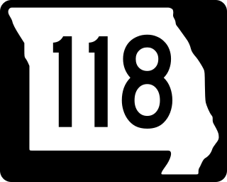
Route 118 is a highway in Holt County. Its eastern terminus is at U.S. Route 59 in Mound City; its western terminus is at Route 111 about six miles (10 km) west of Mound City.

Route 41 is a highway in central Missouri. Its northern terminus is at U.S. Route 24 in southern Carroll County; its southern terminus is at Interstate 70/U.S. Route 40 west of Boonville, where the road continues south as Route 135.

Route 79 is a highway in eastern Missouri. Its northern terminus is at Interstate 72/U.S. Route 36 in downtown Hannibal; its southern terminus is at Interstate 70 in St. Peters. The route closely parallels the Mississippi River.

Route 23 is a highway in central Missouri. Its northern terminus is at U.S. Route 24 near Waverly; its southern terminus is at Route 2 west of Windsor.
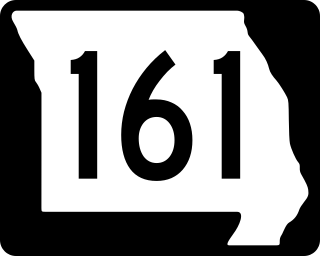
Route 161 is a highway in northeastern Missouri. Its northern terminus is at Business U.S. Route 61 in Bowling Green; its southern terminus is at Interstate 70/U.S. Route 40 south of Montgomery City.

Route 103 is a short highway in southeastern Missouri. Its southern terminus is at Route Z inside the Ozark National Scenic Riverways. The route travels north and intersects a few county roads as it leaves the national park. The road ends at U.S. Route 60 in a three-way junction. After being proposed in 1930, a road was built from the national park to US 60 in 1933. The gravel road was designated as Route 103, and it was paved five years later.
Route 92 is a highway in Platte and Clay counties in northwestern Missouri, United States. Its western terminus is a continuation of K-92 on the Centennial Bridge over the Missouri River at the Kansas state line, and the eastern terminus is at U.S. Route 69 in northern Excelsior Springs.
Route 180 is a highway in the St. Louis, Missouri area. Its western terminus is at Interstate 270 (I-270) in Bridgeton, running east into the western neighborhoods of St. Louis to its eastern terminus at Kingshighway Boulevard, the border of the St. Louis neighborhoods of Kingsway West and Kingsway East.

State Route 266 (SR 266) is a state highway in the U.S. state of California. The route traverses Fish Lake Valley, which is part in California and part in Nevada. The route connects two Nevada state routes that traverse the Nevada portion of the valley, SR 264 and SR 266. The only connection from SR 266 to the rest of California's road network is via SR 168 in the community of Oasis. Prior to 1986 the southern and northern halves of modern SR 266 had separate numerical designations. The southern portion of the highway, along with modern SR 168, dates to the auto trail era, forming part of the Midland Trail.

