Related Research Articles

The Great Lakes, also called the Great Lakes of North America, are a series of large interconnected freshwater lakes spanning the Canada–United States border. The five lakes are Superior, Michigan, Huron, Erie, and Ontario. The Great Lakes Waterway enables modern travel and shipping by water among the lakes. The lakes connect to the Atlantic Ocean via the Saint Lawrence River, and to the Mississippi River basin through the Illinois Waterway.

Niagara Falls is a city in Niagara County, New York, United States. As of the 2020 census, the city had a total population of 48,671. It is adjacent to the Niagara River, across from the city of Niagara Falls, Ontario, and named after the famed Niagara Falls which they share. The city is within the Buffalo–Niagara Falls metropolitan area and the Western New York region.

North Tonawanda is a city in Niagara County, New York, United States. The population was 31,568 at the 2010 census. It is part of the Buffalo–Niagara Falls Metropolitan Statistical Area. The city is named after Tonawanda Creek, its south border.

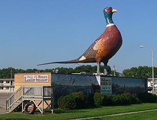
Huron is a city in and the county seat of Beadle County, South Dakota, United States. The population was 14,263 at the 2020 census, and it is the 8th most populous city in South Dakota.

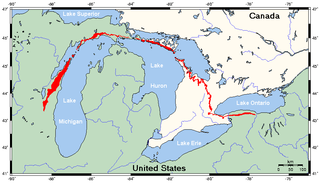
The Niagara Escarpment is a long escarpment, or cuesta, in Canada and the United States that starts from the south shore of Lake Ontario westward, circumscribes the top of the Great Lakes Basin running from New York through Ontario, Michigan, and Wisconsin. The escarpment is the cliff over which the Niagara River plunges at Niagara Falls, for which it is named.

Tonawanda is a city in Erie County, New York, United States. The population was 15,129 at the 2020 census. It is at the northern edge of Erie County, south across the Erie Canal from North Tonawanda, east of Grand Island, and north of Buffalo. It is part of the Buffalo-Niagara Falls metropolitan area.

Tonawanda is a town in Erie County, New York, United States. As of the 2020 census, the town had a population of 72,636. The town is at the north border of the county and is the northern inner ring suburb of Buffalo. It is sometimes referred to, along with its constituent village of Kenmore, as "Ken-Ton". The town was established in 1836, and up to 1903 it included what is now the city of Tonawanda.

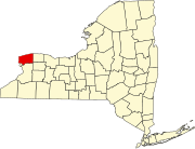
Lockport is both a city and the town that surrounds it in Niagara County, New York, United States. The city is the Niagara county seat, with a population of 21,165 according to 2010 census figures, and an estimated population of 20,305 as of 2019.

The Last of the Mohicans: A Narrative of 1757 is an 1826 historical romance novel by James Fenimore Cooper. It is the second book of the Leatherstocking Tales pentalogy and the best known to contemporary audiences. The Pathfinder, published 14 years later in 1840, is its sequel; its prequel, The Deerslayer, was published a year after The Pathfinder. The Last of the Mohicans is set in 1757, during the French and Indian War, when France and Great Britain battled for control of North America. During this war, both the French and the British used Native American allies, but the French were particularly dependent on Indigenous forces since they were outnumbered in the Northeast frontier areas by the British. Specifically, the events of the novel are set immediately before, during, and after the Siege of Fort William Henry.

Love Canal is a neighborhood in Niagara Falls, New York, United States, infamous as the location of a 0.28 km2 (0.11 sq mi) landfill that became the site of an environmental disaster discovered in 1977. Decades of dumping toxic chemicals killed residents and harmed the health of hundreds, often profoundly. The area was cleaned up over 21 years in a Superfund operation.

Lois Marie Gibbs is an American environmental activist. As a primary organizer of the Love Canal Homeowners Association, Lois Gibbs brought wide public attention to the environmental crisis in Love Canal. Her actions resulted in the evacuation of over 800 families. She founded the non-profit Clearinghouse for Hazardous Waste in 1981 to help train and support local activists with their environmental work. She continues to work with the organization, renamed the Center for Health, Environment, and Justice (CHEJ).
Conestoga-Rovers & Associates (CRA) is a group of companies that provides engineering, environmental consulting, construction, and information technology (IT) services. On July 2, 2014, CRA became a division of the GHD Group. Its current overall headquarters is located in Waterloo, Ontario, however the firm has locations in multiple countries with a separate headquarters in each. Their U.S. headquarters resides in Niagara Falls, New York where the company's seminal project, the Love Canal, took place.

New York State Route 384 (NY 384) is a state highway in Western New York in the United States. It is a north–south route extending from the city of Buffalo, Erie County to the city of Niagara Falls, Niagara County, and is one of several routes directly connecting the two cities. The southern terminus of the route is at NY 5 in downtown Buffalo. NY 384's northern terminus is at the Rainbow Bridge in downtown Niagara Falls. Through its entire course in Erie County, it is known as Delaware Avenue for the street it follows in the city. In Niagara County, NY 384 follows the Niagara River and is named River Road and Buffalo Avenue.
The Niagara Falls City School District is a public school district containing 11 schools in Niagara Falls, New York. The Superintendent of Schools is Mark Laurrie.

Buffalo is the county seat of Erie County, and the second most populous city in the U.S. state of New York, after New York City. Originating around 1789 as a small trading community inhabited by the Neutral Nation near the mouth of Buffalo Creek, the city, then a town, grew quickly after the opening of the Erie Canal in 1825, with the city at its western terminus. Its position at the eastern end of Lake Erie strengthened the economy, based on grain milling and steel production along the southern shores and in nearby Lackawanna.
The Killing Ground is a 1979 American documentary film written by Brit Hume. It was nominated for an Academy Award for Best Documentary Feature.
Hooker Chemical Company was an American firm producing chloralkali products from 1903 to 1968. In 1922, bought the S. Wander & Sons Company to sell lye and chlorinated lime. The company became notorious in 1977, when residents near its chemical waste site, Love Canal, reported extraordinarily high incidences of leukemia, birth defects, and other injuries. Although Hooker had sold its old chemical waste dump site to the Niagara Falls School Board in 1953, the company was held responsible as a result of a lawsuit thereafter.
The following is a timeline of the history of the city of Buffalo, New York, United States.
William O'Brien was a steam cargo ship built in 1914–1915 by New York Shipbuilding Company of Camden for the Carpenter–O'Brien Lumber Company of Delaware. The vessel was extensively employed on East Coast to Europe routes during her career and foundered on one of her regular trips in April 1920.
References
- ↑ U.S. Geological Survey Geographic Names Information System: Model City, New York
- 1 2 3 Germain, David (May 27, 1993). "Mr. Love and his canal". The Times Herald. Port Huron, Michigan. Associated Press. p. 17.
- ↑ O'Brien, Keith (2022). Paradise Falls: The True Story of an Environmental Catastrophe (Hardcover ed.). Pantheon Books. p. 368. ISBN 9780593318430.
- ↑ "Relates History of South Huron". The Daily Plainsman. Huron, South Dakota. April 13, 1937. p. 6.
- ↑ O'Brien 2022, p. 29.
- ↑ "Tacomans Caught in Big Boom City?". The Tacoma Daily Ledger. Tacoma, Washington. November 23, 1913. p. 21.
- ↑ "Madison County People May Lose: Dispatches From Galesburg Indicate That Financial Troubles Impend on Dream City of Lomax". Alton Evening Telegraph. Alton, Illinois. September 30, 1914. p. 4.
- ↑ "Claim Options of 15,000 Acres for New City Project". The News Journal. Wilmington, Delaware. March 21, 1930. p. 4.
- ↑ "Actions At The Love Canal Site". The New York Times . February 23, 1983. Archived from the original on February 7, 2017. Retrieved February 27, 2017.
- ↑ Verhovek, Sam How (August 5, 1988). "After 10 Years, the Trauma of Love Canal Continues". The New York Times. Archived from the original on July 13, 2022. Retrieved July 29, 2008.
- ↑ Glaberson, William (October 22, 1990). "Love Canal: Suit Focuses On Records From 1940's". The New York Times . Archived from the original on February 27, 2017. Retrieved February 27, 2017.
