Royalton, New York

Last updated

Royalton
Town of Royalton
Niagara County New York incorporated and unincorporated areas Royalton highlighted.svg
Location in Niagara County and the state of New York.
USA New York location map.svg
Red pog.svg
Royalton
Coordinates: 43°10′24″N78°32′39″W / 43.17333°N 78.54417°W / 43.17333; -78.54417
Country United States
State New York
County Niagara
Government
  Type Town Council
   Town Supervisor Dan Bragg (R)
   Town Council
Members' List
Area
[1]
  Total70.28 sq mi (182.01 km2)
  Land69.97 sq mi (181.21 km2)
  Water0.31 sq mi (0.80 km2)
Elevation
643 ft (196 m)
Population
 (2010)
  Total7,660
  Estimate 
(2016) [2]
7,541
  Density107.78/sq mi (41.61/km2)
Time zone UTC-5 (Eastern (EST))
  Summer (DST) UTC-4 (EDT)
FIPS code 36-64034
GNIS feature ID0979439
Location within Niagara County. Niagara-Royalton.png
Location within Niagara County.

Royalton is a town in Niagara County, New York, United States. The population was 7,660 at the 2010 census.

Contents

The Town of Royalton is in the southeast corner of the county and is east of the City of Niagara Falls.

History

The Town of Royalton was formed in 1817 from part of the Town of Hartland. The source of the town name is not currently known.

Notable people

Geography

According to the United States Census Bureau, the town has a total area of 70.1 square miles (182 km2), of which 69.8 square miles (181 km2) is land and 0.3 square miles (0.78 km2) (0.37%) is water.

The south border of the town is Tonawanda Creek. The Erie Canal runs through the northern part of the town and the Village of Middleport.

Adjacent cities and towns

Major highways in the Town of Royalton

Demographics

Historical population
CensusPop.Note
1820 1,849
1830 3,13869.7%
1840 3,54913.1%
1850 4,02413.4%
1860 4,79319.1%
1870 4,726−1.4%
1880 4,8883.4%
1890 4,632−5.2%
1900 4,7973.6%
1910 4,9563.3%
1920 4,485−9.5%
1930 4,6603.9%
1940 4,617−0.9%
1950 5,29714.7%
1960 6,58624.3%
1970 7,37512.0%
1980 7,7655.3%
1990 7,453−4.0%
2000 7,7103.4%
2010 7,660−0.6%
2016 (est.)7,541 [2] −1.6%
U.S. Decennial Census [3]

As of the census [4] of 2000, there were 7,710 people, 2,810 households, and 2,121 families residing in the town. The population density was 110.4 inhabitants per square mile (42.6/km2). There were 2,993 housing units at an average density of 42.9 per square mile (16.6/km2). The racial makeup of the town was 97.17% White, 0.64% African American, 0.38% Native American, 0.53% Asian, 0.04% Pacific Islander, 0.18% from other races, and 1.06% from two or more races. Hispanic or Latino of any race were 0.92% of the population.

There were 2,810 households, out of which 35.3% had children under the age of 18 living with them, 63.7% were married couples living together, 8.0% had a female householder with no husband present, and 24.5% were non-families. 20.0% of all households were made up of individuals, and 9.0% had someone living alone who was 65 years of age or older. The average household size was 2.71 and the average family size was 3.13.

In the town, the population was spread out, with 26.5% under the age of 18, 6.8% from 18 to 24, 30.0% from 25 to 44, 23.6% from 45 to 64, and 13.1% who were 65 years of age or older. The median age was 37 years. For every 100 females, there were 98.3 males. For every 100 females age 18 and over, there were 95.8 males.

The median income for a household in the town was $43,516, and the median income for a family was $48,375. Males had a median income of $35,217 versus $24,293 for females. The per capita income for the town was $18,049. About 4.5% of families and 6.8% of the population were below the poverty line, including 7.3% of those under age 18 and 7.4% of those age 65 or over.

Communities and locations in the Town of Royalton

Related Research Articles

<span class="mw-page-title-main">Niagara County, New York</span> County in New York, United States

Niagara County is in the U.S. state of New York. As of the 2020 census, the population was 212,666. The county seat is Lockport. The county name is from the Iroquois word Onguiaahra; meaning the strait or thunder of waters.

<span class="mw-page-title-main">Newstead, New York</span> Town in New York, United States

Newstead is the northeasternmost town in Erie County, New York, United States. The population was 8,689 at the 2020 census. The name is reportedly derived from Newstead Abbey in England.

<span class="mw-page-title-main">Alabama, New York</span> Town in New York, United States

Alabama is a town in Genesee County, New York, United States. The town is in the northwestern part of the county. New York State Routes 63 and 77 intersect in the town. The population was 1,869 at the 2010 census. The town is named after the state of Alabama.

<span class="mw-page-title-main">Pembroke, New York</span> Town in New York, United States

Pembroke is a town in Genesee County, Western New York, United States. The population was 4,292 at the 2010 census. The town is named for a town in west Wales. Pembroke lies on the west border of Genesee County, west of Batavia.

<span class="mw-page-title-main">Cambria, New York</span> Town in New York, United States

Cambria is a town in Niagara County, New York, United States. The population was 5,743 at the 2020 census. Cambria is an early name for Wales.

<span class="mw-page-title-main">Gasport, New York</span> CDP & hamlet in New York, United States

Gasport is a hamlet located in the Town of Royalton in Niagara County, New York, United States. The population was 1,248 at the 2010 census. The name is derived from observed natural gas and the historic Erie Canal port at that location. It is part of the Buffalo–Niagara Falls Metropolitan Statistical Area.

<span class="mw-page-title-main">Hartland, New York</span> Town in New York, United States

Hartland is a town in Niagara County, New York, United States. The population was 4,117 at the 2010 census. The town is named after Hartland, Vermont, the homeplace of some early settlers.

<span class="mw-page-title-main">Middleport, New York</span> Village in New York, United States

Middleport is a village in Niagara County, New York, United States. The population was 1,840 at the 2010 census. The mail ZIP code is 14105. It is part of the Buffalo–Niagara Falls Metropolitan Statistical Area.

<span class="mw-page-title-main">Pendleton, New York</span> Town in New York, United States

Pendleton is a town on the southern edge of Niagara County, New York, United States. It is east of the city of Niagara Falls and southwest of the city of Lockport. The population was 6,397 at the 2010 census.

<span class="mw-page-title-main">Porter, New York</span> Town in New York, United States

Porter is a town in Niagara County, New York, United States. The population was 6,771 at the 2010 census. The town was named after Judge Augustus Porter.

<span class="mw-page-title-main">Somerset, New York</span> Town in New York, United States

Somerset is a town in Niagara County, New York, United States. The population was 2,662 at the 2010 census. The town is believed to be named after Somerset, New Jersey, the source of some early settlers.

<span class="mw-page-title-main">Wheatfield, New York</span> Town in New York, United States

Wheatfield is a town in Niagara County, New York, United States. The population was 18,117 at the 2010 census. The name stems from the agricultural use of the town lands, the growing of wheat.

<span class="mw-page-title-main">Lysander, New York</span> Town in New York, United States

Lysander is a town in Onondaga County, New York, United States. As of the 2020 Census, the population was 23,074. The town was named after Lysander, a Spartan military leader, by a clerk interested in the classics. Lying to the northwest of Syracuse, much of the town is suburban in character.

<span class="mw-page-title-main">Arcadia, New York</span> Town in New York, United States

Arcadia is a town in Wayne County, New York, United States. The population was 14,244 at the 2010 census.

<span class="mw-page-title-main">Galen, New York</span> Town in New York, United States

Galen is a town in Wayne County, New York, United States. The population was 4,290 at the 2010 census. The town is named after the classical physician Galen.

<span class="mw-page-title-main">Lockport (town), New York</span> Town in New York, United States

Lockport is a town in Niagara County, New York, United States. The population was 20,529 at the 2010 census. The name is derived from the series of canal locks on the Erie Canal. The locks lift boats from the lowland of Lake Ontario past the Niagara Escarpment.

<span class="mw-page-title-main">Newfane, New York</span> Town in New York, United States

Newfane is a town in Niagara County, New York, United States. The population was 9,666 at the 2010 census. The name was suggested by an early settler.

<span class="mw-page-title-main">New York State Route 93</span> State highway in western New York, US

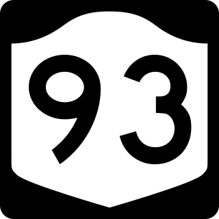
New York State Route 93 (NY 93) is a 43.08-mile (69.33 km) state highway in western New York in the United States. The route begins at an intersection with NY 18F in the village of Youngstown and runs in a general northwest–southeast direction across Niagara and Erie counties to its east end at an intersection with NY 5 in the town of Newstead, just south of the village of Akron. NY 93 serves as a connector between several major arterials, including NY 104 in Cambria, NY 31 just west of the city of Lockport, and NY 78 south of the city.

<span class="mw-page-title-main">New York State Route 31E</span> State highway in western New York, US

New York State Route 31E (NY 31E) is a 5.29-mile (8.51 km) state highway located in western New York in the United States. It serves as a northerly alternate route of NY 31 between the village of Middleport in eastern Niagara County and the nearby village of Medina in Orleans County. NY 31E connects to NY 31 at each end by way of a short overlap with NY 271 in Middleport. Most of NY 31E parallels the Erie Canal, and parts of the route run adjacent to the waterway. Outside of the two villages at each end, NY 31E traverses mostly rural areas of the towns of Royalton and Ridgeway.

References

  1. "2016 U.S. Gazetteer Files". United States Census Bureau. Retrieved July 5, 2017.
  2. 1 2 "Population and Housing Unit Estimates" . Retrieved June 9, 2017.
  3. "Census of Population and Housing". Census.gov. Retrieved June 4, 2015.
  4. "U.S. Census website". United States Census Bureau . Retrieved January 31, 2008.