Somerset, New York

Last updated

Somerset, New York
NY 18 wb at NY 148, July 2023.jpg
Hamlet of Somerset within the town
Niagara County New York incorporated and unincorporated areas Somerset highlighted.svg
Location in Niagara County and the state of New York.
USA New York location map.svg
Red pog.svg
Somerset, New York
Coordinates: 43°20′12″N78°32′46″W / 43.33667°N 78.54611°W / 43.33667; -78.54611
Country United States
State New York
County Niagara
Named for Somerset, New Jersey
Government
  Type Town Council
   Town Supervisor Daniel Engert (R)
   Town Council
Members' List
Area
[1]
  Total37.17 sq mi (96.27 km2)
  Land37.11 sq mi (96.11 km2)
  Water0.06 sq mi (0.16 km2)
Elevation
328 ft (100 m)
Population
 (2010)
  Total2,662
  Estimate 
(2016) [2]
2,579
  Density69.50/sq mi (26.83/km2)
Time zone UTC-5 (Eastern (EST))
  Summer (DST) UTC-4 (EDT)
FIPS code 36-68330
GNIS feature ID0979504

Somerset is a town in Niagara County, New York, United States. The population was 2,662 at the 2010 census. The town is believed to be named after Somerset, New Jersey, the source of some early settlers.

Contents

The Town of Somerset is in the northeast corner of the county and is northeast of the City of Niagara Falls.

History

The Town of Somerset was established in 1823 from a section of the Town of Hartland. Part of Somerset was used later to form the Town of Newfane.

The Thirty Mile Point Light is listed on the National Register of Historic Places. [3]

Geography

According to the United States Census Bureau, the town has a total area of 37.2 square miles (96 km2), of which 37.2 square miles (96 km2) is land and 0.1 square miles (0.26 km2) (0.19%) is water.

Somerset borders Lake Ontario on the north and Orleans County, New York on the east.

Adjacent cities and towns

Major highways in the Town of Somerset

Demographics

Historical population
CensusPop.Note
1830 871
1840 1,742100.0%
1850 2,15423.7%
1860 2,132−1.0%
1870 1,862−12.7%
1880 2,0158.2%
1890 1,962−2.6%
1900 1,923−2.0%
1910 2,26017.5%
1920 2,003−11.4%
1930 1,892−5.5%
1940 2,0417.9%
1950 2,2279.1%
1960 2,48911.8%
1970 2,6777.6%
1980 2,7010.9%
1990 2,655−1.7%
2000 2,8657.9%
2010 2,662−7.1%
2016 (est.)2,579 [2] −3.1%
U.S. Decennial Census [4]

As of the census [5] of 2000, there were 2,865 people, 1,000 households, and 786 families residing in the town. The population density was 77.1 inhabitants per square mile (29.8/km2). There were 1,132 housing units at an average density of 30.5 per square mile (11.8/km2). The racial makeup of the town was 97.07% White, 0.73% African American, 0.66% Native American, 0.52% Asian, 0.45% from other races, and 0.56% from two or more races. Hispanic or Latino of any race were 1.29% of the population.

There were 1,000 households, out of which 38.3% had children under the age of 18 living with them, 65.1% were married couples living together, 8.1% had a female householder with no husband present, and 21.3% were non-families. 17.3% of all households were made up of individuals, and 8.4% had someone living alone who was 65 years of age or older. The average household size was 2.85 and the average family size was 3.18.

In the town, the population was spread out, with 29.5% under the age of 18, 6.9% from 18 to 24, 27.8% from 25 to 44, 23.9% from 45 to 64, and 11.9% who were 65 years of age or older. The median age was 37 years. For every 100 females, there were 106.0 males. For every 100 females age 18 and over, there were 101.9 males.

The median income for a household in the town was $44,216, and the median income for a family was $49,583. Males had a median income of $39,583 versus $20,508 for females. The per capita income for the town was $17,792. About 8.2% of families and 10.1% of the population were below the poverty line, including 16.4% of those under age 18 and 3.8% of those age 65 or over.

Communities and locations in Somerset

The Kintigh Generating Station Kintigh Generating Station - Somerset, New York.jpg
The Kintigh Generating Station

Adjacent towns and areas

The northern border is Lake Ontario with Canada on the opposite shore. The eastern border is the Town of Yates in Orleans County. The south border is the Town of Hartland, and the west border is the Town of Newfane.

Related Research Articles

<span class="mw-page-title-main">Niagara County, New York</span> County in New York, United States

Niagara County is in the U.S. state of New York. As of the 2020 census, the population was 212,666. The county seat is Lockport. The county name is from the Iroquois word Onguiaahra; meaning the strait or thunder of waters.

Orleans is a town in Jefferson County, New York, United States. The population was 2,789 at the 2010 census, up from 2,463 in 2000. The town is located in the northern part of the county and is north of Watertown. Orleans is named after the commune of Orléans in France.

<span class="mw-page-title-main">Hamlin, New York</span> Town in New York, United States

Hamlin is a town in Monroe County, New York, United States. The population was 9,045 at the 2010 census.

<span class="mw-page-title-main">Barker, Niagara County, New York</span> Village in New York, United States

Barker is a village in Niagara County, New York. The population was 533 at the time of the 2010 census. The mail ZIP code is 14012. It is part of the Buffalo–Niagara Falls Metropolitan Statistical Area.

<span class="mw-page-title-main">Cambria, New York</span> Town in New York, United States

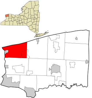
Cambria is a town in Niagara County, New York, United States. The population was 5,743 at the 2020 census. Cambria is an early name for Wales.

<span class="mw-page-title-main">Hartland, New York</span> Town in New York, United States

Hartland is a town in Niagara County, New York, United States. The population was 4,117 at the 2010 census. The town is named after Hartland, Vermont, the homeplace of some early settlers.

<span class="mw-page-title-main">Olcott, New York</span> CDP in New York, United States

Olcott is a hamlet located in the Town of Newfane in Niagara County, New York, United States. As of the 2010 census, this community population was 1,241. Most locals refer to it as Olcott Beach. It is part of the Buffalo–Niagara Falls Metropolitan Statistical Area.

<span class="mw-page-title-main">Pendleton, New York</span> Town in New York, United States

Pendleton is a town on the southern edge of Niagara County, New York, United States. It is east of the city of Niagara Falls and southwest of the city of Lockport. The population was 6,397 at the 2010 census.

<span class="mw-page-title-main">Porter, New York</span> Town in New York, United States

Porter is a town in Niagara County, New York, United States. The population was 6,771 at the 2010 census. The town was named after Judge Augustus Porter.

<span class="mw-page-title-main">Royalton, New York</span> Town in New York, United States

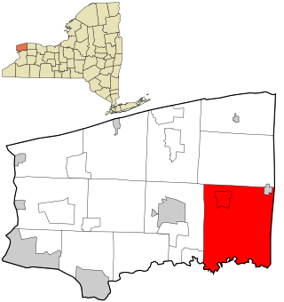
Royalton is a town in Niagara County, New York, United States. The population was 7,660 at the 2010 census.

Farmington is a town located in the northern part of Ontario County, New York, United States. The population was 14,275 at the 2020 census.

<span class="mw-page-title-main">Kendall, New York</span> Town in New York, United States

Kendall is a town in Orleans County, just west of the town of Hamlin in Monroe County, in New York State, United States. The population of Kendall was 2,724 at the 2010 census. The Town of Kendall is in the northeast corner of Orleans County and is northwest of Rochester.

<span class="mw-page-title-main">Ridgeway, New York</span> Town in New York, United States

Ridgeway is a town in Orleans County, New York, United States. The population was 6,886 at the 2000 census. The name of the town is derived from "Ridge Road," an important highway in the 19th century.

<span class="mw-page-title-main">Yates, New York</span> Town in New York, United States

Yates is a town in Orleans County, New York, United States. The population was 2,510 at the 2000 census. The town in named after Joseph C. Yates, a governor of New York.

<span class="mw-page-title-main">Ontario, New York</span> Town in Wayne County, New York, US

Ontario is a town in the northwest corner of Wayne County, New York, United States. The population was 9,778 at the 2000 census, and 10,136 at the 2010 census. The town is named after the Great Lake on its northern border.

Brownville is a town in Jefferson County, New York, United States. The population was 6,263 at the 2010 census, up from 5,839 in 2000. The town is named after Jacob Brown, an early settler and leader.

<span class="mw-page-title-main">Lewiston, New York</span> Town in New York, United States

Lewiston is a town in Niagara County, New York, United States. The population was 15,944 at the 2020 census. The town and its contained village are named after Morgan Lewis, a governor of New York.

<span class="mw-page-title-main">Lockport (town), New York</span> Town in New York, United States

Lockport is a town in Niagara County, New York, United States. The population was 20,529 at the 2010 census. The name is derived from the series of canal locks on the Erie Canal. The locks lift boats from the lowland of Lake Ontario past the Niagara Escarpment.

<span class="mw-page-title-main">Wilson, New York</span> Town in New York, United States

Wilson is a town in Niagara County, New York, United States. The population was 5,993 at the 2010 census. The town was named after an early settler, Reuben Wilson, who built and dwelt in a log cabin on the shore of Lake Ontario at the site of what would become the Village of Wilson.

<span class="mw-page-title-main">Newfane, New York</span> Town in New York, United States

Newfane is a town in Niagara County, New York, United States. The population was 9,666 at the 2010 census. The name was suggested by an early settler.

References

  1. "2016 U.S. Gazetteer Files". United States Census Bureau. Retrieved July 5, 2017.
  2. 1 2 "Population and Housing Unit Estimates" . Retrieved June 9, 2017.
  3. "National Register Information System". National Register of Historic Places . National Park Service. April 15, 2008.
  4. "Census of Population and Housing". Census.gov. Retrieved June 4, 2015.
  5. "U.S. Census website". United States Census Bureau . Retrieved January 31, 2008.

43°20′51″N78°33′21″W / 43.34750°N 78.55583°W / 43.34750; -78.55583