
Garia is a neighbourhood of South Kolkata in the South 24 Parganas district in the Indian state of West Bengal. It is bordered by the neighbourhoods of Jadavpur in the north, Bansdroni/Tollygunge in the north-west, Santoshpur/Mukundapur in the north-east and Narendrapur/Rajpur Sonarpur in the south. It is on the banks of Adi Ganga.
Brahmapur is a neighbourhood of Kolkata in West Bengal, India. It is located in the southern fringes of the city and is flanked by Bansdroni to the north and west, Naktala to the east and Boral to the south.

Durganagar is a neighbourhood in North Dumdum of North 24 Parganas district in the Indian state of West Bengal. It is a part of the area covered by Kolkata Metropolitan Development Authority (KMDA).
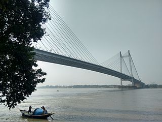
Kolkata the Capital of the Indian state of West Bengal has a good transportation system. Kolkata's transport system is diverse, with a mix of modern and traditional modes of transport catering to the city's large population.

Dhakuria is a neighborhood of Kolkata (Calcutta) in West Bengal, India. It is located in the southern part of the city and is surrounded by Ballygunge and Kasba in the north, Haltu in the east, Jadavpur/ Garia in the south and Lake Gardens/ Jodhpur Park in the west. Dhakuria has emerged as a notable neighborhood in South Kolkata, characterized by significant urban development. The area has seen substantial growth in recent years, marked by:
Netaji Subhas Chandra Bose Road is an important road in South Kolkata that runs in a north-west to south-east direction. It connects the localities of Tollygunge in the north-west and Rajpur Sonarpur in the south through Garia.

New Garia or Nabagaria is neighborhood of South Kolkata in Kolkata district in the Indian state of West Bengal. It is bounded by Chak Garia and Panchasayar to the north, Baishnabghata-Patuli and Briji to the west, Garia railway station and Kamalgazi to the south and Nayabad and Sreenagar to the east.

Garia railway station is a Kolkata Suburban Railway station on the Main line. It is under the jurisdiction of the Sealdah railway division in the Eastern Railway zone of the Indian Railways. It serves the local area of Garia in Kolkata in the Indian state of West Bengal.

Kavi Subhash is the at-grade southern terminus and interchange metro station of the North-South corridor and Bypass Corridor of Kolkata Metro in Kolkata, West Bengal, India. It is named after poet Subhash Mukhopadhyay. This station was opened to public on the auspicious day of Mahalaya in 2010.
Techno City is a locality situated at Panchpota in Garia, close to Kolkata, India. It is located near the Garia railway station, New Garia railway station and Kavi Subhash metro station. It is named after the Techno India Group who have set up two schools and an engineering college here.
Naktala is a neighbourhood in South Kolkata in West Bengal, India. It is bounded by Ganguly Bagan to the north, Bansdroni to the west, Garia Crossing to the south and Baishnabghata Patuli to the east.

Chak Garia is a neighbourhood located in the eastern part of Garia, in West Bengal, India. It is bounded by Jadavpur to the north, New Garia to the south, Baishnabghata-Patuli Township to the west and Mukundapur, Nayabad to the east. It is primarily famous for the highrises namely, Hiland Park and Bengal Ambuja Upohar.
East Kolkata refers to the eastern areas of the city of Kolkata, India. It includes the localities of Metropolitan Township, Dhapa, Tangra, Bantala, Topsia, Tiljala, VIP Nagar, Anandapur, Kalikapur, Mukundapur, Ajoy Nagar, Panchasayar and certain parts of Garia like Baishnabghata-Patuli Township, Chak Garia, Nayabad and New Garia. The northern part of East Kolkata is dominated by the townships of Salt Lake and New Town. The region is characterized by well planned (regular) residential blocks and houses many of the attractions of the city.

Shahid Khudiram is an elevated metro station on the North-South corridor of the Blue Line of Kolkata Metro which is close to Dhalai Bridge in Briji, Garia, a southern neighbourhood of Kolkata, West Bengal, India. This station is named in honour of the Bengali revolutionary Khudiram Bose. This structure is located above the drainage channel between Pranabananda Road and Garia Station Road at the west side of the Eastern Metropolitan Bypass.

Line 1 is a rapid transit metro line of the Kolkata Metro in Kolkata, West Bengal, India. It consists of 26 operational stations from Dakshineswar to Kavi Subhash, out of which 9 of the stations are elevated, 2 are at-grade and the remaining 15 are underground. With a total distance of 32.13 km (19.96 mi), the line connects Dakshineswar and New Garia and uses 5 ft 6 in broad gauge tracks. This line was the first underground railway to be built in India, with the first operations commencing in October 1984 and the full stretch that was initially planned being operational by February 1995. On 28 December 2010, Kolkata Metro became the 17th zone of the Indian Railways. Being the country's first, and a completely indigenous process, the construction of the Kolkata Metro Line 1 was more of a trial-and-error affair, in contrast to the Delhi Metro, which has seen the involvement of numerous international consultants. As a result, it took nearly 23 years to completely construct around 15 km (9.3 mi) underground railway from Birpara up to Tollygunge.

Baghajatin is a locality of South Kolkata in the South 24 Parganas district in Indian state of West Bengal. It has been named in honour of Jatindranath Mukherjee whose nom de guerre was Bagha (Tiger) Jatin. It is located in the southern part of the city and is surrounded by Jadavpur and Santoshpur in the north, Chak Garia and Panchasayar in the east, Baishnabghata Patuli Township in the south and Bijoygarh and Regent Estate in the west. The locality is referred to as the middle-class and currently growing very well-off, upper-middle-class people's locality in South Kolkata. Though it is surrounded by its rich and famous areas, over the it still remains primarily a nice upper-middle-class neighbourhood. Apart from its critical location in south Calcutta, it is also a place inhabited by prominent people with strong social and cultural background. The two most important landmarks that signify this locality are Baghajatin railway station, Baghajatin bus terminal and EM Bypass which are the lifeline of this locality and its USP.

Noapara is the largest elevated metro station on the North-South corridor of the Blue Line of Kolkata Metro in Noapara, Baranagar, Kolkata, West Bengal, India. It opened on 10 July 2013.

New Garia railway station is a Kolkata Suburban Railway station on the Main line. It is under the jurisdiction of the Sealdah railway division in the Eastern Railway zone of the Indian Railways. It serves the local area of New Garia in Kolkata in the Indian state of West Bengal.

Line 6 is a rapid transit metro line of the Kolkata Metro in Kolkata, West Bengal, India. It will connect New Garia with Netaji Subhas Chandra Bose International Airport via two major satellite towns of Kolkata metropolitan region, Salt Lake and New Town. It currently operates between Kavi Subhash and Hemanta Mukhopadhyay. This line will be one of the most important stretches of Kolkata Metro because it will connect the southern and the eastern parts of the city with Kolkata Airport. The total distance of this route will be 29.87 km (18.56 mi). It connects Line 1 at Kavi Subhash and will eventually connect Line 2 at Sector-V and Kaikhali and Line 4 at Airport.

Dum Dum Park is a neighbourhood in South Dumdum of North 24 Parganas district in the Indian state of West Bengal. It is a part of the area covered by Kolkata Metropolitan Development Authority (KMDA).

