Mohiuddin Nagar

Last updated

Mohiuddin Nagar
Block
Mohiuddin Nagar
India Bihar location map.svg
Red pog.svg
Mohiuddin Nagar
Location in Bihar, India
Coordinates: 25°35′N85°40′E / 25.583°N 85.667°E / 25.583; 85.667
CountryFlag of India.svg  India
State Bihar
District Samastipur
Population
 (2001)
  Total13,764
Languages
  Official Hindi,
  Additional official Urdu
   Regional Angika
Time zone UTC+5:30 (IST)

Mohiuddin Nagar is a block and a notified area in Samastipur district in the Indian state of Bihar, India. It derives its name from Sufi saint Shah Afaq Mohiuddin. He was descendant of Shah Qasim Suleiman of Chunar. Earlier this area was known as Sheher Dharhara. There is a fort named Amina Bibi ka Quila commonly known as Fansighar. She was the wife of Shah Afaq and daughter of rebel Afghan general Shamsher Khan who was killed in battle of Ranisarai with Nawab Alivardi Khan.

Contents

Demographics

As of 2001 India census, [1] Mohiuddin Nagar had a population of 13,764. Males constitute 52% of the population and females 48%. Mohiuddin Nagar has an average literacy rate of 44%, lower than the national average of 59.5%: male literacy is 52%, and female literacy is 35%. In Mohiuddin Nagar, 21% of the population is under 6 years of age. The market of Mohiuddin Nagar is famous between their nearest village.

Famous Places

The market is full with crowd of different requirements. around 22 villages are near by to whom this market is backbone.

School

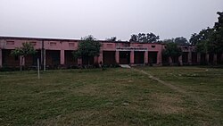
Government High School, Mohiuddin Nagar

Pipal Tree

There is famous ~ more than 200 years old pipal tree situated in middle market near post office. There is a small temple which was built around 60 years ago.

Pipal Tree, Middle Market, Mohiuddinnagar Pipal Tree Middle Market.jpg
Pipal Tree, Middle Market, Mohiuddinnagar
High School, Mohiuddinnagar, Samastipur High School Mohiuddin nagar.jpg
High School, Mohiuddinnagar, Samastipur

Related Research Articles

Mau, also now known as Maunath Bhanjan, is an industrial town and the headquarter of the Mau district. It is located in the eastern part of Uttar Pradesh, India. The town is known for its saree industry which is a traditional business and centuries old art of the people of this city; says, Pallavi Mishra.

<span class="mw-page-title-main">Khetri</span> Place in Rajasthan, India

Khetri Nagar is the town in Jhunjhunu district of Rajasthan in India. It is a part of the Shekhawati region. Khetri consists of two towns, "Khetri Town" founded by Raja Khet Singhji Nirwan and "Khetri Nagar" which is about 10 km away from Khetri. Khetri Nagar, well known for its Copper Project, was built by and is under the control of Hindustan Copper Limited, a public sector undertaking under the Government of India. Khetri Nagar is also known as 'Copper'. There are many attached villages near Khetri Nagar like Manota Khurd, the people of this village was employed in mines. Khetri is full of heritage and diversity. People of various religions live with mutual cooperation and harmony here. Today this adorable part of India is the backward region due to lack of development. Khetri is the town and Tehsil in Jhunjhunu district of Rajasthan state in India. Total number of villages in this Tehsil is 106. Khetri Tehsil sex ratio is 914 females per 1000 of males. Average literacy rate of Khetri Tehsil in 2011 were 72.51%, in which male and female literacy were 85.58% and 58.39% respectively.

Chanpatia is a city Nagar Panchayat situated on the bank of the Burhi Gandak River is the administrative headquarter of Chanpatia block in Paschim Champaran district near the Indo-Nepal border, 18 km from District headquarter Bettiah, 242 km north-west of capital city Patna in the state of Bihar, India. Chanpatia is famous for tasty Marcha Ka chura, Basmati rice and the famous Handi kabab.

Dariyabad is a town and a aadharsh nagar panchayat in Barabanki district in the state of Uttar Pradesh, India.

Devendranagar is a town and a nagar panchayat in Panna district in the state of Madhya Pradesh, India. Earlier before the merger it was part of Erstwhile Princely State of Ajaigarh.

Patparganj is a locality situated in East Delhi District of the National Capital Territory of Delhi, India, and is located near the border with Uttar Pradesh.

Pharenda, or Anandnagar, is a city in the Maharajganj district of the province of Uttar Pradesh in northern India. It is located approximately 44 kilometres north of Gorakhpur near the border with Nepal. District of Pharenda is Maharajganj. This is situated on the Buddhist Circuit which is built from Sarnath to Lumbini. It lies on NH-24 and near NH 29. It is about 45 km from Gorakhpur, 40 km from Siddharthnagar, 30 km from Maharajganj and 55 km from Sonauli Indo-Nepal Border. This place is named after Seth Anandram Jaypuriya. There is closed sugar Mill which was started in about 1935 and closed in 1995. Near Anand Nagar there is a temple is Durga devi mandir, popularly known as Lehara Devi mandir.

Handia is a town, near the city of Prayagraj and a nagar panchayat in the Prayagraj district of the Indian state of Uttar Pradesh.

Laksar is a small town, near Haridwar city and Nagar Palika in Haridwar district of the Indian state of Uttarakhand, situated along National Highway 334A. It is an important sugar manufacturing destination in the state and also known for the Laksar Junction railway station (LRJ), the largest railway junction in the state, which was built in 1866.

<span class="mw-page-title-main">Malihabad</span> Town in Uttar Pradesh, India

Malihabad is a town and nagar panchayat in the Lucknow district of Uttar Pradesh, India. It is also the seat of a tehsil and a community development block of the same name. As of 2011, its population was 17,818, in 3,032 households. Malihabad is the largest of Uttar Pradesh's 14 designated mango belts and accounted for 12.5% of all mango production in the state in 2013. Hundreds of mango varieties are grown here, including the Chausa, Langda, Safeda, and most famously the Dasheri, the "king of mangoes", of which it is one of India's main producers and exporters. Mango grower and Padma Shri recipient Kaleem Ullah Khan has contributed to the popularization of Malihabad's mango industry.

Minjur is a town located in the outskirts of North Chennai, India. It is located in the Thiruvallur district in the Indian state of Tamil Nadu. Minjur is called 'Vada Kanchi' meaning North Kanchipuram. The town has two famous temples for Shiva and Vishnu, similar to Kanchipuram. The neighbourhood is served by Minjur railway station of the Chennai Suburban Railway Network.

Rajpur is a town and a nagar panchayat in Barwani district in the Indian state of Madhya Pradesh. Integrated Border Check Post at Agra Mumbai Highway run by Government of Madhya Pradesh is at Balsamud in Rajpur tehsil.

Saidpur is a town and a nagar panchayat in the Badaun district of the Indian state of Uttar Pradesh.

<span class="mw-page-title-main">Uppal Kalan</span> Suburb in Medchal-Malkajgiri, Telangana, India

Uppal is a suburb in Eastern Hyderabad, Telangana, India. It is the mandal headquarters of Uppal mandal in Keesara revenue division in Medchal-Malkajgiri district. It forms Circle No.2 in the L. B. Nagar Zone of Greater Hyderabad Municipal Corporation. There are four wards i.e., Chilukanagar (7), Habsiguda (8), Ramanthapur (9) and Uppal (10) in this circle.

Hyderabad is a town and nagar panchayat in Hasanganj tehsil of Unnao District, Uttar Pradesh, India. It is located on the main Unnao-Sandila road, near its intersection with the road connecting Lucknow and Bangarmau. Major commodities produced in Hyderabad include roasted rice, food products, and earthenware pottery. As of 2011, its population is 7,697 people, in 1,328 households.

Jalalabad (Jalālābād) is a town and a nagar panchayat in Bijnor district in the Indian state of Uttar Pradesh. Habib khan was 1st pradhan of jalalabad after independence of India for many years. On his name NGO habibia gram vikas sansthan jalalabad running a school named Habib memorial school and Madarsa Habibia lilbanat.

Shahi is a town and a nagar panchayat in Bareilly district in the Indian state of Uttar Pradesh.Shahi is the one of most old British town areas First Chairman of Town Shahi is Haji Nadir Shah khan in 1868 after him his Son Khan bahadur Mohammed Raza Khan is Chairman and M.L.A of bareilly he is also Chairman of district Board Bareilly, after Mohammed Raza Khan death his son Hamid Raza Khan is also became Chairman and M.L.A of Bhojipura Constituency he is a Famous politician after his death in 1989 Son of Hamid Raza Khan, Shahid Raza khan Became Chairman of Town Area Shahi for Almost 50 years

<span class="mw-page-title-main">Dewa, India</span> Town in Uttar Pradesh, India

Dewa Sharif or Dewa is a town and a nagar panchayat in Barabanki district in the state of Uttar Pradesh, India. It is famous for the shrine of Haji Waris Ali Shah. This town is also known by the name of Dewa Sharif in respect for the shrine. It is about 26 km north-east of the capital Lucknow.

Gola Bazar is a town and a nagar panchayat in Gorakhpur district in the Indian state of Uttar Pradesh. It is also known for its gold market. It is located near the Saryu (Ghaghra) river. This river itself is a border between Gorakhpur and Azamgarh. Distance from Gorakhpur City is around 54 km via kauriram. It is one of the tehsils of Gorakhpur. It is very famous for its ghats which are on the bank of river Saryu. Gola market is very famous among the villages and other towns around it.

Jashipur is a town and headquarter of Panchpir subdivision of Mayurbhanj district in the state of Odisha, India. The town is located in southwestern region of Simlipal National Park comprising diverse geographical valleys, forest lands and scores of ancient temples like Khiching temple and first headquarter of erstwhile Mayurbhanj state.

References

  1. "Census of India 2001: Data from the 2001 Census, including cities, villages and towns (Provisional)". Census Commission of India. Archived from the original on 16 June 2004. Retrieved 1 November 2008.