Jalapa is a city in Guatemala. It is the capital of the department of Jalapa; it is also the municipal seat of that department's municipality of Jalapa.

Jalapa is a department of Guatemala, in the south east-of the republic. The capital is the city of Jalapa.

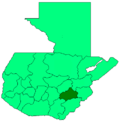
Zacapa is the departmental capital municipality of Zacapa Department, one of the 22 Departments of Guatemala. It is located approximately 70 miles or 112 kilometers from Guatemala City.

Las Vegas is a town, with a population of 10,760, and a municipality in the Honduran department of Santa Bárbara.
Pastores is a town, with a population of 12,621, and a municipality, with a population of 17,814, in the Guatemalan department of Sacatepéquez.
San Jacinto is a municipality, in the Chiquimula department of Guatemala. It has a population of 12,619 and cover an area of 72 km2.
San Agustín Acasaguastlán is a town, with a population of 17,728, and a municipality in the El Progreso department of Guatemala.
Palencia is a town, with a population of 31,824, and a municipality in the Guatemala department of Guatemala.

San José Pinula is a town, with a population of 67,327, and a municipality in the Department of Guatemala in the Republic of Guatemala in Central America. It is located 21 kilometers (13 mi) from the capital, Guatemala City. The city was established in 1886 as Villorio San José. The city is surrounded by mountains. Until a few years ago, the economy was based on the growing of corn, as well as some vegetables such as guisquil, chayote or pataste. However, the growth of Guatemala City in recent years has transformed farmland into suburban neighborhoods. Golf courses, such as Hacienda Nueva Country Club which used to be a convent in the 16th century and Alta Vista Country Club, both considered world-class, are now in and around San José Pinula.
San Luis Jilotepeque is a town, with a population of 11,675, and a municipality in the Jalapa department of Guatemala. The municipality has a population of 24,679, and cover an area of 209 km2.
Asunción Mita is a town, with a population of 20,936 (2018), and a municipality in the Jutiapa department of Guatemala.
Atescatempa is a town and municipality in the Jutiapa department of Guatemala.
Cajolá is a town and municipality in the Quetzaltenango department of Guatemala.
Colomba is a town, with a population of 28,655, and a municipality in the Quetzaltenango department of Guatemala with an area of 214 km2 at an altitude of about 1011 metres.

Ostuncalco, full name San Juan Ostuncalco, is a town, with a population of 20,763, and a municipality in the Quetzaltenango department of Guatemala. Beside Spanish, local people speak the Mam language. La Victoria is a village in this municipality.
Mazatenango is a town, with a population of 77,431, and a municipality in the Suchitepéquez department of Guatemala. It is the capital of Suchitepéquez department and is located 165 km from Guatemala City.
San Antonio Suchitepéquez is a town, with a population of 13,666, and a municipality in the Suchitepéquez department of Guatemala. The municipality is located at an elevation of 300 metres to 500 metres above sea level. It has a population of 59,184 and covers an area of 82.8 km².
San Francisco Zapotitlán is a town, with a population of 18,468, and a municipality in the Suchitepéquez department of Guatemala.

Cantel is a municipality in the Quetzaltenango Department in Guatemala. It is located east of the city of Quetzaltenango and has an area of 52.6 km2. The town of Cantel, with a population of 35,825, is situated at an altitude of 2,370 metres.
Santa Catarina Mita is a town, with a population of 14,520, and a municipality in the Jutiapa department of Guatemala. The municipality cover an area of 207 km2 and has a population of 28,983.