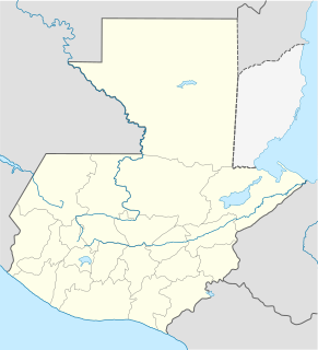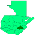
Jalapa is a city in Guatemala. It is the capital of the department of Jalapa; it is also the municipal seat of that department's municipality of Jalapa.

Jutiapa Department is a department of Guatemala that borders along El Salvador and the Pacific Ocean. The capital is the city of Jutiapa. As of 2018, it has a population of 488,395. The department is divided into seventeen municipalities. Jutiapa is the country's southeasternmost department. The main crops are sorghum, tobacco, onion and corn. The climate is dry. An important attraction is the cattle fair. It is at 405 m above sea level.

Guastatoya is a city in Guatemala. It is the capital and largest city of the department of El Progreso. The Guastatoya Water Park is located in the city. It is situated 73 km from the city of Guatemala.

Zacapa is the departmental capital municipality of Zacapa Department, one of the 22 Departments of Guatemala. It is located approximately 112 kilometres (70 mi) from Guatemala City.

Ahuachapán is a city, and municipality, and the capital of the Ahuachapán Department in western El Salvador. The municipality, including the city, covers an area of 244.84 km² and as of 2007 has a population of 110,511 people. Situated near the Guatemalan border, it is the westernmost city in the country and is the center of an agricultural region producing primarily coffee.

Ocotepeque is a municipality in the Honduran department of Ocotepeque. The town of Nueva Ocotepeque is the municipal seat and the capital of the department.
Gualán is a town and municipality in the Guatemalan department of Zacapa. It is located in the Eastern part of the country about 165 Kilometers from Guatemala City on route CA-9.

Jacaltenango is a town and municipality situated in the Western Highlands of Guatemala. It is located in a valley surrounded by the Sierra Madre Mountains. Jacaltenango serves as the municipal seat for the surrounding municipality of the same name. In 2002, its urban population was about 23,500 but at the 2018 census the town's population has decreased to 22,533.
Olopa is a municipality in the Chiquimula department of Guatemala. The municipality comprises an area of 112 km2, distributed in 1 town (Olopa) and 29 villages, with a total population of 27,511.
San Jacinto is a municipality, in the Chiquimula department of Guatemala. It has a population of 12,619 and cover an area of 72 km2.

San Andrés Itzapa is a town, with a population of 24,992, and a municipality of Chimaltenango, Guatemala. San Andrés Itzapa is in the eastern region of Chimaltenango, while the district capital lies to the north, Acatenango lies to the south and to the east is Parramos. The municipality cover an area of 63.7 km2, with a total population of 32,083.

El Jícaro is a town and municipality in the El Progreso department of Guatemala.

San Agustín Acasaguastlán is a town, with a population of 17,728, and a municipality in the El Progreso department of Guatemala.
Palencia is a town, with a population of 31,824, and a municipality in the Guatemala department of Guatemala.

Monjas is a town, with a population of 13,541, and a municipality in the Jalapa department of Guatemala, approximately 80 kilometres (50 mi) from Guatemala City, Guatemala.
San Luis Jilotepeque is a town, with a population of 11,675, and a municipality in the Jalapa department of Guatemala. The municipality has a population of 24,679, and cover an area of 209 km2.

Asunción Mita is a town, with a population of 20,936 (2018), and a municipality in the Jutiapa department of Guatemala.

Atescatempa is a town and municipality in the Jutiapa department of Guatemala.

Ayutla is a municipality in the San Marcos Department of Guatemala. It is situated along the Suchiate River natural border with Mexico in the southern part of the department. The municipality center is Ciudad Tecún Umán. There is a combined road and rail bridge known as Puente Rodolfo Robles linking Ayutla to Ciudad Hidalgo in Chiapas, Mexico.
Santa Catarina Mita is a town, with a population of 14,520, and a municipality in the Jutiapa department of Guatemala. The municipality cover an area of 207 km2 and has a population of 28,983.


