The Arctic Archipelago, also known as the Canadian Arctic Archipelago, is an archipelago lying to the north of the Canadian continental mainland, excluding Greenland.

Guastatoya is a city in Guatemala. It is the capital and largest city of the department of El Progreso. The Guastatoya Water Park is located in the city. It is situated 73 km from the city of Guatemala.
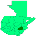
Guazacapán is a town located in Santa Rosa Department in south-west Guatemala. Guazacapán is also the name of the municipality in Santa Rosa Department around the town of Guazacapán. The municipality of Guazacapán covers an area of 130 km² with a population of 18,855 as of 2018.

Trojes is a town, with a population of 9,680, and a municipality in the Honduran department of El Paraíso.
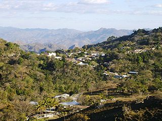
Piraera is one of the municipalities of Lempira department in Honduras. It is located on one of the branches of "Congolón" mountain, it is 105 km away from the city of Gracias.
Las Vegas is a town, with a population of 10,760, and a municipality in the Honduran department of Santa Bárbara.

Uluazapa is a municipality in the San Miguel department of El Salvador. The town is located approximately 30 minutes from San Miguel and is known for its musical atmosphere. Many refer to it as a "cradle of musicians" for its emphasis on musical education. The name "Uluazapa" stands for "Stony place of the Ulúas" in Nauathl, which were Indian tribes that inhabited the area pre-Columbian time. The municipality is made up of surrounding cantons, hamlets, and neighborhoods. The Uluazapa Central Park is located in the middle of the town, next to the colonial "San Pedro Apostal" church and the municipal hall. Surrounding the park are local shop, restaurants, and businesses. It also has a large sport center equipped with a soccer field and basketball courts. The town has a population of 3,351 Inhabitants.
Nueva Trinidad is a municipality in the Chalatenango department of El Salvador.
Taxisco is a town and municipality in the Santa Rosa department of Guatemala. It is located near the shoreline of the Pacific Ocean.

Titiribí is a town and municipality in the Colombian department of Antioquia. Part of the subregion of Southwestern Antioquia.
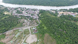
Atrato is a municipality and town in the Chocó Department near the Pacific Ocean, Colombia.

Jordán is a town and municipality in the Santander Department in northeastern Colombia.
Puerto Parra is a town and municipality in the Santander Department in northeastern Colombia.

Imues is a town and municipality in the Nariño Department, Colombia.

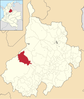
Tello is a town and municipality in the Huila Department, Colombia. It is characterized by its extensive plain between the Magdalena River and the foot of the Cordillera Oriental mountain range up to its peaks, and with the Fortalecillas and Villavieja rivers being located nearby. Its territorial extension is 589 km², its altitude is 575 meters( ) above sea level and its climate is warm with an average temperature of 26ºC.

Cogua is a municipality and town of Colombia in the department of Cundinamarca. It is situated on northern part of the Bogotá savanna with the urban centre at an altitude of 2,600 metres (8,500 ft) at 50 kilometres (31 mi) from the capital Bogotá. Cogua borders Tausa in the north, Nemocón in the east, Pacho in the west and Zipaquirá in the south.

Fuentes de Valdepero is a municipality located in the province of Palencia, Castile and León, Spain. According to the 2004 census (INE), the municipality has a population of 232 inhabitants.

Villavicencio de los Caballeros is a municipality located in the province of Valladolid, Castile and León, Spain. According to the 2004 census (INE), the municipality has a population of 294 inhabitants.
Tequila Municipality is a municipality located in the montane central zone in the State of Veracruz, about 90 kilometres (56 mi) from state capital Xalapa. It has an area of 74.85 km2 (28.90 sq mi). It is located at 18°43′N97°04′W. Its name stems from Te-qui-lan, in the Náhuatl language which means "Place of the Vegetables in the Earth".
Aramari, Bahia is a municipality in the state of Bahia in the North-East region of Brazil.