Monmouth New Hydro Scheme

Last updated
The power station in March 2009 Monmouth New Hydro Scheme - geograph.org.uk - 1538784.jpg
The power station in March 2009

The Monmouth New Hydro Scheme, which incorporates the Osbaston fish pass, is a hydroelectric scheme in Osbaston, near Monmouth, in South-East Wales.

Osbaston, Monmouth

Osbaston is a suburb of Monmouth, Wales, located less than 1 mile (1.6 km) north of the town centre. It was the site of one of the first public electricity generating stations in Britain, using water power from the River Monnow.

Monmouth Town in Monmouthshire, Wales

Monmouth is the historic county town of Monmouthshire in Wales and also a community. Situated where the River Monnow joins the River Wye, just 2 miles (3.2 km) of the border with England. The town is 30 miles (48 km) northeast of Cardiff, and 113 miles (182 km) west of London. It is within the Monmouthshire local authority, and the parliamentary constituency of Monmouth. Monmouth's population in the 2011 census was 10,508, rising from 8,877 in 2001.

Description

The scheme produces 670,000 Kw hours of electricity per year, which is enough to power 152 homes. [1] It also provides heat for the landowner, Ronald Kear's, home. [1] The scheme is built around two screw turbines. These Archimedes' screws are operating in reverse, with water flowing down, to power generators. [1] An earlier hydroelectric power station had been on the site from 1896 until 1953, which itself was built on the foundations of an even older forge. [1] Alongside the scheme is the Osbaston fish pass, built by the Environment Agency Wales at a cost of £600,000. [1] The fish pass allows river-spawning fish, such as salmon, to access an extra 125 miles of river - something which they had not been able to do since Osbaston Weir was put in place in the 18th century. [2]

Screw turbine

The screw turbine is a water turbine which uses the principle of the Archimedean screw to convert the potential energy of water on an upstream level into work. It may be compared to the water wheel. The turbine consists of a rotor in the shape of an Archimedean screw which rotates in a semicircular trough. Water flows into the turbine and its weight presses down onto the blades of the turbine, which in turn forces the turbine to turn. Water flows freely off the end of the turbine into the river. The upper end of the screw is connected to a generator through a gearbox.

Archimedes screw machine historically used for transferring water from a low-lying body of water into irrigation ditches

The water screw, popularly known as the Archimedes' screw and also known as the screw pump, Archimedean screw, or Egyptian screw, is a machine used for transferring water from a low-lying body of water into irrigation ditches. Water is pumped by turning a screw-shaped surface inside a pipe. Archimedes screws are also used for materials such as powders and grains. Although commonly attributed to Archimedes, the device had been used in Ancient Egypt long before his time.

Environment Agency Wales organization

Environment Agency Wales, was, until 31 March 2013, a Welsh Government Sponsored Body, while also being part of the Environment Agency for England and Wales. Its principal aims were to protect and improve the environment in Wales and to promote sustainable development.

Osbaston Weir New fish pass at Osbaston Weir - geograph.org.uk - 1399670.jpg
Osbaston Weir

The power station was officially opened on 23 September 2009 by the Earl of Wessex. [2] Several months later, in June 2010, local schoolchildren released salmon into the River Monnow at the site of the power station - the salmon were initially reared at their school, Osbaston Primary School, as part of a class project. Once the salmon became fry, they were taken to Cynrig Hatchery, in Brecon. [3] The fish pass is not only used by salmon, but also larger creatures - in June 2010, a camera set up at the site of the fish trap caught footage of an otter swimming through the trap. [4]

Earl of Wessex

Earl of Wessex is a title that has been created three times in British history, twice in the pre-Conquest Anglo-Saxon nobility of England and once in the Peerage of the United Kingdom. The region of Wessex, in the south and southwest of England, had been one of the Anglo-Saxon kingdoms, whose expansion in the tenth century created a united Kingdom of England.

River Monnow river in south-west Herefordshire, England and eastern Monmouthshire, Wales

The River Monnow marks the England–Wales border for much of its 42 miles (68 km) length. After flowing through southwest Herefordshire, England, and eastern Monmouthshire, Wales, its confluence with the River Wye is approximately 13 mile (0.54 km) south of Monmouth.

Brecon market town in the county of Powys, Wales

Brecon, archaically known as Brecknock, is a market town and community in Powys, mid-Wales. In 1841, it had a population of 5,701. The population in 2001 was 7,901, increasing to 8,250 at the 2011 census. Historically it was the county town of Brecknockshire (Breconshire); although its role as such was eclipsed with the formation of the County of Powys, it remains an important local centre. Brecon is the third-largest town in Powys, after Newtown and Ystradgynlais. It lies north of the Brecon Beacons mountain range, but is just within the Brecon Beacons National Park.

Related Research Articles

Shannon hydroelectric scheme dam in County Clare

The Shannon hydroelectric Scheme was a major development by the Irish Free State in the 1920s to harness the power of the River Shannon. Its product, the Ardnacrusha power plant, is a hydroelectric power station which is still producing power today and is located near Ardnacrusha within County Clare approximately 2.4 kilometres (1.5 mi) from the Limerick border. It is Ireland's largest river hydroelectric scheme and is operated on a purpose built headrace connected to the River Shannon. The plant includes fish ladders so that returning fish, such as salmon, can climb the river safely past the power station.

Micro hydro

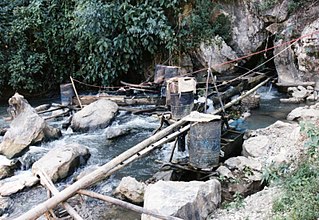
Micro hydro is a type of hydroelectric power that typically produces from 5 kW to 100 kW of electricity using the natural flow of water. Installations below 5 kW are called pico hydro. These installations can provide power to an isolated home or small community, or are sometimes connected to electric power networks, particularly where net metering is offered. There are many of these installations around the world, particularly in developing nations as they can provide an economical source of energy without the purchase of fuel. Micro hydro systems complement solar PV power systems because in many areas, water flow, and thus available hydro power, is highest in the winter when solar energy is at a minimum. Micro hydro is frequently accomplished with a pelton wheel for high head, low flow water supply. The installation is often just a small dammed pool, at the top of a waterfall, with several hundred feet of pipe leading to a small generator housing. In low head sites, generally water wheels and Archimedes screws are used.

Guthega Power Station dam in Snowy Mountains, New South Wales

Guthega Power Station is located in the Snowy Mountains region of New South Wales, Australia. The power station's purpose is for the generation of electricity. It is the first to be completed and smallest of the initial seven hydroelectric power stations that comprise the Snowy Mountains Scheme, a vast hydroelectricity and irrigation complex constructed in south-east Australia between 1949 and 1974 and now run by Snowy Hydro.

Tuloma River river in Murmansk Oblast, Russia

The Tuloma River is a river in Murmansk Oblast in Russia. With a drainage basin of 21,500 square kilometres (8,300 sq mi) and an average discharge at 255 m³/s, the Tuloma is one of the biggest rivers in northern Fennoscandia.

Sandford Lock

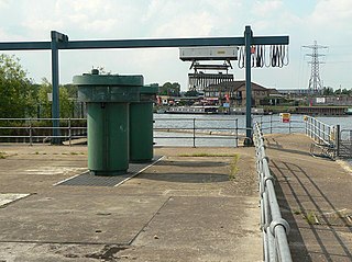
Sandford Lock is a lock on the River Thames in England, situated at Sandford-on-Thames which is just South of Oxford. The first pound lock was built in 1631 by the Oxford-Burcot Commission although this has since been rebuilt. The lock has the deepest fall of all locks on the Thames at 8ft 9in (2.69m) and is connected to a large island which is one of three at this point. The lock lies at the end of Church Lane in Sandford on Thames.

Romney Island island in the River Thames

Romney Island is an island in the River Thames in England connected to Romney Lock, at Windsor, Berkshire. It is a long thin island with trees and scrub, with the upstream end in Windsor and the downstream end almost at Black Potts.

Torrs Hydro

Torrs Hydro is a micro hydroelectric scheme, owned by the community, in New Mills, Derbyshire. It is located on the River Goyt, immediately after its confluence with the River Sett at the Torr weir. A 2.4-metre diameter steel trough screw turbine generates up to 63 kW of electricity.

Settle Hydro

Settle Hydro is a micro hydroelectric scheme, owned by the community, in Settle, North Yorkshire, England. It is located on the River Ribble, at Settle Weir near Bridge End Mill. It uses part of the former mill race. A reverse Archimedean screw generates 50 kW of electricity.

Beeston Hydro

Beeston Hydro is a micro hydroelectric scheme, in Beeston, Nottinghamshire. It is located on the River Trent, and generates up to 1.66 MW of electricity.

Carrigadrohid hydroelectric power station

Carrigadrohid hydroelectric power station is a hydroelectric plant located on the River Lee in County Cork, Ireland. It is owned and operated by the ESB Group.

Cathaleens Fall hydroelectric power station

Cathaleen's Fall hydroelectric power station is a hydroelectric plant located on the River Erne at Ballyshannon in County Donegal, Ireland. It is owned and operated by the ESB Group. The plant is also known as Ballyshannon.

River Bain Hydro

The River Bain Hydro is a hydroelectric generator based on the River Bain in the village of Bainbridge, North Yorkshire, England. It powers most of the properties in the village, with excess electricity being sold off to the national grid. It was opened in 2011 with an installed capacity of 45kW, and is expected to last 40 years. It is a low demand ecofriendly scheme, and more hydro electric power generators are being manufactured to provide green energy at a low cost.

Ruswarp Hydro

Ruswarp Hydro or Whitby Esk Energy, is a Hydroelectric generation scheme that operates on the River Esk at Ruswarp, North Yorkshire, England. The project uses an Archimedes Screw in a reverse direction to generate electricity and was funded by people in the community. Around 4 tonnes of water pass along the screw per second, which generates enough electricity to power 45–48 homes.

Burley Hydro

Burley Hydro Scheme also known as Greenholme Mill Hydro is a micro hydroelectric scheme installed on the River Wharfe at Burley-in-Wharfedale, West Yorkshire, England. The power output of the hydro scheme is 330 kWh with an annual output of 1,400 MWh and is the fourth hydro scheme on the river after the opening of similar power plants at Linton near Grassington, and two further downstream from Burley at Pool-in-Wharfedale and Garnett Wharfe at Otley. All of these schemes have been located on sites previously used to generate power from the water flow.

Linton Lock Hydro

Linton Lock Hydro is a hydroelectric plant on the River Ouse in North Yorkshire, England, between the villages of Linton-on-Ouse and Nun Monkton. The first hydroelectric scheme was built here in 1923, but that was abandoned in the early 1960s. The second scheme to be sited at Linton Lock was installed in 2011 and a new generating unit came on stream in 2017. The combined output from the second and third generation plants is 380 kWh, which is enough to power 450 homes.

Linton Falls Hydro

Linton Falls Hydro is a hydroelectric generating power station located on the Linton Falls Weir of the River Wharfe, near Grassington, North Yorkshire, England. The power station is located on the same site as a hydroelectric scheme that was first opened in 1909, but had closed by 1948. The new scheme, which opened in March 2012, uses the original building which is now a scheduled monument.

Kirkthorpe Hydro dam in Kirkthorpe, Wakefield

Kirkthorpe hydro is a hydroelectric generating plant located on the River Calder at Kirkthorpe Weir, 4 miles (6.4 km) east of the City of Wakefield in West Yorkshire, England. The pant was opened in 2017 and expects to be generating electricity for 100 years. Kirkthorpe Weir is the highest industrial weir in Yorkshire and has prevented fish passing upstream to spawn; the new hydro project has a fish pass built into it.

References

  1. 1 2 3 4 5 Dube, Steve (November 17, 2009). "New hydro-electric plant at Osbaston is a masterstroke of engineering". Western Mail. Retrieved April 28, 2012.
  2. 1 2 "Weir–D... What Ronald Kear Knows About Archimedes, The Royal Family And A Successful Fish Pass (originally accessed 28 April 2012)". Aberdaire Online. September 23, 2009. Archived from the original on April 16, 2011. Retrieved May 22, 2019.
  3. "Osbaston pupils send salmon on their way". Fishing Wales. June 16, 2010. Retrieved April 28, 2012.
  4. Otter caught on film in fish pass. BBC News. June 22, 2010.

Coordinates: 51°49′13″N2°43′27″W / 51.8203°N 2.7241°W / 51.8203; -2.7241

Geographic coordinate system Coordinate system

A geographic coordinate system is a coordinate system that enables every location on Earth to be specified by a set of numbers, letters or symbols. The coordinates are often chosen such that one of the numbers represents a vertical position and two or three of the numbers represent a horizontal position; alternatively, a geographic position may be expressed in a combined three-dimensional Cartesian vector. A common choice of coordinates is latitude, longitude and elevation. To specify a location on a plane requires a map projection.