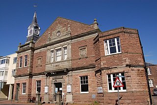
The Dispensary, Monmouth

Last updated
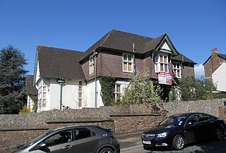
The Dispensary
The Old Dispensary, St James Square (geograph 5435281).jpg
Old Dispensary, St James Square
General information
Architectural styleGeorgian
Town or city Monmouth
Country Wales
Coordinates 51°48′47″N2°42′38″W / 51.81301°N 2.7106°W / 51.81301; -2.7106 Coordinates: 51°48′47″N2°42′38″W / 51.81301°N 2.7106°W / 51.81301; -2.7106
Completed<1868

The Dispensary is a Georgian town house which is fairly typical of many town-centre houses in Monmouth, Wales, dating from the mid 18th century, but with early 19th-century additions. It stands in St James Square, opposite the Catalpa tree. The building was listed at Grade II on 27 June 1952. [1]

Monmouth town in Monmouthshire, Wales

Monmouth is the historic county town of Monmouthshire, Wales and a community. It is situated where the River Monnow meets the River Wye, within 2 miles (3.2 km) of the border with England. The town is 30 miles (48 km) northeast of Cardiff, and 113 miles (182 km) west of London. It is within the Monmouthshire local authority, and the parliamentary constituency of Monmouth. Monmouth's population in the 2011 census was 10,508, rising from 8,877 in 2001.

St James Square, Monmouth square in Monmouth, Monmouthshire, Wales

St James Square is a historic square in the town centre of Monmouth, Monmouthshire, Wales. It is located at the eastern end of Whitecross Street, within the medieval town walls. The area features the Monmouth War Memorial and the controversial, historic Indian Bean Tree. In addition, in 2010, the square was the site of discovery of the first Mesolithic artefacts in Monmouth. St James Square is lined with numerous listed buildings.

The Indian Bean Tree, St James Square, Monmouth

St James Square in Monmouth, Monmouthshire, Wales is the site of a historic Indian Bean Tree. The Catalpa bignonioides, a native of the southeastern United States, was planted in the square about 1900. It was joined by the Monmouth War Memorial in 1921. After more than one hundred years of presiding over the square, the tree became the focus of controversy when it was condemned by the Monmouthshire County Council in 2005. The decision was met with fierce community opposition. The parties involved resolved their differences in 2006, and the tree received treatment, albeit some of it unauthorized. By 2011, the Indian Bean Tree in St James Square was flourishing.

The architectural historian John Newman [2] calls this the "one substantial eighteenth century house" in St James Street, though it is surrounded by later attractive façades. A dispensary was established here in 1857. This became the Monmouth Hospital and Dispensary, with nine beds, in 1868, and closed in 1903. The dispensary is one of 24 buildings on the Monmouth Heritage Trail, marked by a ceramic blue plaque on the wall.

John Newman (architectural historian)

John Arthur Newman is an English architectural historian. He is the author of several of the Pevsner Architectural Guides and is the advisory editor to the series.
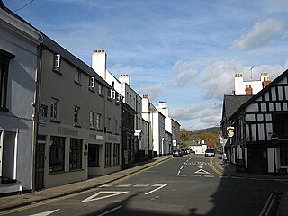
St James Street, Monmouth

St James Street is a historic street in the town centre of Monmouth, Monmouthshire, Wales. It appears as a segment of Whitecross Street on the 1610 map of the town by cartographer John Speed and is within the medieval town walls. On more recent maps, it extends from St James Square southwest to Almshouse Street. In 2010, the street was the site of discovery of Mesolithic era artefacts. St James Street is lined with numerous listed buildings.

Dispensary organization that dispenses medications, medical supplies, and in some cases even medical treatment

A dispensary is an office in a school, hospital, industrial plant, or other organization that dispenses medications, medical supplies, and in some cases even medical and dental treatment. In a traditional dispensary set-up, a pharmacist dispenses medication as per prescription or order form. The English term originated from the medieval Latin noun dispensaria and is cognate with the Latin verb dispensare, "to distribute".

History

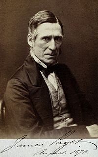
A dispensary had been set up at Little Castle House, Castle Hill, in 1810, [3] but it moved to St James Square in 1868 where it became the town's hospital, funded by local benefactors. Sir James Paget (Surgeon Extraordinary to Queen Victoria), who inspected the premises in 1873, said it was one of "the most convenient and best ventilated and arranged Institutions he had ever seen". It mainly benefitted the poor although it was the deserving poor as those on parish-relief were given a low priority. The Dispensary served as a cottage hospital, except that cases involving childbirth, hospice cases and those with mental diseases were turned away. The annual cost of each bed in 1868 was about £40; this was raised by donations made at Monmouth's banks or directly at the Dispensary. The waiting room displayed the names of major benefactors, which included a gift of £1,000 from John E. W. Rolls [4] (a grandfather of Charles Rolls), who was President of the Institution. Rolls covered the cost of "The Hendre Bed" in perpetuity. The number of outpatients treated in 1876–1877 was over 1600; there were 60 inpatients. The Dispensary's catchment area extended to about eight miles outside Monmouth, including part of the Forest of Dean. [3]

Little Castle House, Monmouth

Little Castle House is a Grade II Listed building in Monmouth Wales. Also known as The Dispensary it was one of Monmouth's early medical facilities.

James Paget British scientist

Sir James Paget, 1st Baronet FRS HFRSE was an English surgeon and pathologist who is best remembered for naming Paget's disease and who is considered, together with Rudolf Virchow, as one of the founders of scientific medical pathology. His famous works included Lectures on Tumours (1851) and Lectures on Surgical Pathology (1853). There are several medical conditions which were described and later named after Paget:

Poor Relief Act 1662

The Poor Relief Act 1662 was an Act of the Cavalier Parliament of England. It was an Act for the Better Relief of the Poor of this Kingdom and is also known as the Settlement Act or, more honestly, the Settlement and Removal Act. The purpose of the Act was to establish the parish to which a person belonged, and hence clarify which parish was responsible for him should he become in need of Poor Relief. This was the first occasion when a document proving domicile became statutory: these were called "settlement certificates".

The lack of an operating room and the difficult stairs at the Dispensary had convinced the authorities that a new hospital was essential and this led to the Dispensary's closure. The Hospital moved from St James Square in 1903 to the Cottage Hospital on the Hereford Road. [5]

Cottage Hospital, Monmouth Hospital in Wales

The Cottage Hospital was a community hospital on the Hereford Road in Monmouth, Wales.

In 1907, the French Sisters were running a private school in the old dispensary building, offering both boarders and day pupils lessons in French, music, painting, drawing, needlework and general education. Soon afterwards, a children's home was established here, a use which continued up to the end of the twentieth century. [6]

Related Research Articles

The Hendre Historic country house in Monmouthshire, Wales

The Hendre,, Rockfield, Monmouthshire is the county's only full-scale Victorian country house. The ancestral estate of the Rolls family, it was the childhood home of Charles Stewart Rolls, the motoring and aviation pioneer and co-founder of Rolls-Royce. Constructed in the Victorian Gothic style, the house was developed by three major architects, George Vaughan Maddox, Thomas Henry Wyatt and Sir Aston Webb. It is located in the parish of Llangattock-Vibon-Avel, some 4 miles (6.4 km) north-west of the town of Monmouth. Built in the eighteenth century as a shooting box, it was vastly expanded by the Rolls family in three stages throughout the nineteenth century. The house is Grade II* Listed and is now the clubhouse of the Rolls of Monmouth Golf Club.

Llangattock-Vibon-Avel rural parish in Monmouthshire, Wales.

Llangattock-Vibon-Avel is a rural parish and community in Monmouthshire, south east Wales, in the United Kingdom. It is located 5 miles (8.0 km) west of Monmouth and some 13 miles (21 km) east of Abergavenny, just off the B4233 old road between the two.

Monmouth Castle Grade I listed building in Monmouth. 11th-century castle

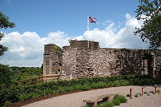
Monmouth Castle is a castle in the town of Monmouth, county town of Monmouthshire, south east Wales. It is a Grade I listed building and scheduled monument.

Monmouth Museum museum in Monmouth, UK

The Monmouth Museum, alternatively known as The Nelson Museum and Local History Centre, is a museum in Monmouth, Monmouthshire, south east Wales. It features a collection of artifacts associated with Admiral Horatio Nelson. The museum is located in the old Market Hall in the town centre in Monmouth, a short distance from the River Monnow, Monmouth Castle and Agincourt Square.

Shire Hall, Monmouth Grade I listed building in Monmouth. Courthouse

The Shire Hall in Agincourt Square, Monmouth, Wales, is a prominent Grade I listed building in the town centre. It was built in 1724, and was formerly the centre for the Assize Courts and Quarter Sessions for Monmouthshire. In 1839/40, the court was the location of the trial of the Chartist leader John Frost and others for high treason for their part in the Newport Rising. The building was also used as a market place. The Shire Hall is owned by Monmouthshire County Council and has audiovisual guides for visitors to Courtroom 1. It is currently used as a Tourist Information Centre and as the offices for Monmouth Town Council, and is open to the public in part.

<i>Statue of Charles Rolls, Monmouth</i> Grade II* listed building in Monmouth. Statue in Monmouth, Wales

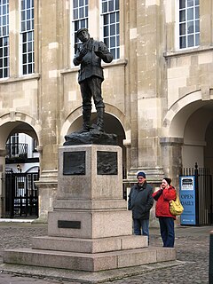
The memorial statue to the aviation pioneer Charles Rolls stands in front of the Shire Hall in Agincourt Square, Monmouth, Wales. The 8 feet (2.4 m) high bronze statue was designed by Sir William Goscombe John, R.A. and Sir Aston Webb, R.A. designed the pink granite plinth. The statue is a Grade II* listed structure.

John Etherington Welch Rolls High Sheriff, Deputy Lieutenant and JP

John Etherington Welch Rolls was a High Sheriff of Monmouthshire, art collector, Deputy Lieutenant and Justice of the Peace. Rolls was President of, and co-founded the Monmouth Show.

St Marys Priory Church, Monmouth Church in Monmouthshire, Wales

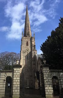
St Mary's Priory Church, in Whitecross Street, Monmouth, Monmouthshire, Wales, is an Anglican church founded as a Benedictine priory in 1075. The current church dates mostly from the 18th and 19th centuries. It was designated a Grade II* listed building in 1952. It is one of 24 buildings on the Monmouth Heritage Trail.

The Rolls Hall, Monmouth public library in Monmouth, Wales

The Rolls Hall, Whitecross Street, Monmouth, Monmouthshire is a Victorian hall, now public library, donated to the town in celebration of Queen Victoria's Golden Jubilee by John Rolls, the future Lord Llangattock. It is a Grade II listed building as of 8 October 2005, and is one of 24 buildings on the Monmouth Heritage Trail.

There are a number of war memorials in Monmouth, Wales.

Whitecross Street, Monmouth

Whitecross Street is a historic street in the town centre of Monmouth, Monmouthshire, Wales. It was in existence by the 15th century, and appears as Whit crose on the 1610 map of the town by cartographer John Speed. It runs in an east-west direction, between Church Street and St James Square. It has been suggested that the street takes its name from a plague cross. Whitecross Street is lined with numerous listed buildings.

Monk Street, Monmouth

Monk Street is an historic street in the town of Monmouth, Monmouthshire, Wales. A portion of it was in existence by the 14th century, and appears on the 1610 map of the town by cartographer John Speed. It runs in a north-south direction, extending northward from its intersection with Whitecross Street. The name of the street relates to the nearby Priory, as well as the gate which was originally on this road and provided part of the town's defences, Monk's Gate. Monk Street is lined with numerous listed buildings.

Kingsley House and Hendre House, Monmouth

Kingsley House and Hendre House are a pair of 19th-century, semi-detached houses on the North Parade section of Monk Street in Monmouth, Monmouthshire, Wales. The grade II listed houses were designed by noted Monmouth architect and builder George Vaughan Maddox, who also designed at least two of the twenty-four blue plaque buildings on the Monmouth Heritage Trail, including the Market Hall and the Monmouth Methodist Church. Hendre House should be distinguished from The Hendre, the estate of the Rolls family.

St James House, Monmouth building in Monmouth, Monmouthshire, Wales

St James House is a grade II listed building in Monmouth, Monmouthshire, Wales. It is in the historic St James Square neighbourhood, within the Medieval town walls. While the house currently has an attractive, 18th-century facade, it originated as a burgage tenement. In addition, behind the house, evidence of a kiln has been unearthed, with both Medieval and Post-medieval pottery. In 2010, archaeological excavation in the square revealed the first evidence of Mesolithic human settlement in Monmouth. Recent residents of St James House have included boarding students from Monmouth School.

12–16 Church Street, Monmouth grade II* listed building in Monmouth

12–16 Church Street in Monmouth, Wales, is a row of three shop houses designed by the architect George Vaughan Maddox and constructed c. 1837. They form part of Maddox's redevelopment of the centre of Monmouth and stand on Church Street, to the rear of Maddox's Priory Street. The architectural historian John Newman has written that Maddox's work "gives Monmouth its particular architectural flavour" and Cadw describes the grouping of 12–16 Church Street as "the best preserved early 19th century shopfront in Monmouth."

References

  1. Old Dispensary, Listed Buildings, accessed January 2010
  2. Newman, John (2000) The Buildings of Wales: Gwent/Monmouthshire. ISBN   0-14-071053-1. University of Wales Press
  3. 1 2 Kissack, K. (1975) Monmouth – the Making of a County Town. ISBN   0-85033-209-5 Phillimore Press
  4. Illustrated Handbook of Monmouth p.39. 1875.
  5. Alan Sutton Publishing, Monmouth and the River Wye in Old Photographs, Alan Sutton Publishing, 1989, ISBN   0-86299-481-0, page 16
  6. "Children's Homes and Institutions in Monmouthshire, Wales". Children's Homes. Retrieved 20 February 2019.