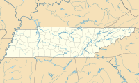
Rostraver Airport is a public use airport in Westmoreland County, Pennsylvania, United States.
Charlotte–Monroe Executive Airport is a public use airport located five nautical miles (9 km) northwest of the central business district of Monroe, a city in Union County, North Carolina, United States. It is owned by the City of Monroe and was formerly known as Monroe Regional Airport.

Toledo Suburban Airport is a public use airport located two nautical miles southwest of the central business district of Lambertville, a city in Monroe County, Michigan, United States. It is located just north of Michigan's border with Ohio and northwest of the city of Toledo, Ohio. It is included in the Federal Aviation Administration (FAA) National Plan of Integrated Airport Systems for 2017–2021, in which it is categorized as a general aviation facility.

Monroe County Airport is a county-owned public-use airport located three nautical miles (6 km) south of the central business district of Monroeville, in Monroe County, Alabama, United States. According to the FAA's National Plan of Integrated Airport Systems for 2009–2013, it is categorized as a general aviation facility.
Shawano Municipal Airport is a city and county-owned public-use airport located one nautical mile (2 km) northeast of the central business district of Shawano, a city in Shawano County, Wisconsin, United States. It is included in the Federal Aviation Administration (FAA) National Plan of Integrated Airport Systems for 2021–2025, in which it is categorized as a local general aviation facility. The airport is located on Shawano Lake and has a landing area for seaplanes.

Murfreesboro Municipal Airport is a city-owned, public-use airport located two nautical miles (3.7 km) north of the central business district of Murfreesboro, a city in Rutherford County, Tennessee, United States. This airport is included in the National Plan of Integrated Airport Systems for 2011–2015, which categorized it as a general aviation airport. Although most U.S. airports use the same three-letter location identifier for the FAA and IATA, this airport is assigned MBT by the FAA, but has no designation from the IATA.
Winchester Municipal Airport is a city-owned public-use airport located three nautical miles southeast of the central business district of Winchester, a city in Franklin County, Tennessee, United States.
Scott Municipal Airport is a public-use airport located four nautical miles southwest of the central business district of Oneida, a city in Scott County, Tennessee, United States. The airport is owned by Scott County. Big South Fork Airpark, a gated community and residential airpark is located adjacent to the airport.
Madisonville Municipal Airport is a city-owned public-use airport located five nautical miles northeast of the central business district of Madisonville, a city in Hopkins County, Kentucky, United States.

Gatlinburg–Pigeon Forge Airport is a county-owned public-use municipal airport in Sevier County, Tennessee, United States. The airport is well north of the cities of Gatlinburg and Pigeon Forge, but only two nautical miles (3.7 km) southeast of the central business district of Sevierville, and within its city limits.
Fayette County Airport is a county-owned, public-use airport located two nautical miles southwest of the central business district of Somerville, in Fayette County, Tennessee, United States. According to the FAA's National Plan of Integrated Airport Systems for 2009–2013, it was classified as a general aviation airport.
Marion County Airport, also known as Brown Field, is a county-owned, public-use airport located four nautical miles southeast of the central business district of Jasper, a town in Marion County, Tennessee, United States.

Abernathy Field is a public use airport located three nautical miles southwest of the central business district of Pulaski, a city in Giles County, Tennessee, United States. It is owned by the City of Pulaski and Giles County. According to the FAA's National Plan of Integrated Airport Systems for 2009–2013, it is categorized as a general aviation facility.
Monroe Municipal Airport is a city owned public use airport located three nautical miles (6 km) northeast of the central business district of Monroe, a city in Green County, Wisconsin, United States. It is included in the Federal Aviation Administration (FAA) National Plan of Integrated Airport Systems for 2021–2025, in which it is categorized as a local general aviation facility.
Campbell County Airport is a county-owned, public-use airport located 1 kilometre (0.62 mi) east of the central business district of Jacksboro, a town in Campbell County, Tennessee, United States. This airport is included in the FAA's National Plan of Integrated Airport Systems for 2011–2015, which categorized it as a general aviation facility.
Beech River Regional Airport is a public-use airport in Henderson County, Tennessee, United States. It is located five nautical miles northwest of the central business district of Parsons, a city in Decatur County.
Carroll County Airport is a county-owned public-use airport in Carroll County, Tennessee, United States. It is located four nautical miles northwest of the central business district of Huntingdon, Tennessee. The airport is included in the FAA's National Plan of Integrated Airport Systems for 2011–2015, which categorized it as a general aviation facility.
Warren County Memorial Airport is a county-owned public-use airport in Warren County, Tennessee, United States. It is located three nautical miles (6 km) west of the central business district of McMinnville, Tennessee. This airport is included in the National Plan of Integrated Airport Systems for 2011–2015, which categorized it as a general aviation facility.
Hawkins County Airport is a county-owned public-use airport in Hawkins County, Tennessee, United States. It is located six nautical miles northeast of the central business district of Rogersville, Tennessee in the city of Surgoinsville, Tennessee. This airport is included in the National Plan of Integrated Airport Systems for 2011–2015, which categorized it as a general aviation facility.
Tompkinsville-Monroe County Airport is a public use airport located two nautical miles (4 km) northeast of the central business district of Tompkinsville, a city in Monroe County, Kentucky, United States. It is included in the National Plan of Integrated Airport Systems for 2011–2015, which categorized it as a general aviation facility.


