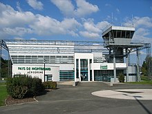
Montbéliard – Courcelles Aerodrome

Last updated
Montbéliard - Courcelles Aerodrome
Aérodrome de Montbéliard - Courcelles
Aerodrome Montbeliard.jpg
Summary
Airport type Public
Operator Syndicat mixte de l’aérodrome de Montbéliard
Serves Montbéliard, Doubs, France
Location Courcelles-lès-Montbéliard
Elevation  AMSL 1,041 ft / 317 m
Coordinates 47°29′12″N006°47′29″E / 47.48667°N 6.79139°E / 47.48667; 6.79139
Map
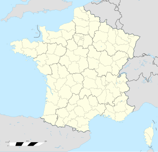
France location map-Regions and departements-2016.svg
Airplane silhouette.svg
LFSM
Location of airport in France
Runways
Direction Length Surface
m ft
08/26 1,700 5,577 Paved
08/26 860 2,822 Grass
Sources: French AIP, [1] UAF, [2] DAFIF [3]

Montbéliard – Courcelles Aerodrome (French : Aérodrome de Montbéliard - Courcelles) ( IATA : XMF, ICAO : LFSM) is an airport serving Montbéliard, [1] a commune in the Doubs department in the Franche-Comté region in eastern France.

French language Romance language

French is a Romance language of the Indo-European family. It descended from the Vulgar Latin of the Roman Empire, as did all Romance languages. French evolved from Gallo-Romance, the spoken Latin in Gaul, and more specifically in Northern Gaul. Its closest relatives are the other langues d'oïl—languages historically spoken in northern France and in southern Belgium, which French (Francien) has largely supplanted. French was also influenced by native Celtic languages of Northern Roman Gaul like Gallia Belgica and by the (Germanic) Frankish language of the post-Roman Frankish invaders. Today, owing to France's past overseas expansion, there are numerous French-based creole languages, most notably Haitian Creole. A French-speaking person or nation may be referred to as Francophone in both English and French.

An IATA airport code, also known as an IATA location identifier, IATA station code or simply a location identifier, is a three-letter code designating many airports around the world, defined by the International Air Transport Association (IATA). The characters prominently displayed on baggage tags attached at airport check-in desks are an example of a way these codes are used.

ICAO airport code four-letter code designating many airports around the world

The ICAOairport code or location indicator is a four-letter code designating aerodromes around the world. These codes, as defined by the International Civil Aviation Organization and published in ICAO Document 7910: Location Indicators, are used by air traffic control and airline operations such as flight planning.

Contents

The airport is located 2  km (1.1  NM ) south of Montbéliard, [1] near Courcelles-lès-Montbéliard.

The kilometre, or kilometer is a unit of length in the metric system, equal to one thousand metres. It is now the measurement unit used officially for expressing distances between geographical places on land in most of the world; notable exceptions are the United States and the road network of the United Kingdom where the statute mile is the official unit used.

Nautical mile unit of distance (1852 m)

A nautical mile is a unit of measurement used in both air and marine navigation, and for the definition of territorial waters. Historically, it was defined as one minute of a degree of latitude. Today it is defined as exactly 1852 metres. The derived unit of speed is the knot, one nautical mile per hour.
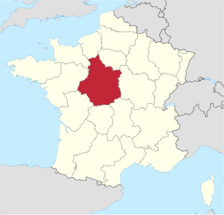
Courcelles-lès-Montbéliard Commune in Bourgogne-Franche-Comté, France

Courcelles-lès-Montbéliard is a commune in the Doubs department in the Bourgogne-Franche-Comté region in eastern France.

Facilities

The airport resides at an elevation of 1,041 feet (317 m) above mean sea level. It has one paved runway designated 08/26 with a bituminous surface measuring 1,700 by 20 metres (5,577 ft × 66 ft). It also has a parallel grass runway which measures 860 by 50 metres (2,822 ft × 164 ft). [1] [2]

Elevation Height of a geographic location above a fixed reference point

The elevation of a geographic location is its height above or below a fixed reference point, most commonly a reference geoid, a mathematical model of the Earth's sea level as an equipotential gravitational surface . The term elevation is mainly used when referring to points on the Earth's surface, while altitude or geopotential height is used for points above the surface, such as an aircraft in flight or a spacecraft in orbit, and depth is used for points below the surface.

Runway Area of surface used by aircraft to takeoff from and land on

According to the International Civil Aviation Organization (ICAO), a runway is a "defined rectangular area on a land aerodrome prepared for the landing and takeoff of aircraft". Runways may be a man-made surface or a natural surface.

Related Research Articles

Chambéry Airport airport

Chambéry Airport or Chambéry-Savoie Airport, also known as Chambéry Aix-les-Bains Airport, is a small international airport near Chambéry, a commune in Savoy, France. Commercial activities started at the airport in 1960.

Bergerac Dordogne Périgord Airport French airport

Bergerac Dordogne Périgord Airport is an airport serving Bergerac, a commune of the Dordogne department in the Nouvelle-Aquitaine region of France. The airport is located 3 kilometres (1.6 NM) south-southeast of Bergerac. It is also known as Bergerac-Roumanière Airport.

Biarritz Pays Basque Airport airport

Biarritz Pays Basque Airport, also known as Biarritz Airport or Biarritz-Parme Airport, is an airport serving Biarritz, France. It is located 5 km (3.1 mi) southeast of Biarritz, near Bayonne and Anglet. In 2017, there were 1,190,991 passenger movements. The airport is served by numerous European hubs. The airport opened on 11 April 1954.

Poitiers–Biard Airport airport

Poitiers–Biard Airport is an airport located at Biard, 2.4 kilometres (1.5 mi) west of Poitiers, in the Vienne department of the Nouvelle-Aquitaine region in France.

Carcassonne Airport airport

Carcassonne Airport is an airport serving Carcassonne and the south of Languedoc. The airport is located on the western edge of the city, 3 km from the city center, in the Aude department of the Languedoc-Roussillon region in France. It is also known as Salvaza Airport, Carcassonne Salvaza Airport or Carcassonne Airport in Pays Cathare. The airport handles commercial national and international flights as well as private, non-regular air traffic.

Moulins – Montbeugny Airport airport in France

Moulins – Montbeugny Airport is an aerodrome or airport located in Toulon-sur-Allier, 7 km (4 NM) southeast of Moulins and west of Montbeugny, all communes in the Allier department of the Auvergne region in central France.

Castres–Mazamet Airport french airport

Castres – Mazamet Airport is an airport serving Castres and Mazamet and the east of Midi-Pyrénées. The airport is located 7 km (4 mi) southeast of Castres and northwest of Mazamet, near the commune of Labruguière, in the Tarn department.

Avignon – Provence Airport airport

Avignon Provence Airport is an airport located in the city of Avignon and 4 kilometres (2 mi) west of Caumont-sur-Durance, in the Vaucluse department of the Provence-Alpes-Côte d'Azur region in France.

Moorea Airport Airport in French Polynesia

Moorea Airport is an airport serving the island of Moorea in French Polynesia, France. It is also known as Temae Airport or Moorea Temae Airport for its location near the village of Temae in northeastern Moorea. The airport is located 7.5 km (4.0 NM) northeast of Afareitu, the island's main village. It is also 15 km (8.1 NM) west of the island of Tahiti. The airport opened on October 6, 1967.

Troyes – Barberey Airport Airport in France

Troyes – Barberey Airport or Aéroport de Troyes - Barberey is an airport located 2 km northwest of Troyes in Barberey-Saint-Sulpice, both communes of the Aube département in the Champagne-Ardenne région of France.

Angers – Loire Airport airport located in Marcé, 20 kilometres (11 nautical miles) northeast of Angers, both communes of the Maine-et-Loire department in the Pays de la Loire region of France

Angers – Loire Airport is an airport located in Marcé, 20 kilometres northeast of Angers, both communes of the Maine-et-Loire department in the Pays de la Loire region of France. It is also known as Angers – Marcé Airport.

Reims – Prunay Aerodrome Airport in France

Reims – Prunay Aerodrome is an airfield serving the city of Reims. It is located 10 km (5.4 NM) east-southeast of Reims, near Prunay, both communes in the Marne department in the Grand Est region in northeastern France.

Montluçon – Guéret Airport airport in France

Montluçon – Guéret Airport is an airport in Lépaud, a commune in the Creuse department of the Nouvelle-Aquitaine region of France. The airport is located 22.5 km (14 mi) southwest of Montluçon in the Allier department. It is also 45 km (28 mi) east of Guéret in the Creuse department.

Saint-Yan Airport airport in France

Saint-Yan Airport, also known as Charolais Bourgogne Sud Airport, is an airport in Saint-Yan, a commune of the Saône-et-Loire department in the Burgundy (Bourgogne) region of France. A campus of the École nationale de l'aviation civile is located on the airport.

Auxerre – Branches Aerodrome airport in France

Auxerre – Branches Aerodrome is an airport serving Auxerre and Branches, both communes of the Yonne department in the Bourgogne region of France. The airport is located 8.5 km (4.6 NM) northwest of Auxerre and approximately 4 km (2.2 NM) southeast of Branches.

Besançon – La Vèze Aerodrome french aerodrome

Besançon – La Vèze Aerodrome is an airport located 5.5 km (3.0 NM) southeast of Besançon in La Vèze, both communes of the Doubs department in the Franche-Comté region of France.

Bourges Airport airport

Bourges Airport is an airport serving Bourges, a commune in the Cher department of the Centre-Val de Loire region of France. It is located 3 km (1.6 NM) southwest of Bourges.

Aix-en-Provence Aerodrome airport in France

Aix-en-Provence Aerodrome, also known as Aix les Milles Airport, is an airport serving Aix-en-Provence, a commune in the Bouches-du-Rhône department of the Provence-Alpes-Côte d'Azur region of France. It is located 6 km (3.2 NM) west-southwest of Aix-en-Provence, in the village of Les Milles.

Colmar Airport airport

Colmar - Houssen Airport is an airport in Houssen, 1 km north of Colmar, both communes in the Haut-Rhin department of the Alsace region in France. The airport is along Autoroute A35 and is served by the Colmar Station.

Orléans – Saint-Denis-de-lHôtel Airport airport in France

Orléans – Saint-Denis-de-l'Hôtel Airport is a French airport located in the Saint-Denis-de-l'Hôtel commune in the Loiret département, Centre-Val de Loire region, France

References

  1. 1 2 3 4 LFSM – MONTBÉLIARD COURCELLES. AIP from French Service d'information aéronautique , effective 26 April 2018.
  2. 1 2 (in French) Aérodrome de Montbéliard - Courcelles (XMF / LFSM) Archived 2010-05-24 at the Wayback Machine. at Union des Aéroports Français
  3. Airport information for LFSM from DAFIF (effective October 2006)