The Graian Alps are a mountain range in the western part of the Alps.

The Province of Rieti is a province in the Lazio region of Italy. Its capital is the city of Rieti. Established in 1927, it has an area of 2,750.52 square kilometres (1,061.98 sq mi) with a total population of 157,887 people as of 2017. There are 73 comuni in the province.

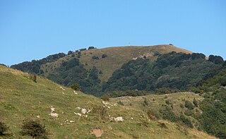
Monte Buio is a mountain in Liguria, northern Italy, part of the Ligurian Apennines. It is located between the provinces of Genoa and Alessandria. It lies at an altitude of 1400 metres.

Monte Frontè is a mountain in Liguria, northern Italy, part of the Alps. It is located in the province of province of Imperia. It lies at an altitude of 2,152 metres. After Monte Saccarello it is the second highest peak in the Ligurian region.

Monte Reale is a mountain of the Ligurian Apennines. It is located in the Province of Genoa along the watershed between the basin of the Scrivia Torrent and that of the Vobbia, its tributary to the right. It is situated in the more western part of the Regional Natural Park of Antola between the municipal territories of Ronco Scrivia and Isola del Cantone.

Monte Reixa is a mountain in Liguria, northern Italy, part of the Ligurian Apennines.

Monte Saccarello (Italian) or Mont Saccarel (French) is a mountain located on the French-Italian border between Liguria, Piedmont and Provence-Alpes-Côte d'Azur.

The Sirente-Velino Regional Park is a regional park in the province of L'Aquila, Abruzzo, central Italy.

The Alta Via dei Monti Liguri is a long-distance waymarked hiking trail in the Italian region of Liguria. In about 440 kilometres (270 mi) and 44 day hikes, it runs through the arc formed by Ligurian Alps and Ligurian Apennines from Ventimiglia to Ceparana.

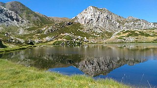
Cima Garlenda is a 2,141 m (7,024 ft) mountain of the Ligurian Alps, in Italy. After Monte Saccarello and Monte Frontè it is the third Ligurian summit.

The Regional Natural Park of the Ligurian Alps is a natural park in Province of Imperia. It was established in 2007 by the legge regionale nr.34 of 15/11/2007.
The Beigua Natural Regional Park is a natural park located in province of Savona and the Metropolitan City of Genoa, both in Liguria (Italy). It's the largest protected area of the region. It gets the name from the highest mountain of the area, Monte Beigua.
The Antola Natural Regional Park is a natural park in Metropolitan City of Genoa. It gets the name from the highest mountain of the area, Monte Antola.

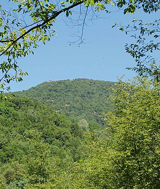
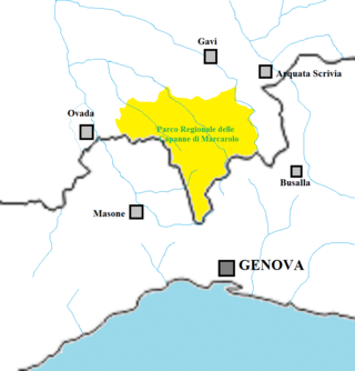
The Capanne di Marcarolo Natural Regional Park is a natural park in the province of Alessandria. It gets the name from a small village in the protected area, Capanne di Marcarolo.

Lago dell'Antenna is an artificial lake in north-west Italy, located in the Genoa (Liguria). Concerned comunes are Urbe and Sassello.

Monte Monega is a 1,882-metre (6,175 ft) mountain of the Ligurian Alps, in Italy.

Monte Salviano is a massif in the Abruzzo Apennines, Central Italy. It includes the peaks of Monte d'Aria, Monte Cimarani and Monte San Felice. Since 1999 the area, falling within the municipal territory of Avezzano, has been included in the Riserva Naturale di Monte Salviano.

The Natural Park of Marguareis(in Italian Parco Naturale del Marguareis) is a regional natural park of the Ligurian Alps located in the Province of Cuneo.

Monte Is Caravius is the highest massif in the Sulcis Mountains, in southern Sardinia, Italy. The information on the height of the relief is still under debate: geographical atlases, historical bibliographic sources, and official documentation attribute the height of 1116 m; other sources, including several of an administrative or technical-scientific nature that use information from territorial information systems, indicate a height of 1113 m.

The Gran Bosco di Salbertrand Natural Park is a nature reserve in Piedmont, Italy. Established in 1980, it protects the Site of Community Importance of the Great Woods of Salbertrand, in the Val Susa, south of the Dora Riparia, between 1,000 and 2,700 meters above sea level. The woods, which cover an area of about eight hundred acres, consist of a mix of silver firs and Norway spruces, rarely found in the Western Alps.


