
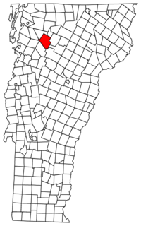
Readsboro is a town in Bennington County, Vermont, in the United States. The town was named for John Reade, a landholder. The population was 763 at the 2010 census, a decrease of 46 from the previous census. It was 857 as of 1859. The hamlet of Heartwellville is in the northern part of Readsboro about 5 miles (8 km) up Route 100 from the hamlet of Readsboro.

Danville is a town in Caledonia County, Vermont, United States. The population was 2,196 at the 2010 census. The primary settlement in town is recorded as the Danville census-designated place (CDP) and had a population of 383 at the 2010 census.

Fairfax is a town in Franklin County, Vermont, United States. The population was 4,285 at the 2010 census, up from 3,765 at the 2000 census.
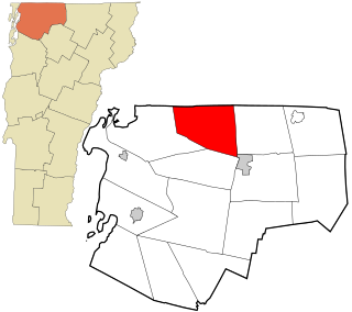
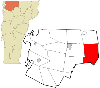
Franklin is a town in Franklin County, Vermont, United States. The population was 1,405 at the 2010 census, up from 1,268 at the 2000 census.

Georgia is a town in Franklin County, Vermont, United States. The population was 4,515 at the 2010 census.

Highgate is a town in Franklin County, Vermont, United States. The population was 3,535 at the 2010 census. The town is on the Canada–US border and is a border town with Philipsburg, Quebec.
Montgomery is a town in Franklin County, Vermont, United States. The population as of the 2010 census was 1,201, up from 992 in 2000. In 1963, part of Avery's Gore in Franklin County became part of Montgomery, with the other section becoming part of Belvidere in Lamoille County.
Derby Line is an incorporated village in the town of Derby in Orleans County, Vermont, United States, slightly north of the 45th parallel, the normal U.S.-Canada boundary. The population was 776 at the 2000 census.
St. Albans City is the county seat of Franklin County, Vermont, in the United States. At the 2010 census, the city population was 6,918. St Albans City is surrounded by "St. Albans Town", which is incorporated separately from the city of St. Albans. The city and county are part of the Burlington metropolitan area, although the city is in Franklin County, north of the metro area's most populous county, Chittenden County.

Swanton is a town in Franklin County, Vermont. The population was 6,427 at the 2010 census. The town includes the village of Swanton.
Cambridge is a town in Lamoille County, Vermont, United States. The population was 3,659 at the 2010 U.S. Census. Cambridge includes the villages of Jeffersonville and Cambridge.

St. Johnsbury is the shire town of Caledonia County, Vermont, United States. The population was 7,603 at the 2010 census. St. Johnsbury is located approximately 10 miles (16 km) northwest of the Connecticut River and 48 miles (77 km) south of the Canada-U.S. border.

The Canada–United States border, officially known as the International Boundary, is the longest international border in the world between two countries. It is shared between Canada and the United States, the second- and fourth/third largest countries by area, respectively. The terrestrial boundary is 8,891 kilometres (5,525 mi) long, of which 2,475 kilometres (1,538 mi) is Canada's border with Alaska. Eight Canadian provinces and territories, and thirteen U.S. states are located along the border.

The Vermont Senate is the upper house of the Vermont General Assembly, the state legislature of the U.S. state of Vermont. The senate consists of 30 members. Senate districting divides the 30 members into three single-member districts, six two-member districts, three three-member districts, and one six-member district. Each senator represents at least 20,300 citizens. Senators are elected to two-year terms and there is no limit to the number of terms that a senator may serve.
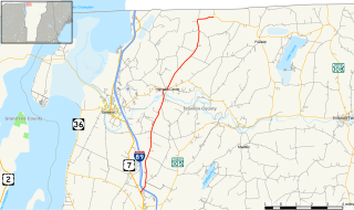
Vermont Route 207 is a north–south state highway in Franklin County, Vermont, United States. It begins in the town of St. Albans at U.S. Route 7 and runs north to the small village of Morses Line within the town of Franklin, where it intersects Vermont Route 235 about 0.5 miles (0.8 km) south of the Canada–US border. North of VT 78, the route is town-maintained and internally designated as major collector 297.

Vermont Route 235 is a short state highway in Franklin County, Vermont, United States. It runs from Vermont Route 120 in Franklin northwest to the Morses Line Border Crossing near the village of Morses Line, where it crosses into Quebec, Canada, and connects to Quebec Route 235, from which it derives its number. The entire route is town-maintained and internally designated as major collector 299.

The Morses Line Border Crossing connects the towns of Saint-Armand, Quebec with Franklin, Vermont on the Canada–US border. It is reached by Vermont Route 235 on the American side and by Quebec Route 235 on the Canadian side.
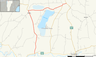
Vermont Route 120 (VT 120) is a 10.554-mile (16.985 km) long state highway located in Franklin County, Vermont, United States. The route begins at an intersection with VT 105 in the town of Sheldon, beginning as a north–south route until the junction with VT 235. At that junction, the route begins a west–east progression, reaching a junction with VT 108 in the town of Berkshire. The route was designated as a decision of the Vermont State Legislature in 1961.


