

On the Isle of Wight, Morton is the area of Brading where Morton Marshes and the River Yar form a boundary to the extension of housing estates from Sandown.
Morton is distinguished by hawthorn hedges. It is the site of some Roman ruins. [1]
On the Isle of Wight, Morton is the area of Brading where Morton Marshes and the River Yar form a boundary to the extension of housing estates from Sandown.
Morton is distinguished by hawthorn hedges. It is the site of some Roman ruins. [1]

The ancient 'Kynges Towne' of Brading is the main town of the civil parish of the same name. The ecclesiastical parish of Brading used to cover about a tenth of the Isle of Wight. The civil parish now includes the town itself and Adgestone, Morton, Nunwell and other outlying areas between Ryde, St Helens, Bembridge, Sandown and Arreton. Alverstone was transferred to the Newchurch parish some thirty years ago.
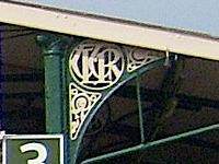
The Isle of Wight Railway was a railway company on the Isle of Wight, United Kingdom; it operated 14 miles of railway line between Ryde and Ventnor. It opened the first section of line from Ryde to Sandown in 1864, later extending to Ventnor in 1866. The Ryde station was at St Johns Road, some distance from the pier where the majority of travellers arrived. A tramway operated on the pier itself, and a street-running tramway later operated from the Pier to St Johns Road. It was not until 1880 that two mainland railways companies jointly extended the railway line to the Pier Head, and IoWR trains ran through, improving the journey arrangements.

The River Yar on the Isle of Wight, England, rises in a chalk coomb in St. Catherine's Down near Niton, close to the southern tip of the island. It flows across the Lower Cretaceous rocks of the eastern side of the island, through the gap in the central Upper Cretaceous chalk ridge of the Island at Yarbridge, then across the now drained Brading Haven to Bembridge Harbour in the northeast.

Nunwell is the location of Nunwell House, near Brading on the Isle of Wight, which was the home of the Oglander family for many centuries. It is in the civil parish of Brading. The present family are not direct descendants through the male line and thus the baronetcy has died out.

Sandown-Shanklin was an urban district on the Isle of Wight, England, from 1933. It was created by the merger of Shanklin and Sandown urban districts along with parts of the civil parishes of Brading, Bonchurch and Yaverland from the Isle of Wight Rural District. In 1961 it had a population of 14,386. It was abolished in 1974 under the Local Government Act 1972, to form part of the South Wight district.
The Isle of Wight Rural District was a rural district on the Isle of Wight from 1894 to 1974 covering most of the island, apart from urban areas. In 1933, the area of the district was reduced by the transfer of parts of the civil parishes of Brading, Bonchurch and Yaverland to the newly created Sandown-Shanklin Urban District.
Brading Town Football Club is an English football club based in Brading, Isle of Wight. They are currently members of the Isle of Wight League Division One and play at the Peter Henry Ground.

Sandown Castle was a Device Fort built at Sandown on the Isle of Wight by Henry VIII in 1545 to protect against the threat of French attack. Constructed from stone with angular bastions, its design was a hybrid of Italian military architectural thinking with traditional English military design. The site was raided by a French force that summer while the fortification was still being constructed. The site suffered from coastal erosion and the castle was demolished in 1631.

Yarbridge is a hamlet on the Isle of Wight, England. It is at the southern tip of the parish of Brading.

Brading Roman Villa was a Roman courtyard villa which has been excavated and put on public display in Brading on the Isle of Wight.

Mersley is a farming hamlet on the Isle of Wight. Mersley is in Newchurch Parish, and is adjacent to the village of Newchurch itself. Mersley is home to a large garlic farm which is part of the Isle of Wight Garlic Festival in nearby Newchurch, held annually since 1983 and now drawing 25,000 visitors a year. This garlic farm has also been investigated for inappropriate pesticide use in the past.

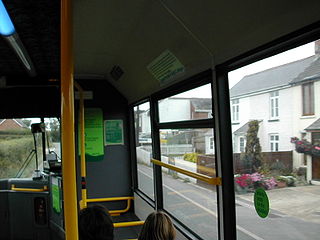
St Helen's with its 232-foot-long (71 m) single platform was the only intermediate stop on the 2+3⁄4-mile (4.4 km) branch line that connected Brading to the coast at Bembridge.

Bembridge was the terminus of the 2+3⁄4-mile branch railway line that connected it to the main line at Brading on the Isle of Wight, England. On holiday Saturdays the sector table revolved continuously because the station area was too small to contain points.
Brading Marshes to St. Helen's Ledges is a 488.5-hectare (1,207-acre) Site of special scientific interest which stretches from Brading along the Yar valley between Bembridge and St Helens, Isle of Wight through to the sea at Priory Bay on the north east coast of the Isle of Wight. It encompasses the Brading Marshes RSPB reserve, Bembridge harbour and the inter tidal sand, mud flats and rocky ledges exposed off the coast at low water, including the land around St Helens Fort which is not attached to the mainland. It is the second largest SSSI on the Isle of Wight. The site was notified in 1951 for both its biological and geological features.

St Mary's Church is a parish church in the Church of England located in Brading, Isle of Wight.
Gaskins is a hamlet on the Isle of Wight in England UK. It is on the B3330, approximately 1 mile (1.6 km) West of St Helens, and approximately 2 miles (3.2 km) Northeast of Brading.
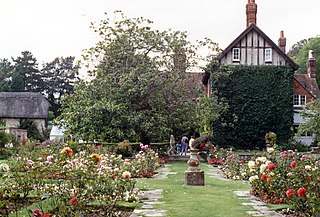
Morton Manor is a manor house originating in the 13th century, in Brading, Isle of Wight, England. It is located 1 mile (1.6 km) southwest of Sandown Road. The fairly small 14th-century house was modified in the 19th century. Constructed of varied materials, it was refurbished and extended in the early 20th century in an Arts and Crafts style. The house has a Tudor fireplace in the dining room, with William De Morgan green glazed tiles, and the manor includes a small museum of rural life.

Nunwell House, also Nunwell Manor, is a historic English country house in Brading, Isle of Wight. Located 3 miles (4.8 km) south of Ryde, the Tudor and Jacobean style house also has later additions. The house contains family militaria. It was occupied by the Oglander family from Norman times. Nunwell House is a Grade II* listed building.
Hill Farmhouse is an English country house in Brading, Isle of Wight. The 17th century farmhouse, a Grade II listed building, is located on Carpenters Road. It was constructed of local limestone. While the two storey gabled porch was an addition, the mullioned window to the left of the porch is an original. An arched doorway is Tudor style.

Isle of Wight East is a constituency of the House of Commons in the UK Parliament. Further to the completion of the 2023 Periodic Review of Westminster constituencies, it was first contested at the 2024 general election, since when it has been represented by Joe Robertson for the Conservative Party.
50°40′25″N1°08′52″W / 50.6735°N 1.1479°W
| | This Isle of Wight location article is a stub. You can help Wikipedia by expanding it. |