Mosor

Last updated
Mosor
Mosor mountain01.jpg
View of Mosor from the Mosor Star Village
Highest point
Elevation 1,339 m (4,393 ft)
Coordinates 43°31′37.80″N16°38′14.40″E / 43.5271667°N 16.6373333°E / 43.5271667; 16.6373333
Geography
Croatia relief map.png
Red triangle with thick white border.svg
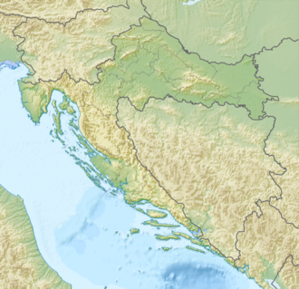
Mosor
Location of Mosor in Croatia
Location Split-Dalmatia County, Croatia

Mosor (Latin : Massarus), or Mount Mosor (Massarus Mons; Italian : Monte Massaro), is a mountain range in Croatia located near the city of Split on the Adriatic coast. It belongs to Dinaric Alps, and it stretches from the pass of Klis in the northwest to the Cetina River in the southeast.

The highest peak is the eponymous Mosor peak at 1,339 m.a.s.l. [1] There are no inhabited areas on the mountain above 600 metres. Mosor is mainly composed of karst — limestone rocks.

It attracts mountaineers from Croatia. There are two alpine huts and many mountaineering paths on Mosor.

Related Research Articles

Split-Dalmatia County County in southern Croatia

Split-Dalmatia County is a central-southern Dalmatian county in Croatia. The administrative center is Split. The population of the county is 455,242 (2011). The land area is 4,540 km2. Split-Dalmatia County is Croatia's most rapidly urbanising and developing region, as economic opportunities and living standards are among the highest alongside capital Zagreb and Istria County.

Dinara Mountain range in the Dinaric Alps

Dinara is a 100 kilometres (62 mi) long mountain range in the Dinaric Alps, located on the border of Bosnia and Herzegovina and Croatia. It has four major mountains or peaks, from north-west to south-east:

Učka

The Učka is a mountain range in western Croatia. It rises behind the Opatija riviera, on the eastern side of the Istrian peninsula.

Kamešnica (mountain)

Kamešnica is a mountain in the Dinarides, located in the southern end of the Dinara Mountain Range on the border between Bosnia and Herzegovina and Croatia (Dalmatia). It is 1,851 metres (6,073 ft) tall and stretches from the northwest white road pass Vaganj (1173 m) to the Buško Blato artificial lake. The tallest peak is Konj (Horse) 1,855 metres (6,086 ft), which is located in Bosnia and Herzegovina and offer views of both sides of the border. In clear weather, it is possible to see the most remote areas of the Adriatic Sea and its islands. The vicinity's many trails and caves make it popular with hikers.

Biokovo

Biokovo is the second-highest mountain range in Croatia, located along the Dalmatian coast of the Adriatic Sea, between the rivers of Cetina and Neretva.

Sniježnica

Sniježnica is a mountain located in the southernmost part of Croatia, north of the Konavle region. The eponymous highest peak is 1,234 m.a.s.l.

Krndija

Krndija is a mountain in Slavonia, Croatia, extending eastwards from Papuk. It is located south of Orahovica and Našice and north of Požega.

Požeška gora Mountain in Croatia

Požeška gora,, is a mountain located south of Požega, Croatia in the region of central Slavonia. The mountain is a part of Slavonian mountains enveloping the Požega Valley, located adjacent to Psunj to the east of Požeška gora, and to the west of Dilj. Požeška gora and Dilj are separated by a gap through which Orljava River flows south out of the Požega Valley. The highest peak of the mountain is Kapavac, 618 metres above sea level.

Plješivica Mountain of the Dinaric Alps in Croatia

Plješivica or Plješevica, also called Lička Plješevica, is a mountain in Croatia and on the border with Bosnia and Herzegovina, part of the Dinaric Alps. It stretches in the direction north–south, and it extends from the mountain pass that separates it from Mala Kapela, along the Krbava field to the west and the Una River canyon to the east, and ending near Gračac where it touches on Velebit.

Svilaja

Svilaja is a mountain range in Croatia, located inland of Dalmatia, in Zagora.

Velika Kapela

The Velika Kapela is a large mountain range in the east of Gorski Kotar, Croatia.

Risnjak

Risnjak is a mountain in the Risnjak National Park, in Gorski Kotar, Croatia. It belongs to the Dinaric Alps mountain range. The name of the massif probably comes from ris, the Croatian word for lynx. Another interpretation suggests that it comes from the local word risje, which is a name for a type of grass.

Bilogora is a low mountainous range in Central Croatia. It consists of a series of hills and small plains some 80 kilometres in length stretching in the direction northwest-southeast, along the southwest part of the Podravina region. The highest peak is called Rajčevica, located in the north of the mountain.

Ivanšćica Mountain in northern Croatia

Ivanščica (Croatian pronunciation: [iʋǎnʃʈ͡ʂit͡sa], is a mountain in northern Croatia. The highest peak is the eponymous Ivanščica at 1,059 metres.

Viševica

Viševica is a mountain in Gorski Kotar, Croatia. Its highest peak is the eponymous Viševica at 1,428 m.a.s.l.

Bitoraj

Bitoraj is a mountain in Gorski Kotar, Croatia. It is variously defined as a standalone mountain or as group of peaks of Velika Kapela. The highest peaks on it are Burni Bitoraj at 1,386 m.a.s.l., Velika Javornica at 1374 m.a.s.l., and the eponymous Bitoraj peak at 1,140 m.a.s.l.

Tuhobić (mountain)

Tuhobić is a mountain in Gorski Kotar, Croatia. Its highest peaks are at 1,109 and 1,106 m.a.s.l..

Šibenik (mountain)

Šibenik is a mountain in inland Dalmatia, Croatia. Its highest peak is Veliki Šibenik at 1,314 m.a.s.l.

Kalnik (mountain)

Kalnik or Kalničko gorje is a mountain in northwestern Croatia. Its highest peak is the eponymous Kalnik at 642 metres (2,106 ft).

References

  1. Ostroški, Ljiljana, ed. (December 2015). Statistički ljetopis Republike Hrvatske 2015 [Statistical Yearbook of the Republic of Croatia 2015](PDF). Statistical Yearbook of the Republic of Croatia (in Croatian and English). Vol. 47. Zagreb: Croatian Bureau of Statistics. p. 48. ISSN   1333-3305 . Retrieved 27 December 2015.