Related Research Articles

Kakahi ) is a small King Country settlement about 10 kilometres (6.2 mi) up the Whanganui River from Taumarunui, New Zealand. Founded as a sawmill town, it takes its name from the Māori word for the New Zealand freshwater mussel.

Mount Tauhara is a dormant lava dome volcano in New Zealand's North Island, reaching 1,088 metres (3,570 ft) above sea level. It is situated in the area of caldera rim overlap of the Whakamaru Caldera and Taupō Volcano towards the centre of the Taupō Volcanic Zone, which stretches from Whakaari / White Island in the north to Mount Ruapehu in the south. It is 6 kilometres (4 mi) east of the town of Taupō, next to the northeastern shore of Lake Taupō.
Waihi Village, also known as Little Waihi, is a small Māori community of around 25 households on the southwestern shores of Lake Taupō seven kilometres northwest of Tūrangi, New Zealand. It has been the site of three major landslides, in 1910, 1846 and around 1780, which killed over 200 people in total. The landslides flowed down the Waimatai Stream from their source above the village in the Hipaua Steaming Cliffs geothermal area.
Maniaiti Marae or Wallace Pā is a marae in Manunui, 8km south-east from the outskirts of Taumarunui, in the central North Island of New Zealand.
Pākā Bay, formerly called Halletts Bay is a bay on the eastern shore of Lake Taupō, New Zealand, about 27km south-east of Taupō township. It was known as Hamaria, in the nineteenth century. and before that Paka. The early Māori explorer Tia built a tūāhu to signify he occupied the land and named the cliffs Taupō-nui-a-Tia. This name was later given to the lake by the occupying tribes that followed.

In Māori traditions, Tia was an early Māori explorer of Aotearoa New Zealand and a rangatira (chief) in the Arawa tribal confederation. He is responsible for the names of various features and settlements around the central North Island, most notably Lake Taupō. He might have lived around 1400.
Waihāhā is a village and rural community in the Taupō District and Waikato region of New Zealand's North Island.

Motuaiko Island is the only island within Lake Taupō on the North Island of New Zealand. It sits near the town of Motutere. The name "Motutaiko" is from the Māori language, with "motu" meaning island, and "taiko" being a name for the black petrel.
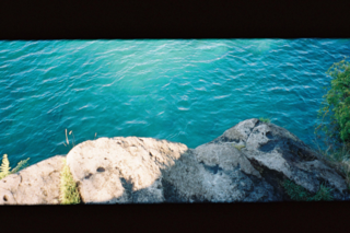
Bulli Point is a point on Lake Taupō, in the central North Island of New Zealand. The point is a popular spot for rock jumping.
Te Ata-inutai was a Māori rangatira (chieftain) of the Ngāti Raukawa iwi in the Tainui tribal confederation based at Whare-puhunga in the Waikato region of New Zealand. He led an attack against Ngāti Tūwharetoa on the south shore of Lake Taupō, as a result of disputes arising from the Ngāti Tama–Ngāti Tūwharetoa War and forged a peace treaty with the Tūwharetoa chieftain Te Rangi-ita, but was ultimately murdered in his old age by members of Tūwharetoa in vengeance for his earlier attack. He probably lived in the early seventeenth century.
Whiti-patatō was a rangatira (chieftain) of Ngāti Raukawa, based at Whare-puhunga in the Waikato region of New Zealand, who led an attack on Ngāti Tūwharetoa to avenge the death of the Ngāti Raukawa rangatira, Te Ata-inutai, probably in the mid-seventeenth century.
Waikari was a 17th-century Māori ariki or rangatira (chieftain) of Ngāti Tūwharetoa from the region around Lake Taupō, New Zealand. He was one of the leaders in the Ngāti Tūwharetoa invasion of Taupō, fighting against Ngāti Kurapoto and Ngāti Hotu, and Subsequently, he led an attack on Ngāti Apa, who were settled on Lake Rotoaira and was the main leader in the Ngāti Tama-Ngāti Tūwharetoa War, which marked the final consolidation of Tūwharetoa control over the whole of Lake Taupō. He was killed by Ngāti Raukawa rangatira Te Ata-inutai. He probably lived in the late sixteenth and early seventeenth centuries.
Tūwharetoa a Turiroa was a Māori rangatira (chieftain) of Ngāti Kurapoto and Ngāti Tūwharetoa from the region around Lake Taupō, New Zealand. He was involved in multiple conflicts between Ngāti Tūwharetoa and Ngāti Raukawa, and his death, around the middle of the seventeenth century, marked the end of a cycle of revenge sparked by the Ngāti Tama–Ngāti Tūwharetoa War
Tū-te-tawhā was a 17th-century Māori rangatira (chieftain) of Ngāti Tūwharetoa from the region around Lake Taupō, New Zealand. He established the border between Ngāti Tūwharetoa and Ngāti Maniapoto to the west. Along with his brother-in-law Tū-hereua, he defeated Ngāti Whitikaupeka in the Battle of Uwhiuwhi-hiawai, but he was subsequently killed in an ill-advised attempt to take the Ngāti Apa fortress of Orangi-te-taea. He is sometimes known as Tū-te-tawhā I to distinguish him from his grandson Tū-te-tawhā Whare-oneone / Tū-te-tawhā II.
Tamamutu was a 17th-century Māori ariki (chieftain) of the Ngāti Te Rangiita hapū and the paramount chief of the Ngāti Tūwharetoa iwi of the region around Lake Taupō, New Zealand. He was based at Motutere, but was an active warrior, leading campaigns against the Whanganui Māori of the Manganuioteao River valley to the southwest, against Te Arawa on the shores of Lake Rotorua to the north, and against Ngati Kahungunu in Hawke’s Bay. He was also a talented orator, who is the source of several whakatauki and forged a lasting peace between Ngāti Tūwharetoa and Te Arawa. On his death, he was succeeded as paramount chief of Ngāti Tūwharetoa by his son Kapawa.
The Tūhoe–Ngāti Tūwharetoa War was a conflict which took place on the east coast of Lake Taupō in the central North Island of New Zealand in the mid- to late eighteenth century, between the Tūhoe iwi of Te Urewera and the Ngāti Tūwharetoa iwi of Lake Taupō.
Te Rangi-tua-mātotoru was an 18th-century Māori rangatira and tohunga of the Ngāti Te Rangiita hapū and ariki of the Ngāti Tūwharetoa iwi of the region around Lake Taupō, New Zealand. He built three great wharenui for different sections of Ngāti Tūwharetoa. When the Tūwharetoa chieftain Tutakaroa attacked Te Rangi-tua-mātotoru’s allies in Ngāti Tahu, he summoned allies from Te Arawa to attack Tutakaroa at Whakaohokau, but had second thoughts about the venture and arranged a peace before Te Arawa could wreak havoc. He sent a force to help Te Uamairangi from the Ngāti Te Upokoiri hapū of Ngāti Kahungunu escape to Whakatane after he was defeated in a bid for control of Ngāti Kahungunu. In his old age, he negotiated the peace which ended the Tūhoe-Ngāti Tūwharetoa War. After his death, he was eventually succeeded by Herea Te Heuheu Tukino I.

Te Tauri was an early 19th-century Māori rangatira (chieftain) of the Ngāti Te Rangiita hapū of Ngāti Tūwharetoa from the region around Lake Taupō, New Zealand. He is remembered as a prominent leader and powerful warrior.
The Kakaramea-Tihia Massif is an andesitic volcano in the central North Island of New Zealand. It extends from the peak of Kakaramea at 1,300 metres (4,300 ft) in the west to the peak of Tinui at 1,169 metres (3,835 ft). The term Kakaramea means many colours in Māori and relates to rock/soil colour on parts of the massif so is a common place name in New Zealand. The massif is located in the North Island Volcanic Plateau, to the south of Lake Taupō. Lake Rotoaira lies to the south-east as does further away Mount Tongariro and to the east is Pihanga on the other side of the Te Ponanga Saddle from Tihia.

The Ngati Maru–Ngati Tuwharetoa War was one of the conflicts between Māori tribes during the Musket Wars in New Zealand.
References
- ↑ Dowling, P. (ed.) (2004). ’’Reed New Zealand atlas’’. Auckland: Reed Publishing. ISBN 0 7900 0952 8
- ↑ Grace, John Te Herekiekie (1959). Tuwharetoa: The history of the Maori people of the Taupo District. Auckland [N.Z.]: A.H. & A.W. Reed. p. 200. ISBN 9780589003739.
- ↑ "Waipehi Walk," Department of Conservation. Retrieved 21 January 2022.
38°53′15″S175°57′30″E / 38.88750°S 175.95833°E
| | This Waikato geography article is a stub. You can help Wikipedia by expanding it. |