
Mount Columbia is a mountain located in the Winston Churchill Range of the Rocky Mountains. It is the highest point in Alberta, Canada, and is second only to Mount Robson for height and topographical prominence in the Canadian Rockies. It is located on the border between Alberta and British Columbia on the northern edge of the Columbia Icefield. Its highest point, however, lies within Jasper National Park in Alberta.

Mount Bryce is a mountain at the southwestern corner of the Columbia Icefield, in British Columbia, Canada, near the border with Alberta. It can be seen from the Icefields Parkway.

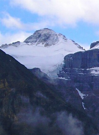
Mount Brazeau is a mountain in Alberta, Canada.

The Blue Range is a mountain range of the Canadian Rockies, located on the Continental Divide in Banff National Park, Canada. The range was so named on account of its blueish colour when viewed from afar. Mount Alcantara is the highest point in the range.

Abbot Pass lies between Mount Lefroy and Mount Victoria, in the divide between the valleys of Lake O'Hara and Lake Louise. It was named for Philip Stanley Abbot who died in 1896 in an attempt to climb Mount Lefroy with Charles Fay, Charles Thompson, and George T. Little.

Mount Sir Wilfrid Laurier is the highest peak of the Cariboo Mountains in the east-central interior of British Columbia, Canada. The mountain is part of the Premier Range, which is located just west of Valemount.
Mount Rutherford is a mountain in Jasper National Park in Alberta, Canada. It is part of the Northern Front Ranges of the Canadian Rockies. Its peak stands 3 km (2 mi) east of Harvey Lake and north of the Snaring River, a tributary of the Athabasca River.

Mount Ratz is a mountain located just west of the Stikine River, about 5 km (3 mi) east of the British Columbia-Alaska border. It is the highest peak in the Stikine Icecap and of the Boundary Ranges which in turn form part of the Coast Mountains. It is an extremely high-prominence summit, with a difference in elevation with its "key col" at Hyland Ranch Pass of 2,430 m (7,972 ft). Thus making it one of Canada's Ultra peaks.
Mount Nesselrode, also known as Boundary Peak 98, is a 2,474 m (8,117 ft) peak in the Boundary Ranges of the Coast Mountains, located on and in part defining the border between British Columbia, Canada, and Alaska, United States. About 40 miles (64 km) north of Juneau to the west of the lower Stikine River and in the heart of the Stikine Icecap in Juneau Icefield southwest of Atlin Lake, the summit, with a prominence of 924 m (3,031 ft), is also the corner point of Alaska's Haines Borough and Juneau Borough.
Jarvis Pass is a mountain pass in Kakwa Provincial Park in the Northern Rockies of British Columbia, Canada, located to the north of Kakwa Lake, on the British Columbia-Alberta boundary, and therefore is on the Continental Divide. It was one of the many passes surveyed as a route for the Canadian Pacific Railway in the 1870s.
Kananaskis Village is an unincorporated community in Alberta's Rockies within the Kananaskis Country park system in the Kananaskis Improvement District of Alberta, Canada. It is located approximately 26 km (16 mi) south of the Trans-Canada Highway, 3 km (1.9 mi) west of Highway 40 via Mt. Allan Drive and Centennial Drive. The community is located on the west shore of the Kananaskis River at the base of Mount Kidd.
Mount Ulysses, is the highest mountain in the Muskwa Ranges of the Northern Canadian Rockies in British Columbia. It and neighbouring peaks are part of a group of names drawing on the epic poem The Odyssey, in which here Ulysses wanders for 10 years before being able to return home to Ithaca.
Mount Farnham is British Columbia's 17th highest peak, and 21st most prominent. It was named after Paulding Farnham from New York. It is the highest peak in the Purcells.
Mount Gorman is located on the border of Alberta and British Columbia. It was named in 1925 after A.O. Gorman, a government surveyor with the Dominion Land Survey.
Mount Little is situated at the northern end of Kootenay National Park, and straddles the Continental Divide marking the Alberta-British Columbia border. It was named in 1916 after George F. Little, a member of the first ascent party.

Terrapin Mountain is located southeast of Lake Magog in Mount Assiniboine Provincial Park and straddles the Continental Divide marking the Alberta-British Columbia border. It was named in 1918 for its resemblance to a turtle. A ridge extending north from the mountain terminates at Naiset Point.

Mount Worthington is located on the eastern side of Mount McHarg, in Height of the Rockies Provincial Park, and straddles the Continental Divide marking the Alberta-British Columbia border. It was named in 1956 after Lt. Col. Don Worthington who was killed in action in 1944 during the Second World War while commanding the 7th Battalion, The British Columbia Regiment.
A mountain formerly known as Mount Pétain, but with no current official name, is located on the border of the Canadian provinces of Alberta and British Columbia (BC) on the Continental Divide.
Mount Burstall is a summit in Alberta, Canada.
Mount Merlin is the highest mountain of the Jacques Range, located in Jasper National Park, Alberta, Canada.

