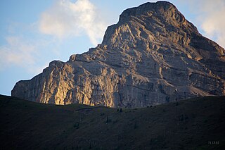
Mount Alberta is a mountain located in the upper Athabasca River Valley of Jasper National Park, Alberta, Canada. J. Norman Collie named the mountain in 1898 after Princess Louise Caroline Alberta. It is the most difficult of the 11,000ers from a climbing point of view.

Mount Bryce is a mountain at the southwestern corner of the Columbia Icefield, in British Columbia, Canada, near the border with Alberta. It can be seen from the Icefields Parkway.

Mount Brazeau is a mountain in Alberta, Canada.

The Blue Range is a mountain range of the Canadian Rockies, located on the Continental Divide in Banff National Park, Canada. The range was so named on account of its blueish colour when viewed from afar. Mount Alcantara is the highest point in the range.
Mount Thomlinson is a mountain in the Babine Range of the Skeena Mountains in northern British Columbia, Canada, located at the head of Thomlinson Creek, southeast of the junction of Babine River and Skeena River and north of Hazelton. It has a prominence of 1,661 m (5,449 ft), created by the Babine-Stuart Pass, thus making it one of Canada's many Ultra peaks. Thomlinson is one of the most isolated mountains of Canada.
Mount Cronin is a mountain in the Babine Range of the Skeena Mountains in northern British Columbia, Canada, located at the head of Cronin Creek in Babine Mountains Provincial Park just northeast of Smithers. It has a prominence of 1,571 m (5,154 ft), created by the Harold Price-Fulton Pass, making it one of Canada's Ultra peaks. The mountain was named after James Cronin, who operated a mine on this mountain in the 19th century.

Mount Muir is a mountain located on the Continental Divide on the Alberta-British Columbia border. The mountain was named in 1918 after Alexander Muir. It is located in the High Rock Range.
Mount Ulysses, is the highest mountain in the Muskwa Ranges of the Northern Canadian Rockies in British Columbia. It and neighbouring peaks are part of a group of names drawing on the epic poem The Odyssey, in which here Ulysses wanders for 10 years before being able to return home to Ithaca.

Lynx Mountain is a mountain peak in the Canadian Rockies. It is located on the Continental Divide between the provinces of Alberta and British Columbia, in the Cushina Ridge of the Continental Ranges. It was named by Lucius Quincy Coleman for the remains of a lynx they found on the ice of the nearby Coleman Glacier in 1908.
Mount Chown is Alberta's 36th highest peak. It is named after the Reverend Samuel Dwight Chown. It is located in the northwest corner of Jasper National Park on the border with the Willmore Wilderness Park. It lies between the Chown and Resthaven Glaciers.
Mount Côté is located on the border of Alberta and British Columbia. The mountain is named for Jean Côté, a Canadian politician.

Mount Fraser is a mountain located on the border of Alberta and British Columbia. It is Alberta's 38th highest peak and Alberta's 22nd most prominent mountain. It is also British Columbia's 50th highest peak. It was named in 1917 after Simon Fraser.
Mount Scott is located on the border of Alberta and British Columbia, North of the Hooker Icefield in Hamber Provincial Park. It is Alberta's 44th highest peak, and Alberta's 46th most prominence mountain. It is also British Columbia's 57th highest peak. It was named in 1913 after Captain Robert Falcon Scott.

Mount Cautley is located on the border of Alberta and British Columbia on the Continental Divide, SE of Assiniboine Pass. Richard W. Cautley was a surveyor from Ipswich, England. As part of the Alberta/British Columbia Boundary Commission, his party was in charge of mapping precise boundaries in the usable mountain passes of the Canadian Rockies.
Mount Darrah is located on the border of Alberta and British Columbia on the Continental Divide. It was named in 1916 after Captain Darrah.

Mount Belanger is a 3,109-metre (10,200 ft) mountain, making it Alberta's 130th highest peak. It was named in 1814 in memory of André Bélanger, a French Canadian, member of the Astoria expedition, who with Gabriel Franchère and others where coming back by land to Montréal. After having set up Astoria at the mouth of the Columbia River in present day Oregon. André Bélanger and Olivier Roy-Lapensée drowned in the Athabasca River in 1814 and Thus Gabriel Franchère named that mountain after him and a rapid and a piece of land in memory of Lapensée. It lies within peaks that are between the Athabasca River and Whirlpool Rivers in Jasper National Park.

Anderson Peak is a summit in Alberta, Canada.
Mount Dent is a summit that straddles the border between British Columbia and Alberta, Canada.
Mount Hood is a 2,903-metre (9,524-foot) mountain summit located in the Opal Range of the Canadian Rockies of Alberta, Canada.

The Spray Mountains is a mountain range of the Canadian Rockies located in southwestern Alberta, Canada.


