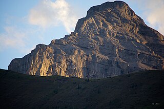
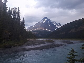
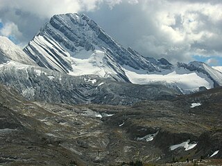
Mount Morden Long is a mountain located in the Athabasca River Valley of Jasper National Park in Alberta, Canada.

Mount Brazeau is a mountain in Alberta, Canada.

Mount Joffre is a mountain located on the Continental Divide, in Peter Lougheed Provincial Park, Alberta, and Elk Lakes and Height of the Rockies Provincial Parks in British Columbia. The mountain was named in 1918 by the Interprovincial Boundary Survey after Marshal Joseph Joffre, commander-in-chief of the French Army during World War I.

Mount Saskatchewan is a mountain located in the North Saskatchewan River valley of Banff National Park, in the Canadian Rockies of Alberta, Canada.

Mount Tyrwhitt is a mountain in British Columbia and Alberta, Canada, located between Highway 40 and Elk Pass in the Elk Range of the Canadian Rockies, west of the Highwood Pass parking lot in Kananaskis Country and south east of Upper Kananaskis Lake. Located on the Continental Divide, it is also therefore on the border between British Columbia and Alberta, which follows the Divide in this area.
Mount Cronin is a mountain in the Babine Range of the Skeena Mountains in northern British Columbia, Canada, located at the head of Cronin Creek in Babine Mountains Provincial Park just northeast of Smithers. It has a prominence of 1,571 m (5,154 ft), created by the Harold Price-Fulton Pass, making it one of Canada's Ultra peaks. The mountain was named after James Cronin, who operated a mine on this mountain in the 19th century.

Mount Bridgland is a 2,930-metre (9,610 ft) mountain located in the Victoria Cross Ranges of Jasper National Park in Alberta, Canada. It was named by Frank Sissons in 1923 after Morrison P. Bridgland (1878-1948), a Dominion Land Surveyor who named many peaks in Jasper Park and the Canadian Rockies.

Mount Muir is a mountain located on the Continental Divide on the Alberta-British Columbia border. The mountain was named in 1918 after Alexander Muir. It is located in the High Rock Range.

Highwood Pass is a mountain pass in Kananaskis Country, Alberta, Canada. It lies west of Mount Rae and Mount Arethusa of the Misty Range, south of Elbow Pass. It lies within the Peter Lougheed Provincial Park on Alberta Highway 40. The Highwood River originates in the pass.

Mount Bess is located on the border of Alberta and British Columbia. It is the 83rd highest peak in Alberta. It was named in 1910 by J. Norman Collie after Bessie Gunn, who accompanied Collie's expedition.

Mount Fraser is a mountain located on the border of Alberta and British Columbia. It is Alberta's 38th highest peak and Alberta's 22nd most prominent mountain. It is also British Columbia's 50th highest peak. It was named in 1917 after Simon Fraser.
Mount Scott is located on the border of Alberta and British Columbia, North of the Hooker Icefield in Hamber Provincial Park. It is Alberta's 44th highest peak, and Alberta's 46th most prominence mountain. It is also British Columbia's 57th highest peak. It was named in 1913 after Captain Robert Falcon Scott.
Mount Ermatinger is located on the border of Alberta and British Columbia, NE of Kinbasket Lake. It was named in 1920 by Arthur O. Wheeler for Edward Ermatinger.
Mount Hooker is located on the border of Alberta and British Columbia, Canada. It was named in 1827 by David Douglas after William Jackson Hooker. Until the turn of the century, Mount Hooker and the nearby Mount Brown were thought to be the highest mountains in the Canadian Rockies.
Mount Conway is a mountain located on the border of Alberta and British Columbia. It was named in 1901 by J. Norman Collie after Martin Conway, an alpinist.
Mount Bulyea is located in Banff National Park on the border of Alberta and British Columbia. It was named in 1920 after Hon. George H. V. Bulyea, a Canadian Pacific Railway employee and first Lieutenant Governor of Alberta.
Mount Barnard is located on the border of Alberta and British Columbia, NW of the head of Waitabit Creek and North of Golden. It is the 30th highest peak in Alberta and the 42nd highest peak in British Columbia. It was named in 1917 by boundary surveyors after Sir Francis Stillman Barnard, a Lieutenant Governor of BC during the 1910s. It should not be confused with the higher Californian peak of the same name.
Mount Trutch is a mountain located on the border of Alberta and British Columbia, Canada. It was named in 1920 after Sir Joseph Trutch, a Canadian politician who was the first Lieutenant Governor of British Columbia.

Mount Sir Douglas is located on the border of Alberta and British Columbia on the Continental Divide, at the northern end of Height of the Rockies Provincial Park and east of Invermere. It is Alberta's 18th highest peak, and 28th prominence mountain as well as British Columbia's 28th highest peak. It was named in 1916 by interprovincial boundary surveyors after Field Marshal Sir Douglas Haig.
Mount Dent is a summit that straddles the border between British Columbia and Alberta, Canada.


