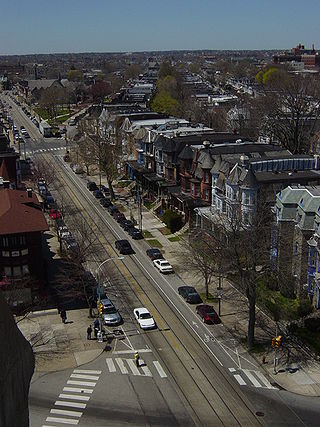
Mount Sinai Hospital, founded in 1852, is one of the oldest and largest teaching hospitals in the United States. It is located in East Harlem in the New York City borough of Manhattan, on the eastern border of Central Park stretching along Madison and Fifth Avenues, between East 98th Street and East 103rd Street. The entire Mount Sinai health system has over 7,400 physicians, as well as 3,919 beds, and delivers over 16,000 babies a year.

South Philadelphia, nicknamed South Philly, is the section of Philadelphia bounded by South Street to the north, the Delaware River to the east and south, and the Schuylkill River to the west. A diverse working-class community of many neighborhoods, South Philadelphia is well-known for its large Italian-American population, but it also contains large Asian American, Irish-American, African-American, and Latino populations.

Bolton Hill is a neighborhood in Baltimore, Maryland, with 20 blocks of mostly preserved buildings from the late 19th century. It is listed on the National Register of Historic Places, preserved as a Baltimore City Historic District, and included within the boundaries of Baltimore National Heritage Area. The neighborhood is bounded by North Avenue, Mount Royal Avenue, Cathedral Street, Dolphin Street, and Eutaw Place. Bolton Hill is a largely residential neighborhood with three-story row houses with red brick, white marble steps, and high ceilings. There are also larger more ornate originally single-family houses, many houses of worship, parks, monuments, and a few large apartment buildings. Many significant residents have lived in the neighborhood, including F. Scott Fitzgerald, Woodrow Wilson, the Cone sisters, and Florence Rena Sabin.

West Philadelphia, nicknamed West Philly, is a section of the city of Philadelphia. Although there are no officially defined boundaries, it is generally considered to reach from the western shore of the Schuylkill River, to City Avenue to the northwest, Cobbs Creek to the southwest, and the SEPTA Media/Wawa Line to the south. An alternate definition includes all city land west of the Schuylkill; this would also include Southwest Philadelphia and its neighborhoods. The eastern side of West Philadelphia is also known as University City.

Pennsport is a neighborhood in the South Philadelphia section of Philadelphia, Pennsylvania, United States.

Stuyvesant Square is the name of both a park and its surrounding neighborhood in the New York City borough of Manhattan. The park is located between 15th Street, 17th Street, Rutherford Place, and Nathan D. Perlman Place. Second Avenue divides the park into two halves, east and west, and each half is surrounded by the original cast-iron fence.

Park Heights is an area of Baltimore, Maryland, that lies approximately 5 miles northwest of downtown Baltimore and within two miles of the Baltimore County line. A 1,500-acre community, Park Heights comprises 12 smaller neighborhoods that together contain approximately 30,000 residents. It is bounded on the south by Druid Park Drive, on the west by Wabash Avenue, on the east by Greenspring Avenue, and on the north by Northern Parkway. Interstate-83 is less than a half mile to the east.
David L. Reich is an American academic anesthesiologist, who has been President & Chief Operating Officer of The Mount Sinai Hospital, and President of Mount Sinai Queens, since October 2013.
Jefferson Einstein Hospital is a non-profit hospital located in North Philadelphia, Pennsylvania. The hospital is a part of the Thomas Jefferson. The medical center offers residency and fellowship training programs in many specialized areas. It also includes a Level I Regional Resource Trauma Center and a Level III Neonatal Intensive Care Unit. Einstein Medical Center Philadelphia is the largest independent teaching hospital in the Philadelphia region with over 30 accredited programs training over 3,500 students each year with 400 residents.
Mount Sinai Hospital, formerly at times known as Mount Sinai Medical Center, is a 319-bed major urban hospital in Chicago, Illinois, with its main campus located adjacent to Douglass Park at 15th Street and California Avenue on the city's West Side. The hospital was established in 1912 under the name Maimonides Hospital, with a mission of serving poor immigrants from Europe while providing training to Jewish physicians, primarily of Eastern European descent. After a period of financial difficulty, it closed in 1918, and was reopened as "Mount Sinai Hospital" in 1919, with 60 beds and continuing its original mission.

The Mount Sinai Health System is the largest hospital network in New York City. It was formed in September 2013 by merging the operations of Continuum Health Partners and the Mount Sinai Medical Center.

Dickinson Square West is a neighborhood in South Philadelphia, Pennsylvania, United States bordered by neighborhoods Queen Village to the north, Whitman to the south, Pennsport to the east and Passyunk Square and East Passyunk Crossing to the west. The neighborhood was previously referred to as "Dickinson Narrows", but was officially reestablished as "Dickinson Square West" in 2013 by the Registered Community Organization, Dickinson Square West Civic Association, located within its boundaries. In October, 2018, The Dickinson Square West Civic Association passed an amendment to expand the southern boundary from Mifflin Street to Snyder Ave

Queens Hospital Center (QHC), also known as NYC Health + Hospitals/Queens and originally called Queens General Hospital, is a large public hospital campus in the Jamaica Hills and Hillcrest neighborhoods of Queens in New York City. It is operated by NYC Health + Hospitals, a public benefit corporation of the city.

Mount Sinai Beth Israel is a 799-bed teaching hospital in Manhattan. It is part of the Mount Sinai Health System, a nonprofit health system formed in September 2013 by the merger of Continuum Health Partners and Mount Sinai Medical Center, and an academic affiliate of the Icahn School of Medicine at Mount Sinai. The Mount Sinai Health System's school of nursing, Mount Sinai Phillips School of Nursing (PSON), was founded at Beth Israel Hospital in 1902.
Einstein Healthcare Network is a private non-profit healthcare organization part of Jefferson Health based in the Philadelphia, Pennsylvania. The healthcare network serves Greater Philadelphia and its flagship hospital is Einstein Medical Center, a safety net hospital, located in Philadelphia. The healthcare network offers residency and fellowship training programs in many specialized areas, including pharmacy practice. The healthcare network has a combine total of 1,044 beds and has over 8,500 employees.

Dorothy Dworkin was a Canadian nurse, businesswoman and philanthropist. She was the first professionally trained nurse in Toronto's Jewish community and among its most prominent healthcare advocates. She led the fundraising campaign for the city's first Jewish hospital and is considered the matriarch of Mount Sinai Hospital. Through her family travel business, she helped thousands of Eastern European Jews immigrate to Canada and escape the Holocaust. Dworkin worked with many community charities and was a strong supporter of the Jewish trade unions through the city's Labour Lyceum. She was also the publisher and editor of a Yiddish newspaper and produced a Yiddish radio program. In 2009, she was recognized as a Person of National Historic Significance in Canada.

The Washington Avenue Immigration Station was an immigrant processing facility in Philadelphia, Pennsylvania, United States located at the end of Washington Avenue at Pier 53 on the Delaware River, south of modern-day Penn's Landing waterfront district. The building opened in 1873 and was demolished in 1915.

Mount Sinai West, opened in 1871 as Roosevelt Hospital, is affiliated with the Icahn School of Medicine at Mount Sinai and the Mount Sinai Health System.


